TopoQuest Logo
Do you find TopoQuest useful?
Help keep TopoQuest running and adding new maps/features by donating!
Bitcoin:  19c7KJd3qBynnjoSw5npx9KScwjBe4ifkT
Litecoin:  LXs6TkuXGGXo1vDsWCkWVdjQX94eUKd6ui
Home View Maps Find Maps Find Places Resources & Links


Williamson, New York Topographic Map

USGS Map Title: Williamson, NY
USGS Map MRC: 43077B2
DRG (GeoTIFF) Download: o43077b2.tif


Neighboring USGS Topographic Map Quads:


  Furnaceville, NY  
43077C3
 

  Pultneyville, NY  
43077C2
 

  Salmon Creek, NY  
43077C1
 

  Ontario, NY  
43077B3
 

  Williamson, NY  
43077B2
 

  Sodus, NY  
43077B1
 

  Macedon, NY  
43077A3
 

  Palmyra, NY  
43077A2
 

  Newark, NY  
43077A1


Map MRC Location:

N44°
W78°
N44°
W77°
H8 H7 H6 H5 H4 H3 H2 H1
G8 G7 G6 G5 G4 G3 G2 G1
F8 F7 F6 F5 F4 F3 F2 F1
E8 E7 E6 E5 E4 E3 E2 E1
D8 D7 D6 D5 D4 D3 D2 D1
C8 C7 C6 C5 C4 C3 C2 C1
B8 B7 B6 B5 B4 B3 B2 B1
A8 A7 A6 A5 A4 A3 A2 A1
N43°
W78°
N43°
W77°

Williamson, NY USGS 1:24K Topographic Map Preview:
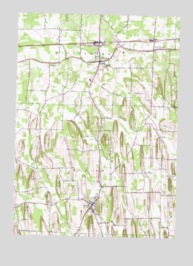
Williamson, NY USGS Topographic Map
Click on map above to begin viewing in our Map Viewer.

This topographic map contains these locations and features:
Feature Name Type Latitude Longitude GNIS ID View Map
Ag-Alley AirportAirportN43.1602°W77.1779°2443097View Map
Beam HillSummitN43.1887°W77.1361°943237View Map
Bible Baptist ChurchChurchN43.2335°W77.2184°2598191View Map
CC FarmsLocaleN43.2356°W77.1992°2547344View Map
Community of Faith ChurchChurchN43.2236°W77.1875°2598200View Map
Cory CornersLocaleN43.1434°W77.2211°947502View Map
Cory HillSummitN43.1478°W77.2230°947503View Map
East WilliamsonPopulated PlaceN43.2306°W77.1453°949274View Map
East Williamson Fire DistrictBuildingN43.2294°W77.1452°2735487View Map
East Williamson Post OfficePost OfficeN43.2312°W77.1441°2599539View Map
Firemans ParkParkN43.2222°W77.1942°2380863View Map
First Methodist ChurchChurchN43.2240°W77.1840°2494628View Map
First Reformed ChurchChurchN43.1443°W77.1865°2598207View Map
Frankes NurseryLocaleN43.1653°W77.2036°2547348View Map
Free Methodist ChurchChurchN43.2304°W77.1444°2494626View Map
Gilbert CemeteryCemeteryN43.1619°W77.1458°951089View Map
Grace Baptist ChurchChurchN43.1426°W77.2349°2598210View Map
Hall Center CemeteryCemeteryN43.1673°W77.2485°952047View Map
Hidden Valley Mobile Home ParkPopulated PlaceN43.1389°W77.2372°2493980View Map
MarionPopulated PlaceN43.1434°W77.1891°956524View Map
Marion Census Designated PlaceCensusN43.1409°W77.1951°2631642View Map
Marion Elementary SchoolSchoolN43.1444°W77.1883°2494507View Map
Marion Fire DepartmentBuildingN43.1416°W77.1887°2735489View Map
Marion Junior-Senior High SchoolSchoolN43.1725°W77.1889°2494505View Map
Marion Post OfficePost OfficeN43.1426°W77.1898°2599542View Map
Marion Public LibraryBuildingN43.1424°W77.1882°2599589View Map
Marion Village CemeteryCemeteryN43.1471°W77.1899°2494582View Map
Mason FarmsLocaleN43.2197°W77.2317°2547485View Map
Myra Shipley Garfield Memorial BuildingBuildingN43.2238°W77.1826°2494624View Map
New York State Police Troop E Zone 2 Williamson StationBuildingN43.2333°W77.1928°2781139View Map
Owls NestPopulated PlaceN43.1820°W77.1386°959699View Map
Pigeon HillSummitN43.1581°W77.2366°960376View Map
Prospect HillSummitN43.1326°W77.1897°961174View Map
Redeem Bethel Church of God in ChristChurchN43.2345°W77.1663°2599585View Map
Reformed Church of East WilliamsonChurchN43.2310°W77.1419°2494627View Map
Ridge Chapel CemeteryCemeteryN43.2217°W77.2245°962493View Map
Saint Gregory's ChurchChurchN43.1421°W77.1864°2598262View Map
School Number 4 (historical)SchoolN43.2289°W77.1453°2380864View Map
Second Reformed ChurchChurchN43.1408°W77.1895°2598268View Map
Sherman CemeteryCemeteryN43.1869°W77.1845°2494583View Map
The First Baptist Church of WilliamsonChurchN43.2244°W77.1807°2494625View Map
Town of MarionCivilN43.1630°W77.1942°979199View Map
Town of WilliamsonCivilN43.2417°W77.1922°979640View Map
United Church of MarionChurchN43.1433°W77.1882°2598274View Map
Upper Corners CemeteryCemeteryN43.1559°W77.1836°968267View Map
Upper Room Church God in ChristChurchN43.2335°W77.1283°2598275View Map
Whispering WoodsPopulated PlaceN43.2289°W77.1975°2493977View Map
WilliamsonPopulated PlaceN43.2240°W77.1861°971317View Map
Williamson Census Designated PlaceCensusN43.2232°W77.1852°2631643View Map
Williamson Elementary SchoolSchoolN43.2189°W77.1798°2494629View Map
Williamson Fire Company Number 1BuildingN43.2240°W77.1850°2494623View Map
Williamson Free Public LibraryBuildingN43.2311°W77.1865°2599594View Map
Williamson Middle SchoolSchoolN43.2206°W77.1821°2494638View Map
Williamson Post OfficePost OfficeN43.2229°W77.1861°2599555View Map
Williamson Presbyterian ChurchChurchN43.2240°W77.1880°2494622View Map
Williamson Reformed ChurchChurchN43.2238°W77.1897°2598279View Map
Williamson Senior High SchoolSchoolN43.2131°W77.1933°2494637View Map
Williamson Town HallBuildingN43.2311°W77.1864°2599603View Map
Williamson Volunteer Ambulance ServiceBuildingN43.2292°W77.1899°2719224View Map

Note: Coordinates in the location and feature list above are referenced to NAD83 datum.


Copyright (C) 2008-2025 Ryan Niemi / Sunset Dynamics ... All Rights Reserved