TopoQuest Logo
Do you find TopoQuest useful?
Help keep TopoQuest running and adding new maps/features by donating!
Bitcoin:  19c7KJd3qBynnjoSw5npx9KScwjBe4ifkT
Litecoin:  LXs6TkuXGGXo1vDsWCkWVdjQX94eUKd6ui
Home View Maps Find Maps Find Places Resources & Links


Williamsville, Illinois Topographic Map

USGS Map Title: Williamsville, IL
USGS Map MRC: 39089H5
DRG (GeoTIFF) Download: o39089h5.tif


Neighboring USGS Topographic Map Quads:


  Greenview, IL  
40089A6
 

  Middletown, IL  
40089A5
 

  Broadwell, IL  
40089A4
 

  Athens, IL  
39089H6
 

  Williamsville, IL  
39089H5
 

  Cornland, IL  
39089H4
 

  Springfield West, IL  
39089G6
 

  Springfield East, IL  
39089G5
 

  Mechanicsburg, IL  
39089G4


Map MRC Location:

N40°
W90°
N40°
W89°
H8 H7 H6 H5 H4 H3 H2 H1
G8 G7 G6 G5 G4 G3 G2 G1
F8 F7 F6 F5 F4 F3 F2 F1
E8 E7 E6 E5 E4 E3 E2 E1
D8 D7 D6 D5 D4 D3 D2 D1
C8 C7 C6 C5 C4 C3 C2 C1
B8 B7 B6 B5 B4 B3 B2 B1
A8 A7 A6 A5 A4 A3 A2 A1
N39°
W90°
N39°
W89°

Williamsville, IL USGS 1:24K Topographic Map Preview:
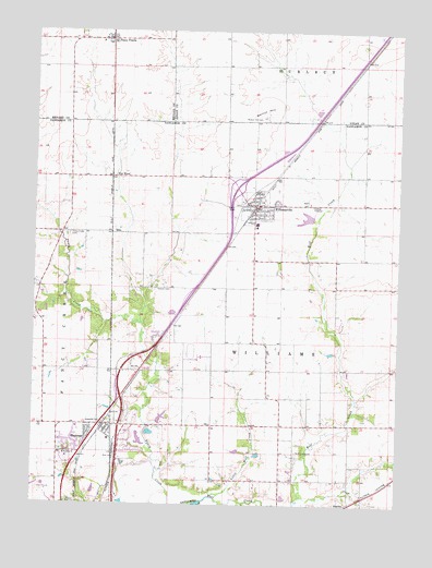
Williamsville, IL USGS Topographic Map
Click on map above to begin viewing in our Map Viewer.

This topographic map contains these locations and features:
Feature Name Type Latitude Longitude GNIS ID View Map
American Hill School (historical)SchoolN39.9831°W89.5123°1720835View Map
Bice CemeteryCemeteryN39.8977°W89.5123°1821038View Map
Bice School (historical)SchoolN39.8967°W89.5184°1747280View Map
Bock Farms AirportAirportN39.9855°W89.5111°2679097View Map
EllisPopulated PlaceN39.9467°W89.5987°422665View Map
Fancy Creek CemeteryCemeteryN39.9462°W89.6131°408264View Map
Fancy Creek School (historical)SchoolN39.9389°W89.6190°1747294View Map
Fancy PrairiePopulated PlaceN39.9975°W89.5995°408265View Map
Fancy Prairie Elementary SchoolSchoolN39.9973°W89.6029°1808801View Map
Fancy Prairie Volunteer Fire DepartmentBuildingN39.9979°W89.6020°2640669View Map
Interchange 105CrossingN39.9145°W89.5937°1821078View Map
Interchange 109CrossingN39.9589°W89.5559°1821079View Map
Kern CemeteryCemeteryN39.9129°W89.6132°1821083View Map
KnollwoodPopulated PlaceN39.9195°W89.5829°1821084View Map
Little Wolf CreekStreamN39.8762°W89.5668°412432View Map
Locust Lane School (historical)SchoolN39.9181°W89.5584°1747311View Map
Mount FulcherPopulated PlaceN39.9920°W89.5123°1720884View Map
PeabodyPopulated PlaceN39.8775°W89.6009°1747315View Map
Rail Golf ClubLocaleN39.8787°W89.6209°1984172View Map
Saint John Vianney ChurchChurchN39.8884°W89.6137°417346View Map
Sangamo Center School (historical)SchoolN39.8962°W89.5640°1747321View Map
SelbytownLocaleN39.9267°W89.5726°1747325View Map
ShermanPopulated PlaceN39.8937°W89.6048°418363View Map
Sherman Elementary SchoolSchoolN39.8923°W89.5990°1821109View Map
Sherman Fire Protection DistrictBuildingN39.8965°W89.6123°2640241View Map
Sherman Post OfficePost OfficeN39.8964°W89.6052°2788382View Map
Sherman United Methodist ChurchChurchN39.8956°W89.6097°2629171View Map
Stewart CemeteryCemeteryN39.9328°W89.5826°419126View Map
Superior School (historical)SchoolN39.9903°W89.5601°1720895View Map
Tipton School (historical)SchoolN39.8956°W89.6159°1747333View Map
Township of WilliamsCivilN39.9255°W89.5409°429937View Map
Van WoodPopulated PlaceN39.9614°W89.5987°423273View Map
Village of ShermanCivilN39.8878°W89.6065°2399802View Map
Village of WilliamsvilleCivilN39.9517°W89.5507°2399698View Map
Walnut Grove School (historical)SchoolN39.9764°W89.6026°1748060View Map
Walnut HillSummitN39.9778°W89.5462°420473View Map
Walnut Hill CemeteryCemeteryN39.9772°W89.5468°420474View Map
Weingardt PondReservoirN39.8979°W89.5808°1691913View Map
Weingardt Pond DamDamN39.8967°W89.5834°1691912View Map
WilliamsvillePopulated PlaceN39.9542°W89.5487°421218View Map
Williamsville Christian ChurchChurchN39.9564°W89.5501°1984170View Map
Williamsville Fire Protection DistrictBuildingN39.9451°W89.5492°2640178View Map
Williamsville High SchoolSchoolN39.9492°W89.5487°1821121View Map
Williamsville Police DepartmentBuildingN39.9536°W89.5490°2758923View Map
Williamsville Post OfficePost OfficeN39.9538°W89.5480°2788571View Map
Williamsville United Methodist ChurchChurchN39.9517°W89.5468°1984171View Map
Wolf CreekStreamN39.8770°W89.5632°421369View Map
Wolf Creek CemeteryCemeteryN39.8889°W89.5346°421384View Map

Note: Coordinates in the location and feature list above are referenced to NAD83 datum.


Copyright (C) 2008-2024 Ryan Niemi / Sunset Dynamics ... All Rights Reserved