TopoQuest Logo
Do you find TopoQuest useful?
Help keep TopoQuest running and adding new maps/features by donating!
Bitcoin:  19c7KJd3qBynnjoSw5npx9KScwjBe4ifkT
Litecoin:  LXs6TkuXGGXo1vDsWCkWVdjQX94eUKd6ui
Home View Maps Find Maps Find Places Resources & Links


Broadwell, Illinois Topographic Map

USGS Map Title: Broadwell, IL
USGS Map MRC: 40089A4
DRG (GeoTIFF) Download: o40089a4.tif


Neighboring USGS Topographic Map Quads:


  New Holland, IL  
40089B5
 

  Lincoln West, IL  
40089B4
 

  Lincoln East, IL  
40089B3
 

  Middletown, IL  
40089A5
 

  Broadwell, IL  
40089A4
 

  Mount Pulaski, IL  
40089A3
 

  Williamsville, IL  
39089H5
 

  Cornland, IL  
39089H4
 

  Lake Fork, IL  
39089H3


Map MRC Location:

N41°
W90°
N41°
W89°
H8 H7 H6 H5 H4 H3 H2 H1
G8 G7 G6 G5 G4 G3 G2 G1
F8 F7 F6 F5 F4 F3 F2 F1
E8 E7 E6 E5 E4 E3 E2 E1
D8 D7 D6 D5 D4 D3 D2 D1
C8 C7 C6 C5 C4 C3 C2 C1
B8 B7 B6 B5 B4 B3 B2 B1
A8 A7 A6 A5 A4 A3 A2 A1
N40°
W90°
N40°
W89°

Broadwell, IL USGS 1:24K Topographic Map Preview:
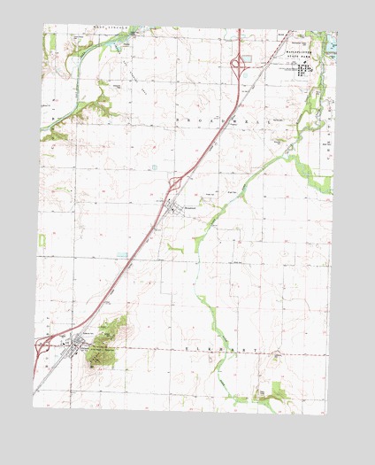
Broadwell, IL USGS Topographic Map
Click on map above to begin viewing in our Map Viewer.

This topographic map contains these locations and features:
Feature Name Type Latitude Longitude GNIS ID View Map
Braucher CemeteryCemeteryN40.0889°W89.3978°1720839View Map
Briggs School (historical)SchoolN40.1006°W89.4607°404865View Map
BroadwellPopulated PlaceN40.0681°W89.4432°404889View Map
Corwin School (historical)SchoolN40.0995°W89.4420°406605View Map
Deer CreekStreamN40.1123°W89.3782°407064View Map
Development Center CemeteryCemeteryN40.1209°W89.3873°1720843View Map
ElkhartPopulated PlaceN40.0206°W89.4829°407876View Map
Elkhart CemeteryCemeteryN40.0196°W89.4709°1720846View Map
Elkhart Christian ChurchChurchN40.0189°W89.4820°1984025View Map
Elkhart Elementary SchoolSchoolN40.0178°W89.4820°1816610View Map
Elkhart HillSummitN40.0209°W89.4707°409022View Map
Elkhart Methodist ChurchChurchN40.0214°W89.4793°1984027View Map
Elkhart Post OfficePost OfficeN40.0206°W89.4811°2788727View Map
Elkhart Rural Fire Protection DistrictBuildingN40.0220°W89.4993°2640710View Map
FogartyPopulated PlaceN40.0937°W89.4198°1720852View Map
Foster CemeteryCemeteryN40.0709°W89.4293°1720853View Map
Goldsmith CemeteryCemeteryN40.1049°W89.4664°1720854View Map
Honeyhook School (historical)SchoolN40.0709°W89.3951°410484View Map
Interchange 115CrossingN40.0203°W89.4965°1816626View Map
Interchange 119CrossingN40.0739°W89.4423°1816627View Map
Interchange 123CrossingN40.1125°W89.4165°1816628View Map
Kline CemeteryCemeteryN40.0489°W89.4168°1720862View Map
Lake ForkStreamN40.0848°W89.3954°411717View Map
Lakeside School (historical)SchoolN40.0017°W89.4240°411753View Map
Latham Thompson CemeteryCemeteryN40.0245°W89.4676°1720866View Map
Lawrence CemeteryCemeteryN40.0192°W89.3984°1720869View Map
Lincoln Correctional CenterBuildingN40.1178°W89.3899°2740098View Map
Lincoln Development Center AnnexHospitalN40.1123°W89.3890°1720874View Map
Lincoln Gas Storage AreaOilfieldN40.1112°W89.4634°1720875View Map
Lincoln Rural Fire Protection District Station 2 Bravo Fire DepartmentBuildingN40.0673°W89.4422°2640706View Map
Logan Correctional CenterBuildingN40.1135°W89.3911°2740099View Map
Lucas Chapel CemeteryCemeteryN40.1203°W89.4876°1720880View Map
Plainview School (historical)SchoolN40.0275°W89.3962°415756View Map
Railsplitter State ParkParkN40.1167°W89.3918°1720890View Map
Rankin School (historical)SchoolN40.1164°W89.4009°416386View Map
Read School (historical)SchoolN40.0556°W89.3951°416437View Map
Rocky Ford BridgeBridgeN40.1220°W89.4634°425399View Map
Saint John ChapelChurchN40.0192°W89.4709°1720893View Map
Saint Patricks ChurchChurchN40.0189°W89.4837°1984033View Map
Sunnyside School (historical)SchoolN40.0489°W89.4468°419396View Map
Township of BroadwellCivilN40.0902°W89.4267°428712View Map
Village of BroadwellCivilN40.0669°W89.4429°2397462View Map
Village of ElkhartCivilN40.0175°W89.4801°2398805View Map
Warrick CemeteryCemeteryN40.0957°W89.3973°1720901View Map
Wright CemeteryCemeteryN40.0714°W89.4159°1720904View Map

Note: Coordinates in the location and feature list above are referenced to NAD83 datum.


Copyright (C) 2008-2025 Ryan Niemi / Sunset Dynamics ... All Rights Reserved