TopoQuest Logo
Do you find TopoQuest useful?
Help keep TopoQuest running and adding new maps/features by donating!
Bitcoin:  19c7KJd3qBynnjoSw5npx9KScwjBe4ifkT
Litecoin:  LXs6TkuXGGXo1vDsWCkWVdjQX94eUKd6ui
Home View Maps Find Maps Find Places Resources & Links


Wind Cave, South Dakota Topographic Map

USGS Map Title: Wind Cave, SD
USGS Map MRC: 43103E4
DRG (GeoTIFF) Download: o43103e4.tif


Neighboring USGS Topographic Map Quads:


  Cicero Peak, SD  
43103F5
 

  Mount Coolidge, SD  
43103F4
 

  Butcher Hill, SD  
43103F3
 

  Pringle, SD  
43103E5
 

  Wind Cave, SD  
43103E4
 

  Boland Ridge, SD  
43103E3
 

  Minnekahta NE, SD  
43103D5
 

  Hot Springs, SD  
43103D4
 

  Buffalo Gap, SD  
43103D3


Map MRC Location:

N44°
W104°
N44°
W103°
H8 H7 H6 H5 H4 H3 H2 H1
G8 G7 G6 G5 G4 G3 G2 G1
F8 F7 F6 F5 F4 F3 F2 F1
E8 E7 E6 E5 E4 E3 E2 E1
D8 D7 D6 D5 D4 D3 D2 D1
C8 C7 C6 C5 C4 C3 C2 C1
B8 B7 B6 B5 B4 B3 B2 B1
A8 A7 A6 A5 A4 A3 A2 A1
N43°
W104°
N43°
W103°

Wind Cave, SD USGS 1:24K Topographic Map Preview:
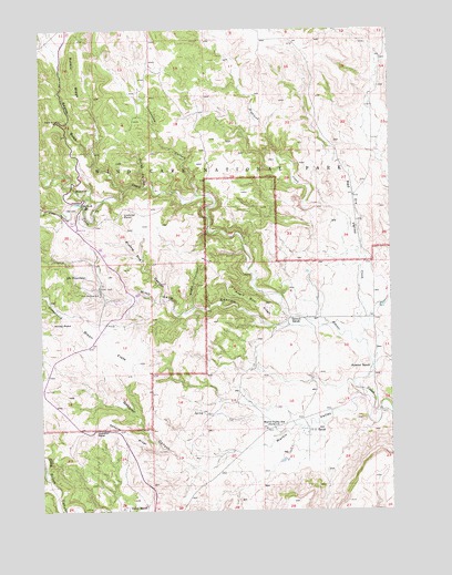
Wind Cave, SD USGS Topographic Map
Click on map above to begin viewing in our Map Viewer.

This topographic map contains these locations and features:
Feature Name Type Latitude Longitude GNIS ID View Map
Bison FlatsFlatN43.5433°W103.4788°1261276View Map
Cold Spring CreekStreamN43.5811°W103.4774°1261469View Map
Cottonwood CreekStreamN43.5478°W103.3999°1261493View Map
Curley CanyonValleyN43.5844°W103.4632°1261518View Map
Dry CreekStreamN43.5439°W103.3855°1261579View Map
Elk MountainSummitN43.5602°W103.4912°1261630View Map
Elk Mountain CampgroundsLocaleN43.5658°W103.4952°1263119View Map
Gobbler CanyonValleyN43.5143°W103.4351°1261720View Map
Gobbler PassGapN43.5214°W103.4808°1261721View Map
Gobbler RidgeRidgeN43.5239°W103.4784°1261722View Map
Highland CreekStreamN43.5655°W103.3841°1261813View Map
Limestone CanyonValleyN43.5818°W103.4447°1261952View Map
Lookout PointCapeN43.5764°W103.4710°1261994View Map
Martin ValleyValleyN43.5299°W103.3868°1262026View Map
Martin Valley SchoolSchoolN43.5214°W103.4199°1262027View Map
Negro CanyonValleyN43.5529°W103.4461°1262111View Map
Negro Wool RidgeRidgeN43.5597°W103.4356°1262115View Map
Nobeck DamDamN43.5800°W103.4860°1262760View Map
Norbeck LakeReservoirN43.5800°W103.4869°1262133View Map
Pigtail BridgeBridgeN43.6011°W103.4944°1262201View Map
Prairie Dog CanyonValleyN43.5561°W103.4575°1262237View Map
Reaves GulchValleyN43.5938°W103.4814°1262265View Map
Red ValleyValleyN43.5604°W103.3861°1267034View Map
Sanson RanchLocaleN43.5500°W103.4116°1262361View Map
Seven-11 RanchLocaleN43.5211°W103.4049°1262385View Map
Streeter RanchLocaleN43.5375°W103.3821°1262525View Map
Wildcat CanyonValleyN43.5064°W103.4986°1262716View Map
Wind Cave CanyonValleyN43.5473°W103.4036°1262731View Map
Wind Cave National ParkParkN43.5801°W103.4395°1263056View Map
Windy PointCapeN43.5486°W103.4971°1262736View Map
Zuber RanchLocaleN43.5008°W103.4699°1262759View Map

Note: Coordinates in the location and feature list above are referenced to NAD83 datum.


Copyright (C) 2008-2024 Ryan Niemi / Sunset Dynamics ... All Rights Reserved