TopoQuest Logo
Do you find TopoQuest useful?
Help keep TopoQuest running and adding new maps/features by donating!
Bitcoin:  19c7KJd3qBynnjoSw5npx9KScwjBe4ifkT
Litecoin:  LXs6TkuXGGXo1vDsWCkWVdjQX94eUKd6ui
Home View Maps Find Maps Find Places Resources & Links


Cicero Peak, South Dakota Topographic Map

USGS Map Title: Cicero Peak, SD
USGS Map MRC: 43103F5
DRG (GeoTIFF) Download: o43103f5.tif


Neighboring USGS Topographic Map Quads:


  Berne, SD  
43103G6
 

  Custer, SD  
43103G5
 

  Iron Mountain, SD  
43103G4
 

  Fourmile, SD  
43103F6
 

  Cicero Peak, SD  
43103F5
 

  Mount Coolidge, SD  
43103F4
 

  Argyle, SD  
43103E6
 

  Pringle, SD  
43103E5
 

  Wind Cave, SD  
43103E4


Map MRC Location:

N44°
W104°
N44°
W103°
H8 H7 H6 H5 H4 H3 H2 H1
G8 G7 G6 G5 G4 G3 G2 G1
F8 F7 F6 F5 F4 F3 F2 F1
E8 E7 E6 E5 E4 E3 E2 E1
D8 D7 D6 D5 D4 D3 D2 D1
C8 C7 C6 C5 C4 C3 C2 C1
B8 B7 B6 B5 B4 B3 B2 B1
A8 A7 A6 A5 A4 A3 A2 A1
N43°
W104°
N43°
W103°

Cicero Peak, SD USGS 1:24K Topographic Map Preview:
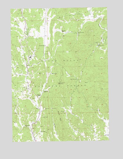
Cicero Peak, SD USGS Topographic Map
Click on map above to begin viewing in our Map Viewer.

This topographic map contains these locations and features:
Feature Name Type Latitude Longitude GNIS ID View Map
Bare Top Number 2 Lode MineMineN43.7389°W103.5560°1265043View Map
Beck Lode MineMineN43.7472°W103.5166°1265037View Map
Beecher Number Two MineMineN43.7072°W103.5763°1261252View Map
Beecher RockPillarN43.6894°W103.5899°1265613View Map
Bowman RidgeRidgeN43.6468°W103.5636°1261332View Map
Bull Moose Lode MineMineN43.7394°W103.5491°1265041View Map
Burgess Mica Prospect MineMineN43.7392°W103.6005°1265045View Map
Burt Mica MineMineN43.7464°W103.5374°1264972View Map
Cicero PeakSummitN43.6794°W103.5613°1261445View Map
Custer County AirportAirportN43.7328°W103.6137°1262830View Map
Echo ValleyValleyN43.6871°W103.6065°1261621View Map
Evergreen SchoolSchoolN43.7147°W103.5830°1261653View Map
Flora Lode MineMineN43.7411°W103.5441°1265042View Map
Flynn Creek Picnic AreaLocaleN43.6833°W103.5419°1263103View Map
Flynn Creek SpringSpringN43.6833°W103.5409°1261683View Map
Gladys Nells MineMineN43.6525°W103.5574°1261718View Map
Glen Erin CreekStreamN43.7394°W103.5185°1261719View Map
Gray Rocks (historical)LocaleN43.7486°W103.6171°1264623View Map
Haselrodt SpringSpringN43.7140°W103.5132°1261780View Map
Haven CanyonValleyN43.6288°W103.5005°1261785View Map
Hazelrodt Picnic AreaLocaleN43.7155°W103.5055°1263104View Map
Hazelrodt Summer HomesLocaleN43.7194°W103.5027°1263105View Map
Heidepriem and Cattles MineMineN43.7469°W103.6052°1265048View Map
Hot Shot MineMineN43.7458°W103.5144°1265036View Map
Lake of the PinesLakeN43.7266°W103.5390°1262209View Map
Lee Burrows Dike MineMineN43.7478°W103.5246°1265035View Map
Linwood MineMineN43.6394°W103.5905°1261962View Map
Lucky Spar Lode MineMineN43.7442°W103.6041°1265047View Map
Lucky Star Prospect MineMineN43.7417°W103.6116°1265046View Map
Lucky Strike MineMineN43.6558°W103.5746°1262004View Map
Mayo (historical)LocaleN43.6791°W103.6046°1264622View Map
Mayo SchoolSchoolN43.6764°W103.6060°1262033View Map
McCurran RanchLocaleN43.7275°W103.5594°1262040View Map
Mica King MineMineN43.7394°W103.5219°1265038View Map
Mica King Number 3 Claim MineMineN43.7458°W103.5230°1265034View Map
Mitchell Number 1 Lode MineMineN43.7389°W103.5369°1265040View Map
NihartPopulated PlaceN43.6564°W103.5910°1265302View Map
Nihart SpringSpringN43.6478°W103.5858°1262127View Map
Rambler Lode MineMineN43.7458°W103.5599°1265044View Map
Rose Quartz MineMineN43.7158°W103.5155°1262331View Map
Saint Louis MineMineN43.7380°W103.5157°1265691View Map
SanatorPopulated PlaceN43.6966°W103.6058°1262357View Map
Sidney CreekStreamN43.7500°W103.5757°1262412View Map
Sonny Boy Lode MineMineN43.7397°W103.5380°1265039View Map
Star and Blue Bonnet Claims MineMineN43.7458°W103.5246°1265033View Map
STAR Evergreen High SchoolSchoolN43.7043°W103.6008°2729514View Map
STAR Evergreen Junior High SchoolSchoolN43.7043°W103.6008°2729516View Map
Sutherland RanchLocaleN43.6675°W103.5902°1262542View Map
Sutherland SpringSpringN43.6724°W103.5841°1262544View Map
Tanner RanchLocaleN43.6344°W103.5891°1262554View Map
Tinsley MineMineN43.7475°W103.5149°1265593View Map
Triangle A MineMineN43.7414°W103.5157°1262608View Map
United States Forest Service Tatanka HotshotsBuildingN43.7086°W103.6004°2580791View Map
Ventling RanchLocaleN43.6400°W103.6096°1262632View Map
Warren Ranch (historical)LocaleN43.6539°W103.5491°1264155View Map
Wayside Lode MineMineN43.7397°W103.5363°1265594View Map
Well Pole CreekStreamN43.6947°W103.6024°1262668View Map
White Elephant MineMineN43.6561°W103.5830°1262695View Map
Winters RanchLocaleN43.6889°W103.5746°1265712View Map

Note: Coordinates in the location and feature list above are referenced to NAD83 datum.


Copyright (C) 2008-2024 Ryan Niemi / Sunset Dynamics ... All Rights Reserved