TopoQuest Logo
Do you find TopoQuest useful?
Help keep TopoQuest running and adding new maps/features by donating!
Bitcoin:  19c7KJd3qBynnjoSw5npx9KScwjBe4ifkT
Litecoin:  LXs6TkuXGGXo1vDsWCkWVdjQX94eUKd6ui
Home View Maps Find Maps Find Places Resources & Links


Boswells Tavern, Virginia Topographic Map

USGS Map Title: Boswells Tavern, VA
USGS Map MRC: 38078A2
DRG (GeoTIFF) Download: o38078a2.tif


Neighboring USGS Topographic Map Quads:


  Barboursville, VA  
38078B3
 

  Gordonsville, VA  
38078B2
 

  Orange, VA  
38078B1
 

  Keswick, VA  
38078A3
 

  Boswells Tavern, VA  
38078A2
 

  Louisa, VA  
38078A1
 

  Boyd Tavern, VA  
37078H3
 

  Zion Crossroads, VA  
37078H2
 

  Ferncliff, VA  
37078H1


Map MRC Location:

N39°
W79°
N39°
W78°
H8 H7 H6 H5 H4 H3 H2 H1
G8 G7 G6 G5 G4 G3 G2 G1
F8 F7 F6 F5 F4 F3 F2 F1
E8 E7 E6 E5 E4 E3 E2 E1
D8 D7 D6 D5 D4 D3 D2 D1
C8 C7 C6 C5 C4 C3 C2 C1
B8 B7 B6 B5 B4 B3 B2 B1
A8 A7 A6 A5 A4 A3 A2 A1
N38°
W79°
N38°
W78°

Boswells Tavern, VA USGS 1:24K Topographic Map Preview:
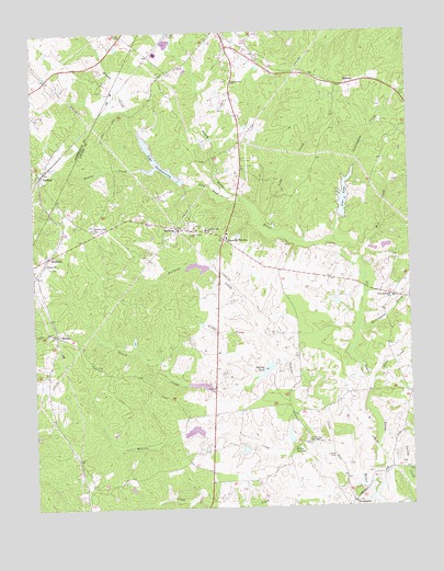
Boswells Tavern, VA USGS Topographic Map
Click on map above to begin viewing in our Map Viewer.

This topographic map contains these locations and features:
Feature Name Type Latitude Longitude GNIS ID View Map
Bartonville DamDamN38.1101°W78.2081°1489851View Map
Bartonville PondReservoirN38.1101°W78.2081°1489852View Map
Berea ChurchChurchN38.0090°W78.1344°1463091View Map
Blakes Mill (historical)LocaleN38.0549°W78.1275°1494674View Map
Boswells TavernLocaleN38.0710°W78.1856°1463689View Map
Bowler CreekStreamN38.0896°W78.2128°1463712View Map
Bunch CreekStreamN38.0401°W78.1686°1464091View Map
Camp CreekStreamN38.0079°W78.1475°1464321View Map
Central BranchStreamN38.0007°W78.1761°1464683View Map
Cobham ChurchChurchN38.0643°W78.2458°1465034View Map
Dove ForkStreamN38.0824°W78.1808°1465917View Map
Free Union ChurchChurchN38.0718°W78.1969°1466871View Map
Givies CreekStreamN38.0457°W78.1747°1467115View Map
Gordonsville ChurchChurchN38.1115°W78.1817°1467265View Map
Green Spring DistrictCivilN38.0616°W78.1730°1927331View Map
Green SpringsSpringN38.0153°W78.1641°1467488View Map
Green Springs SchoolSchoolN38.0732°W78.1917°1467489View Map
Happy CreekStreamN38.0996°W78.2139°1467726View Map
Hawkwood DamDamN38.0201°W78.1947°1490341View Map
Hawkwood LakeReservoirN38.0202°W78.1972°1490342View Map
Hudson CreekStreamN38.0085°W78.1428°1468350View Map
Huon West Mill (historical)LocaleN38.0585°W78.1414°1494695View Map
Izac DamDamN38.0762°W78.1458°1490335View Map
Izac LakeReservoirN38.0817°W78.1459°1502043View Map
Lake GordonsvilleReservoirN38.0911°W78.2080°1467266View Map
Lake Gordonsville DamDamN38.0868°W78.1997°1490336View Map
Lasley CreekStreamN38.0004°W78.1253°1469148View Map
Lickinghole CreekStreamN38.0690°W78.1489°1469417View Map
LindsayPopulated PlaceN38.0882°W78.2464°1493202View Map
LoganLocaleN38.1215°W78.2247°1675314View Map
Long CreekStreamN38.0754°W78.1753°1469808View Map
Louisa Dragway (historical)LocaleN38.0649°W78.1619°1494710View Map
Mechanicsville (historical)Populated PlaceN38.0732°W78.1983°1494715View Map
Mechanicsville Post Office (historical)Post OfficeN38.0732°W78.1983°1759822View Map
MedlockPopulated PlaceN38.0171°W78.1558°1494716View Map
MeltonsPopulated PlaceN38.1110°W78.1433°1493277View Map
Meltons Post OfficePost OfficeN38.1110°W78.1433°1759823View Map
Mill CreekStreamN38.0646°W78.1406°1470512View Map
Millington CreekStreamN38.0465°W78.1419°1470574View Map
Nininger DamDamN38.0535°W78.1481°1490323View Map
Nininger LakeReservoirN38.0541°W78.1496°1490324View Map
Nolting DamDamN38.0382°W78.1708°1490325View Map
Nolting PondReservoirN38.0361°W78.1728°1471557View Map
Pleasant Plain ChurchChurchN38.0732°W78.2292°1472502View Map
PoindexterPopulated PlaceN38.0015°W78.1447°1477634View Map
Poindexter Post OfficePost OfficeN38.0015°W78.1447°1759826View Map
Poore CreekStreamN38.0332°W78.1381°1472612View Map
Purcell DamDamN38.0168°W78.1647°1490321View Map
Purcell LakeReservoirN38.0187°W78.1654°1490322View Map
Saint Johns ChapelChurchN38.0174°W78.1583°1473752View Map
South Anna Number Five DamDamN38.0168°W78.1797°1490301View Map
South Anna Number Seven DamDamN38.0001°W78.1747°1490302View Map
Spring BranchStreamN38.0013°W78.1994°1474980View Map
ThelmaPopulated PlaceN38.0457°W78.2419°1475621View Map
WaldropPopulated PlaceN38.0737°W78.2017°1476229View Map
Waldrop Post OfficePost OfficeN38.0737°W78.2017°1759830View Map
Walkers MillLocaleN38.1182°W78.2261°1675415View Map
Watson CemeteryCemeteryN38.0110°W78.1461°1494733View Map
Wheeler CreekStreamN38.0085°W78.1433°1476554View Map
WhitlockPopulated PlaceN38.0662°W78.2444°1476686View Map
Wills Memorial ChurchChurchN38.0549°W78.1300°1476802View Map

Note: Coordinates in the location and feature list above are referenced to NAD83 datum.


Copyright (C) 2008-2024 Ryan Niemi / Sunset Dynamics ... All Rights Reserved