TopoQuest Logo
Do you find TopoQuest useful?
Help keep TopoQuest running and adding new maps/features by donating!
Bitcoin:  19c7KJd3qBynnjoSw5npx9KScwjBe4ifkT
Litecoin:  LXs6TkuXGGXo1vDsWCkWVdjQX94eUKd6ui
Home View Maps Find Maps Find Places Resources & Links


Windy Hill, Montana Topographic Map

USGS Map Title: Windy Hill, MT
USGS Map MRC: 44111G7
DRG (GeoTIFF) Download: o44111g7.tif


Neighboring USGS Topographic Map Quads:


  Iron Creek, MT  
44111H8
 

  Big Horn Mountain, MT  
44111H7
 

  Granite Mountain, MT  
44111H6
 

  Eureka Basin, MT  
44111G8
 

  Windy Hill, MT  
44111G7
 

  Freezeout Mountain, MT  
44111G6
 

  Metzel Creek, MT  
44111F8
 

  Lower Red Rock Lake, MT  
44111F7
 

  Elk Springs, MT  
44111F6


Map MRC Location:

N45°
W112°
N45°
W111°
H8 H7 H6 H5 H4 H3 H2 H1
G8 G7 G6 G5 G4 G3 G2 G1
F8 F7 F6 F5 F4 F3 F2 F1
E8 E7 E6 E5 E4 E3 E2 E1
D8 D7 D6 D5 D4 D3 D2 D1
C8 C7 C6 C5 C4 C3 C2 C1
B8 B7 B6 B5 B4 B3 B2 B1
A8 A7 A6 A5 A4 A3 A2 A1
N44°
W112°
N44°
W111°

Windy Hill, MT USGS 1:24K Topographic Map Preview:
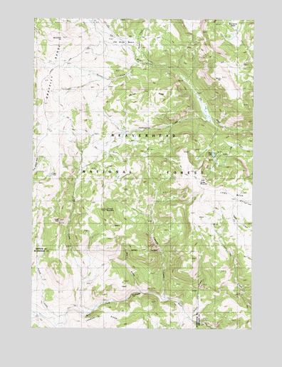
Windy Hill, MT USGS Topographic Map
Click on map above to begin viewing in our Map Viewer.

This topographic map contains these locations and features:
Feature Name Type Latitude Longitude GNIS ID View Map
Barnett CreekStreamN44.8574°W111.8164°779373View Map
Blue LakeLakeN44.8203°W111.7731°780149View Map
Buford CreekStreamN44.7560°W111.8569°780556View Map
Cascade CreekStreamN44.7613°W111.8000°780988View Map
Cascade MountainSummitN44.7980°W111.8336°781003View Map
Crater RidgeRidgeN44.8469°W111.8114°781854View Map
Divide MountainSummitN44.8091°W111.7814°782411View Map
Dry GulchValleyN44.7646°W111.8139°801812View Map
Elk River BasinBasinN44.8602°W111.8275°783124View Map
Fault LakeLakeN44.8115°W111.8657°771317View Map
Fossil CreekStreamN44.7574°W111.8416°783625View Map
Fossil PeakSummitN44.7938°W111.8600°783627View Map
Gazelle Creek Pack TrailTrailN44.8644°W111.7877°783873View Map
Hellroaring CreekStreamN44.8355°W111.7764°784736View Map
Landon RidgeRidgeN44.7533°W111.8261°785947View Map
Lobo MesaSummitN44.8024°W111.7675°786409View Map
Lobo Mesa Pack TrailTrailN44.8191°W111.8025°786410View Map
Monument HillSummitN44.8666°W111.8600°787595View Map
Nelson CreekStreamN44.8569°W111.8080°787943View Map
Portal CreekStreamN44.7533°W111.7839°789117View Map
Rossiter CreekStreamN44.8733°W111.8428°789797View Map
Windy HillSummitN44.8513°W111.7697°793408View Map
Wolverine BasinBasinN44.8708°W111.7616°793466View Map

Note: Coordinates in the location and feature list above are referenced to NAD83 datum.


Copyright (C) 2008-2025 Ryan Niemi / Sunset Dynamics ... All Rights Reserved