TopoQuest Logo
Do you find TopoQuest useful?
Help keep TopoQuest running and adding new maps/features by donating!
Bitcoin:  19c7KJd3qBynnjoSw5npx9KScwjBe4ifkT
Litecoin:  LXs6TkuXGGXo1vDsWCkWVdjQX94eUKd6ui
Home View Maps Find Maps Find Places Resources & Links


Granite Mountain, Montana Topographic Map

USGS Map Title: Granite Mountain, MT
USGS Map MRC: 44111H6
DRG (GeoTIFF) Download: o44111h6.tif


Neighboring USGS Topographic Map Quads:


  Broomtail Ridge, MT  
45111A7
 

  Bucks Nest, MT  
45111A6
 

  No Man Peak, MT  
45111A5
 

  Big Horn Mountain, MT  
44111H7
 

  Granite Mountain, MT  
44111H6
 

  Bad Luck Creek, MT  
44111H5
 

  Windy Hill, MT  
44111G7
 

  Freezeout Mountain, MT  
44111G6
 

  Cliff Lake, MT  
44111G5


Map MRC Location:

N45°
W112°
N45°
W111°
H8 H7 H6 H5 H4 H3 H2 H1
G8 G7 G6 G5 G4 G3 G2 G1
F8 F7 F6 F5 F4 F3 F2 F1
E8 E7 E6 E5 E4 E3 E2 E1
D8 D7 D6 D5 D4 D3 D2 D1
C8 C7 C6 C5 C4 C3 C2 C1
B8 B7 B6 B5 B4 B3 B2 B1
A8 A7 A6 A5 A4 A3 A2 A1
N44°
W112°
N44°
W111°

Granite Mountain, MT USGS 1:24K Topographic Map Preview:
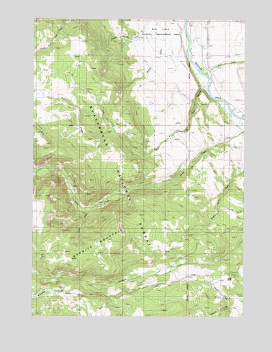
Granite Mountain, MT USGS Topographic Map
Click on map above to begin viewing in our Map Viewer.

This topographic map contains these locations and features:
Feature Name Type Latitude Longitude GNIS ID View Map
10S01E06BBBD01 WellWellN44.9983°W111.6566°807266View Map
10S01E06BBCC01 WellWellN44.9960°W111.6572°807259View Map
10S01E06CCB_01 WellWellN44.9860°W111.6544°807255View Map
10S01E07CABD01 SpringSpringN44.9758°W111.6514°807246View Map
10S01E07DDB_01 WellWellN44.9713°W111.6391°807245View Map
Camp CreekStreamN44.9202°W111.7186°780836View Map
Curley Bill CreekStreamN44.9896°W111.6591°1797623View Map
Gold ButteSummitN44.8908°W111.6327°784037View Map
Granite MountainSummitN44.9069°W111.7075°784174View Map
Kelly RanchLocaleN44.9519°W111.6708°794515View Map
Klatt RanchLocaleN44.9524°W111.6697°785786View Map
Moose CreekStreamN44.9591°W111.6261°787630View Map
North Fork Wall CreekStreamN44.9533°W111.7030°788275View Map
South Madison CampgroundLocaleN44.9963°W111.6591°794514View Map
Stock CreekStreamN44.9824°W111.6261°791534View Map
Wall CanyonValleyN44.9716°W111.6516°792766View Map
Wall CreekStreamN44.9713°W111.6483°792769View Map
Wolf CreekStreamN44.9771°W111.6500°793449View Map
Wolf Creek RanchLocaleN44.9791°W111.6494°793456View Map
Wolverine CreekStreamN44.8905°W111.7316°793468View Map

Note: Coordinates in the location and feature list above are referenced to NAD83 datum.


Copyright (C) 2008-2025 Ryan Niemi / Sunset Dynamics ... All Rights Reserved