TopoQuest Logo
Do you find TopoQuest useful?
Help keep TopoQuest running and adding new maps/features by donating!
Bitcoin:  19c7KJd3qBynnjoSw5npx9KScwjBe4ifkT
Litecoin:  LXs6TkuXGGXo1vDsWCkWVdjQX94eUKd6ui
Home View Maps Find Maps Find Places Resources & Links


Wocus, Oregon Topographic Map

USGS Map Title: Wocus, OR
USGS Map MRC: 42121C7
DRG (GeoTIFF) Download: o42121c7.tif


Neighboring USGS Topographic Map Quads:


  Shoalwater Bay, OR  
42121D8
 

  Modoc Point, OR  
42121D7
 

  Swan Lake Point, OR  
42121D6
 

  Howard Bay, OR  
42121C8
 

  Wocus, OR  
42121C7
 

  Whiteline Reservoir, OR  
42121C6
 

  Keno, OR  
42121B8
 

  Klamath Falls, OR  
42121B7
 

  Altamont, OR  
42121B6


Map MRC Location:

N43°
W122°
N43°
W121°
H8 H7 H6 H5 H4 H3 H2 H1
G8 G7 G6 G5 G4 G3 G2 G1
F8 F7 F6 F5 F4 F3 F2 F1
E8 E7 E6 E5 E4 E3 E2 E1
D8 D7 D6 D5 D4 D3 D2 D1
C8 C7 C6 C5 C4 C3 C2 C1
B8 B7 B6 B5 B4 B3 B2 B1
A8 A7 A6 A5 A4 A3 A2 A1
N42°
W122°
N42°
W121°

Wocus, OR USGS 1:24K Topographic Map Preview:
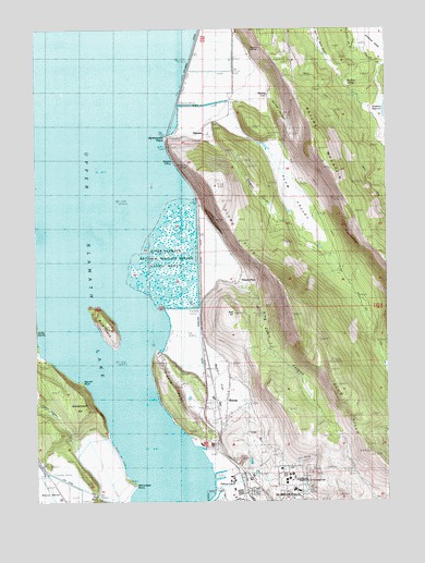
Wocus, OR USGS Topographic Map
Click on map above to begin viewing in our Map Viewer.

This topographic map contains these locations and features:
Feature Name Type Latitude Longitude GNIS ID View Map
AlgomaPopulated PlaceN42.3471°W121.8156°1135996View Map
Algoma InclineCliffN42.3707°W121.7986°1116856View Map
Algoma Post Office (historical)Post OfficeN42.3471°W121.8156°1164821View Map
Algoma SidingLocaleN42.3401°W121.8275°1166774View Map
Bald HillSummitN42.2993°W121.8061°1117173View Map
Bennett PointCapeN42.2813°W121.8606°1117530View Map
Buck IslandIslandN42.2974°W121.8517°1118196View Map
Cove PointCapeN42.2854°W121.8331°1119412View Map
Government HillSummitN42.2740°W121.8581°1121272View Map
Hanks MarshSwampN42.3139°W121.8272°1121558View Map
Herlihy CanyonValleyN42.3560°W121.7903°1121768View Map
Hummingbird SpringSpringN42.3685°W121.7992°1122130View Map
John F Moehl StadiumLocaleN42.2587°W121.7856°2699995View Map
King Cabin CanyonValleyN42.3057°W121.7997°1122738View Map
Klamath County Fire District 1 Station 5BuildingN42.2692°W121.8099°2576961View Map
Klamath Falls Ranger DistrictBuildingN42.2516°W121.7908°1875824View Map
KOTI-TVTowerN42.2621°W121.7617°1158737View Map
McCornack PointCapeN42.2543°W121.8417°1123922View Map
Merle West Medical Center HelipadAirportN42.2540°W121.7844°1131637View Map
Naylox (historical)LocaleN42.3571°W121.7931°1124606View Map
Naylox MountainSummitN42.3429°W121.7750°1124607View Map
Naylox Post Office (historical)Post OfficeN42.3571°W121.7931°1165690View Map
Neubert SpringSpringN42.3597°W121.7641°1124656View Map
Oregon Institute of TechnologySchoolN42.2554°W121.7853°2699683View Map
Oregon Institute of TechnologySchoolN42.2563°W121.7862°1135530View Map
Pelican (historical)LocaleN42.2585°W121.8039°1166247View Map
Pelican CityPopulated PlaceN42.2532°W121.7972°1136619View Map
Plum HillsSummitN42.2990°W121.7842°1136633View Map
Plum ValleyValleyN42.3515°W121.8061°1125491View Map
Rabbit FlatFlatN42.2829°W121.8131°1125764View Map
Rattlesnake PointCapeN42.3457°W121.8292°1125836View Map
Shady PinePopulated PlaceN42.3082°W121.8036°1136741View Map
Shaw Historical LibraryBuildingN42.2569°W121.7865°2699067View Map
Simpson CanyonValleyN42.3238°W121.7908°1126990View Map
Sky Lakes Medical CenterHospitalN42.2530°W121.7847°2610875View Map
Sky Lakes Medical Center HeliportAirportN42.2528°W121.7862°2698955View Map
Terminal CityPopulated PlaceN42.2665°W121.8111°1158954View Map
The NeckCapeN42.2529°W121.8553°1127987View Map
Whiteline SpringSpringN42.3499°W121.7595°1132657View Map
WocusLocaleN42.2726°W121.8089°1129266View Map

Note: Coordinates in the location and feature list above are referenced to NAD83 datum.


Copyright (C) 2008-2024 Ryan Niemi / Sunset Dynamics ... All Rights Reserved