TopoQuest Logo
Do you find TopoQuest useful?
Help keep TopoQuest running and adding new maps/features by donating!
Bitcoin:  19c7KJd3qBynnjoSw5npx9KScwjBe4ifkT
Litecoin:  LXs6TkuXGGXo1vDsWCkWVdjQX94eUKd6ui
Home View Maps Find Maps Find Places Resources & Links


Whiteline Reservoir, Oregon Topographic Map

USGS Map Title: Whiteline Reservoir, OR
USGS Map MRC: 42121C6
DRG (GeoTIFF) Download: o42121c6.tif


Neighboring USGS Topographic Map Quads:


  Modoc Point, OR  
42121D7
 

  Swan Lake Point, OR  
42121D6
 

  Sprague River West, OR  
42121D5
 

  Wocus, OR  
42121C7
 

  Whiteline Reservoir, OR  
42121C6
 

  Swan Lake, OR  
42121C5
 

  Klamath Falls, OR  
42121B7
 

  Altamont, OR  
42121B6
 

  Dairy, OR  
42121B5


Map MRC Location:

N43°
W122°
N43°
W121°
H8 H7 H6 H5 H4 H3 H2 H1
G8 G7 G6 G5 G4 G3 G2 G1
F8 F7 F6 F5 F4 F3 F2 F1
E8 E7 E6 E5 E4 E3 E2 E1
D8 D7 D6 D5 D4 D3 D2 D1
C8 C7 C6 C5 C4 C3 C2 C1
B8 B7 B6 B5 B4 B3 B2 B1
A8 A7 A6 A5 A4 A3 A2 A1
N42°
W122°
N42°
W121°

Whiteline Reservoir, OR USGS 1:24K Topographic Map Preview:
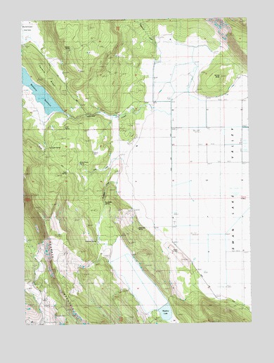
Whiteline Reservoir, OR USGS Topographic Map
Click on map above to begin viewing in our Map Viewer.

This topographic map contains these locations and features:
Feature Name Type Latitude Longitude GNIS ID View Map
Anderson CreekStreamN42.3355°W121.6686°1161662View Map
Antelope ValleyValleyN42.3668°W121.7403°1137255View Map
Brookside CreekStreamN42.3068°W121.6956°1161668View Map
Brookside SpringSpringN42.2995°W121.7063°1132656View Map
Cabin CreekStreamN42.3138°W121.6917°1118439View Map
Cabin Creek SpringSpringN42.3158°W121.7200°1118443View Map
Chitwood SpringSpringN42.2888°W121.6881°1135772View Map
Cold SpringSpringN42.3306°W121.7283°1119101View Map
Coleman RanchLocaleN42.3246°W121.6900°1119141View Map
Deer SpringSpringN42.3123°W121.7268°1119839View Map
Edgewood CreekStreamN42.3388°W121.6567°1154943View Map
Edgewood RanchLocaleN42.3679°W121.6761°1120395View Map
Gabriel CemeteryCemeteryN42.3205°W121.7118°1121030View Map
Grizzly ButteSummitN42.3513°W121.6403°1121443View Map
Hibbert CemeteryCemeteryN42.2797°W121.6659°1121783View Map
Holcomb SpringSpringN42.2838°W121.7112°1121897View Map
Janssen RanchLocaleN42.3593°W121.7319°1122384View Map
Janssen SpringSpringN42.3630°W121.7240°1122385View Map
Janssen Spring CreekStreamN42.3651°W121.7428°1132654View Map
Meadow LakeReservoirN42.2544°W121.6733°1161435View Map
Meadow Lake DamDamN42.2563°W121.6744°1161694View Map
Meadow Lake ValleyFlatN42.2665°W121.6928°1159053View Map
Oberman ReservoirReservoirN42.3612°W121.6460°1161661View Map
Oregon Technical Institute (historical)SchoolN42.2625°W121.7436°1125034View Map
Oretech Post OfficePost OfficeN42.2624°W121.7436°1164569View Map
Surveyors SpringSpringN42.3225°W121.7369°1127769View Map
Swan (historical)LocaleN42.3410°W121.6894°1638045View Map
Swan Lake MeadowFlatN42.3235°W121.6317°1132664View Map
Swan Post Office (historical)Post OfficeN42.3410°W121.6894°1166018View Map
Twomile RidgeRidgeN42.3524°W121.7383°1128387View Map
Twomile ValleyBasinN42.3457°W121.7428°1132464View Map
Whiteline DamDamN42.3372°W121.7280°1133717View Map
Whiteline DitchCanalN42.3318°W121.7386°1132655View Map
Whiteline ReservoirReservoirN42.3448°W121.7411°1161589View Map

Note: Coordinates in the location and feature list above are referenced to NAD83 datum.


Copyright (C) 2008-2024 Ryan Niemi / Sunset Dynamics ... All Rights Reserved