TopoQuest Logo
Do you find TopoQuest useful?
Help keep TopoQuest running and adding new maps/features by donating!
Bitcoin:  19c7KJd3qBynnjoSw5npx9KScwjBe4ifkT
Litecoin:  LXs6TkuXGGXo1vDsWCkWVdjQX94eUKd6ui
Home View Maps Find Maps Find Places Resources & Links


Wolf Creek Summit, Utah Topographic Map

USGS Map Title: Wolf Creek Summit, UT
USGS Map MRC: 40111D1
DRG (GeoTIFF) Download: o40111d1.tif


Neighboring USGS Topographic Map Quads:


  Woodland, UT  
40111E2
 

  Soapstone Basin, UT  
40111E1
 

  Iron Mine Mountain, UT  
40110E8
 

  Heber Mountain, UT  
40111D2
 

  Wolf Creek Summit, UT  
40111D1
 

  Wolf Creek, UT  
40110D8
 

  Co-op Creek, UT  
40111C2
 

  Jimmies Point, UT  
40111C1
 

  Raspberry Knoll, UT  
40110C8


Map MRC Location:

N41°
W112°
N41°
W111°
H8 H7 H6 H5 H4 H3 H2 H1
G8 G7 G6 G5 G4 G3 G2 G1
F8 F7 F6 F5 F4 F3 F2 F1
E8 E7 E6 E5 E4 E3 E2 E1
D8 D7 D6 D5 D4 D3 D2 D1
C8 C7 C6 C5 C4 C3 C2 C1
B8 B7 B6 B5 B4 B3 B2 B1
A8 A7 A6 A5 A4 A3 A2 A1
N40°
W112°
N40°
W111°

Wolf Creek Summit, UT USGS 1:24K Topographic Map Preview:
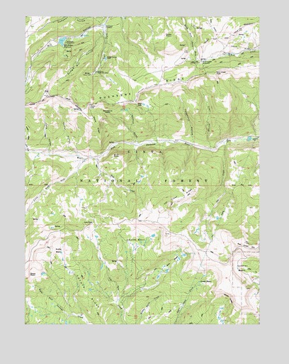
Wolf Creek Summit, UT USGS Topographic Map
Click on map above to begin viewing in our Map Viewer.

This topographic map contains these locations and features:
Feature Name Type Latitude Longitude GNIS ID View Map
Becky BasinBasinN40.3952°W111.1196°1438556View Map
Beef PastureAreaN40.4411°W111.0968°1451190View Map
Bills BasinBasinN40.3999°W111.0466°1438767View Map
Buck KnollSummitN40.4436°W111.0752°1439231View Map
Camp HollowValleyN40.4455°W111.1129°1439444View Map
Campbell HollowValleyN40.4969°W111.0838°1439455View Map
Coleman BasinBasinN40.3980°W111.0129°1439890View Map
Corral HollowValleyN40.4458°W111.1010°1439975View Map
Coyote RidgeRidgeN40.3805°W111.0871°1440120View Map
Death HollowValleyN40.4463°W111.1243°1440325View Map
Duchesne RidgeRidgeN40.4672°W111.0949°1440700View Map
East Fork Mill HollowValleyN40.4955°W111.0832°1440812View Map
Heart LakeReservoirN40.4647°W111.0610°1454761View Map
Jimmies BasinBasinN40.4083°W111.0666°1442145View Map
Jones BasinBasinN40.3916°W111.0299°1442203View Map
Little West ForkStreamN40.4422°W111.0935°1442812View Map
Low PassGapN40.4166°W111.0893°1442992View Map
Mill Hollow CampgroundLocaleN40.4894°W111.1041°1454819View Map
Mill Hollow DamDamN40.4916°W111.1041°1447861View Map
Mill Hollow Granite School CenterSchoolN40.4780°W111.0877°1443464View Map
Mill Hollow Guard StationLocaleN40.4958°W111.0827°1443465View Map
Mill Hollow ReservoirReservoirN40.4901°W111.1060°1443466View Map
Neeley BasinBasinN40.4927°W111.0471°1443782View Map
Pass CreekStreamN40.4422°W111.0868°1444235View Map
Red Creek MountainSummitN40.4080°W111.0082°1444794View Map
Sandstone BasinBasinN40.4602°W111.0816°1445318View Map
Scotty BasinBasinN40.4047°W111.1060°1445388View Map
Shale RidgeRidgeN40.4561°W111.0877°1445468View Map
Telephone HollowValleyN40.4486°W111.0363°1446379View Map
Trail HollowValleyN40.4466°W111.0263°1446681View Map
Vat CreekStreamN40.4491°W111.0193°1446915View Map
Vat Creek RidgeRidgeN40.4247°W111.0463°1446916View Map
Vat TunnelCanalN40.4093°W111.0263°1451221View Map
Washout GulchValleyN40.4491°W111.0654°1447027View Map
White LedgeCliffN40.3866°W111.0157°1447257View Map
Wolf Creek CampgroundLocaleN40.4813°W111.0327°1454955View Map
Wolf Creek PeakSummitN40.4766°W111.0243°1449208View Map
Wolf Creek SummitSummitN40.4813°W111.0313°1447497View Map
Yellow LakeLakeN40.4644°W111.0911°1447556View Map

Note: Coordinates in the location and feature list above are referenced to NAD83 datum.


Copyright (C) 2008-2024 Ryan Niemi / Sunset Dynamics ... All Rights Reserved