TopoQuest Logo
Do you find TopoQuest useful?
Help keep TopoQuest running and adding new maps/features by donating!
Bitcoin:  19c7KJd3qBynnjoSw5npx9KScwjBe4ifkT
Litecoin:  LXs6TkuXGGXo1vDsWCkWVdjQX94eUKd6ui
Home View Maps Find Maps Find Places Resources & Links


Wolf Creek, Utah Topographic Map

USGS Map Title: Wolf Creek, UT
USGS Map MRC: 40110D8
DRG (GeoTIFF) Download: o40110d8.tif


Neighboring USGS Topographic Map Quads:


  Soapstone Basin, UT  
40111E1
 

  Iron Mine Mountain, UT  
40110E8
 

  Grandaddy Lake, UT  
40110E7
 

  Wolf Creek Summit, UT  
40111D1
 

  Wolf Creek, UT  
40110D8
 

  Hanna, UT  
40110D7
 

  Jimmies Point, UT  
40111C1
 

  Raspberry Knoll, UT  
40110C8
 

  Tabby Mountain, UT  
40110C7


Map MRC Location:

N41°
W111°
N41°
W110°
H8 H7 H6 H5 H4 H3 H2 H1
G8 G7 G6 G5 G4 G3 G2 G1
F8 F7 F6 F5 F4 F3 F2 F1
E8 E7 E6 E5 E4 E3 E2 E1
D8 D7 D6 D5 D4 D3 D2 D1
C8 C7 C6 C5 C4 C3 C2 C1
B8 B7 B6 B5 B4 B3 B2 B1
A8 A7 A6 A5 A4 A3 A2 A1
N40°
W111°
N40°
W110°

Wolf Creek, UT USGS 1:24K Topographic Map Preview:
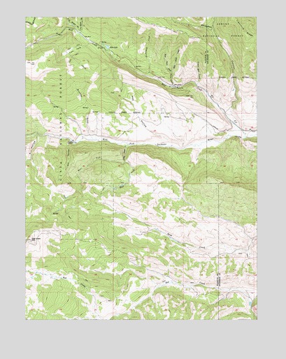
Wolf Creek, UT USGS Topographic Map
Click on map above to begin viewing in our Map Viewer.

This topographic map contains these locations and features:
Feature Name Type Latitude Longitude GNIS ID View Map
A HollowValleyN40.4519°W110.9946°1438107View Map
Annie Mae CreekStreamN40.4724°W110.9082°1438231View Map
Bear CampLocaleN40.4716°W110.9179°1438438View Map
Blue LakeLakeN40.4876°W110.9564°1438940View Map
Buckboard CreekStreamN40.4774°W110.9332°1439238View Map
Buckley DrawValleyN40.4511°W110.9660°1439248View Map
Dry HollowValleyN40.4488°W110.9754°1440645View Map
East Fork Little Sand CreekStreamN40.4397°W110.9460°1440811View Map
East Twin CreekStreamN40.4772°W110.9216°1440852View Map
Hay HollowValleyN40.4483°W110.9229°1441640View Map
Lightning RidgeRidgeN40.4913°W110.8768°1442588View Map
Little Sand CreekStreamN40.4472°W110.9460°1442778View Map
Mill ForkStreamN40.4947°W110.8991°1443446View Map
North Fork Phelps BrookStreamN40.4936°W110.9710°1443925View Map
Rhoades CanyonValleyN40.4619°W110.8899°1444881View Map
South Fork Phelps BrookStreamN40.4933°W110.9707°1445863View Map
Tabby SwaleValleyN40.3822°W110.8785°1446309View Map
Tims HoleBasinN40.4863°W110.9732°1446615View Map
Twin CreekStreamN40.4708°W110.9202°1446779View Map
West Fork Little Sand CreekStreamN40.4397°W110.9460°1447147View Map
West Twin CreekStreamN40.4772°W110.9216°1447184View Map
Wolf CreekStreamN40.4502°W110.8813°1447495View Map

Note: Coordinates in the location and feature list above are referenced to NAD83 datum.


Copyright (C) 2008-2025 Ryan Niemi / Sunset Dynamics ... All Rights Reserved