TopoQuest Logo
Do you find TopoQuest useful?
Help keep TopoQuest running and adding new maps/features by donating!
Bitcoin:  19c7KJd3qBynnjoSw5npx9KScwjBe4ifkT
Litecoin:  LXs6TkuXGGXo1vDsWCkWVdjQX94eUKd6ui
Home View Maps Find Maps Find Places Resources & Links


Boulder Butte, Oregon Topographic Map

USGS Map Title: Boulder Butte, OR
USGS Map MRC: 44118F6
DRG (GeoTIFF) Download: o44118f6.tif


Neighboring USGS Topographic Map Quads:


  Sharp Ridge, OR  
44118G7
 

  Desolation Butte, OR  
44118G6
 

  Olive Lake, OR  
44118G5
 

  Susanville, OR  
44118F7
 

  Boulder Butte, OR  
44118F6
 

  Vinegar Hill, OR  
44118F5
 

  Cougar Rock, OR  
44118E7
 

  Dixie Meadows, OR  
44118E6
 

  Bates, OR  
44118E5


Map MRC Location:

N45°
W119°
N45°
W118°
H8 H7 H6 H5 H4 H3 H2 H1
G8 G7 G6 G5 G4 G3 G2 G1
F8 F7 F6 F5 F4 F3 F2 F1
E8 E7 E6 E5 E4 E3 E2 E1
D8 D7 D6 D5 D4 D3 D2 D1
C8 C7 C6 C5 C4 C3 C2 C1
B8 B7 B6 B5 B4 B3 B2 B1
A8 A7 A6 A5 A4 A3 A2 A1
N44°
W119°
N44°
W118°

Boulder Butte, OR USGS 1:24K Topographic Map Preview:
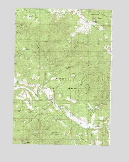
Boulder Butte, OR USGS Topographic Map
Click on map above to begin viewing in our Map Viewer.

This topographic map contains these locations and features:
Feature Name Type Latitude Longitude GNIS ID View Map
Badger CreekStreamN44.6924°W118.7097°1137393View Map
Bear Paw MeadowFlatN44.7413°W118.7305°1137735View Map
Beaver CreekStreamN44.6524°W118.6791°1137807View Map
Big Boulder CreekStreamN44.6660°W118.7169°1137978View Map
Big Boulder TrailTrailN44.7288°W118.6711°1138497View Map
Boulder ButteSummitN44.7382°W118.6466°1138461View Map
Butte CreekStreamN44.6424°W118.6525°1139056View Map
China DiggingsMineN44.6577°W118.6516°1639298View Map
Corey GulchValleyN44.6682°W118.6625°1140122View Map
Corner CreekStreamN44.6596°W118.6872°1152987View Map
Cougar RidgeRidgeN44.7207°W118.6886°1152981View Map
Coyote BluffCliffN44.6260°W118.6408°1155469View Map
Coyote CreekStreamN44.6746°W118.7500°1140318View Map
Coyote MeadowFlatN44.7124°W118.7386°1140332View Map
Crockett SpringSpringN44.7073°W118.7426°1140452View Map
Dry CreekStreamN44.6649°W118.7002°1141282View Map
East Fork Coyote CreekStreamN44.6813°W118.7452°1141551View Map
East Fork Sunshine CreekStreamN44.6568°W118.7102°1141610View Map
Granite Boulder CreekStreamN44.6479°W118.6647°1142912View Map
Grassy SpringSpringN44.6277°W118.7394°1142978View Map
Haystack SpringSpringN44.6562°W118.7443°1143421View Map
McCalpine MeadowFlatN44.7270°W118.6257°1116600View Map
Middle Fork Sunshine CreekStreamN44.6571°W118.7144°1146162View Map
Myrtle ButteSummitN44.7196°W118.7119°1146709View Map
Myrtle CreekStreamN44.7002°W118.7113°1146710View Map
Plute SpringSpringN44.7179°W118.6438°1155468View Map
Ragged CreekStreamN44.6574°W118.6813°1148134View Map
Reed MineMineN44.7193°W118.6608°1156696View Map
Riverside GulchValleyN44.6415°W118.6608°1148495View Map
Ruby CreekStreamN44.6513°W118.6777°1148825View Map
Squatter FlatFlatN44.6531°W118.6744°1152986View Map
Stalter MineMineN44.7094°W118.6400°1150329View Map
Stithum MineMineN44.6362°W118.6968°1150441View Map
Sunshine CreekStreamN44.6629°W118.6977°1150687View Map
Sunshine Guard StationBuildingN44.6662°W118.7006°1150692View Map
Sunshine SpringsSpringN44.6707°W118.7026°1153805View Map
Tincup CreekStreamN44.6438°W118.6325°1151266View Map
Vinegar Hill-Indian Rock Scenic AreaParkN44.7379°W118.6347°1167308View Map
West Fork Ruby CreekStreamN44.6335°W118.6777°1152108View Map
Windlass CreekStreamN44.6388°W118.6274°1152501View Map
Wray CreekStreamN44.6813°W118.7116°1152655View Map
Wray MineMineN44.6999°W118.6533°1152656View Map

Note: Coordinates in the location and feature list above are referenced to NAD83 datum.


Copyright (C) 2008-2025 Ryan Niemi / Sunset Dynamics ... All Rights Reserved