TopoQuest Logo
Do you find TopoQuest useful?
Help keep TopoQuest running and adding new maps/features by donating!
Bitcoin:  19c7KJd3qBynnjoSw5npx9KScwjBe4ifkT
Litecoin:  LXs6TkuXGGXo1vDsWCkWVdjQX94eUKd6ui
Home View Maps Find Maps Find Places Resources & Links


Desolation Butte, Oregon Topographic Map

USGS Map Title: Desolation Butte, OR
USGS Map MRC: 44118G6
DRG (GeoTIFF) Download: o44118g6.tif


Neighboring USGS Topographic Map Quads:


  The Cockscomb, OR  
44118H7
 

  Kelsay Butte, OR  
44118H6
 

  Silver Butte, OR  
44118H5
 

  Sharp Ridge, OR  
44118G7
 

  Desolation Butte, OR  
44118G6
 

  Olive Lake, OR  
44118G5
 

  Susanville, OR  
44118F7
 

  Boulder Butte, OR  
44118F6
 

  Vinegar Hill, OR  
44118F5


Map MRC Location:

N45°
W119°
N45°
W118°
H8 H7 H6 H5 H4 H3 H2 H1
G8 G7 G6 G5 G4 G3 G2 G1
F8 F7 F6 F5 F4 F3 F2 F1
E8 E7 E6 E5 E4 E3 E2 E1
D8 D7 D6 D5 D4 D3 D2 D1
C8 C7 C6 C5 C4 C3 C2 C1
B8 B7 B6 B5 B4 B3 B2 B1
A8 A7 A6 A5 A4 A3 A2 A1
N44°
W119°
N44°
W118°

Desolation Butte, OR USGS 1:24K Topographic Map Preview:
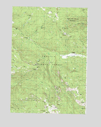
Desolation Butte, OR USGS Topographic Map
Click on map above to begin viewing in our Map Viewer.

This topographic map contains these locations and features:
Feature Name Type Latitude Longitude GNIS ID View Map
Battle Creek TrailTrailN44.8593°W118.7213°1137592View Map
Bull PrairieFlatN44.8668°W118.6880°1138913View Map
Cabin CreekStreamN44.7879°W118.7316°1152940View Map
Cold SpringSpringN44.8579°W118.6787°1139943View Map
Cold Spring TrailTrailN44.8638°W118.6472°1139965View Map
Desolation ButteSummitN44.8504°W118.6641°1140921View Map
Desolation Butte LookoutLocaleN44.8338°W118.6641°1156128View Map
Desolation Guard StationLocaleN44.8215°W118.6447°1140924View Map
Desolation MeadowsFlatN44.8189°W118.6555°1140925View Map
Donaldson MineMineN44.7602°W118.6688°1141173View Map
Donaldson RockSummitN44.7565°W118.6751°1150294View Map
Farley SpringSpringN44.8404°W118.6541°1142016View Map
Farley Spring TrailTrailN44.8324°W118.6519°1142018View Map
Head O'Boulder CampLocaleN44.7513°W118.6913°1143432View Map
Head O'Boulder SpringSpringN44.7516°W118.6928°1155470View Map
Howard CreekStreamN44.8379°W118.7233°1143845View Map
Indian RockSummitN44.7565°W118.6922°1144072View Map
Indian Rock Lookout TowerTowerN44.7568°W118.6917°1156129View Map
Indian Rock TrailTrailN44.7790°W118.6875°1156127View Map
Jumpoff Joe CampLocaleN44.8010°W118.7091°1144425View Map
Jumpoff Joe LakeLakeN44.8120°W118.7057°1144426View Map
Jumpoff Joe PeakSummitN44.8013°W118.7066°1158304View Map
Jumpoff Joe TrailTrailN44.8135°W118.7141°1144427View Map
Line CreekStreamN44.8185°W118.6450°1145042View Map
Lost CampLocaleN44.7927°W118.6608°1145501View Map
Lost Camp TrailTrailN44.7935°W118.6563°1145504View Map
Lost LakeLakeN44.8032°W118.6467°1145545View Map
Lost Lake TrailTrailN44.7660°W118.6308°1145551View Map
Lower Howard CampLocaleN44.8379°W118.7230°1145623View Map
Meadow CampLocaleN44.8474°W118.7447°1158365View Map
North Fork Desolation CreekStreamN44.8196°W118.6883°1146944View Map
Pole CreekStreamN44.7888°W118.7233°1152941View Map
Princess TrailTrailN44.7861°W118.6871°1144073View Map
Ranger Station Camp (historical)LocaleN44.8190°W118.6333°1148213View Map
Saddle CampLocaleN44.7565°W118.6269°1148899View Map
Skinner CreekStreamN44.8185°W118.6533°1149595View Map
Skinner MineMineN44.8377°W118.6663°1149597View Map
South Fork Desolation CreekStreamN44.8193°W118.6888°1149967View Map
Sponge CreekStreamN44.8452°W118.7358°1150134View Map
Sponge Creek CampLocaleN44.8635°W118.7186°1150135View Map
Summit CampLocaleN44.7727°W118.6369°1150607View Map
Sunset SpringSpringN44.8425°W118.6607°1150681View Map
Sunset TrailTrailN44.8465°W118.6880°1150683View Map
Upper Howard CampLocaleN44.8504°W118.7033°1151680View Map

Note: Coordinates in the location and feature list above are referenced to NAD83 datum.


Copyright (C) 2008-2025 Ryan Niemi / Sunset Dynamics ... All Rights Reserved