TopoQuest Logo
Do you find TopoQuest useful?
Help keep TopoQuest running and adding new maps/features by donating!
Bitcoin:  19c7KJd3qBynnjoSw5npx9KScwjBe4ifkT
Litecoin:  LXs6TkuXGGXo1vDsWCkWVdjQX94eUKd6ui
Home View Maps Find Maps Find Places Resources & Links


Wolverton, Minnesota Topographic Map

USGS Map Title: Wolverton, MN
USGS Map MRC: 46096E6
DRG (GeoTIFF) Download: o46096e6.tif


Neighboring USGS Topographic Map Quads:


  Hickson, ND  
46096F7
 

  Comstock, MN  
46096F6
 

  Baker, MN  
46096F5
 

  Christine, ND  
46096E7
 

  Wolverton, MN  
46096E6
 

  Wolverton SE, MN  
46096E5
 

  Galchutt, ND  
46096D7
 

  Abercrombie, ND  
46096D6
 

  Wahpeton NE, MN  
46096D5


Map MRC Location:

N47°
W97°
N47°
W96°
H8 H7 H6 H5 H4 H3 H2 H1
G8 G7 G6 G5 G4 G3 G2 G1
F8 F7 F6 F5 F4 F3 F2 F1
E8 E7 E6 E5 E4 E3 E2 E1
D8 D7 D6 D5 D4 D3 D2 D1
C8 C7 C6 C5 C4 C3 C2 C1
B8 B7 B6 B5 B4 B3 B2 B1
A8 A7 A6 A5 A4 A3 A2 A1
N46°
W97°
N46°
W96°

Wolverton, MN USGS 1:24K Topographic Map Preview:
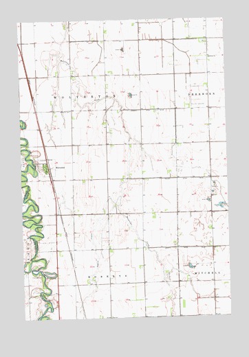
Wolverton, MN USGS Topographic Map
Click on map above to begin viewing in our Map Viewer.

This topographic map contains these locations and features:
Feature Name Type Latitude Longitude GNIS ID View Map
City of WolvertonCivilN46.5630°W96.7362°2397359View Map
County Ditch Number Five ACanalN46.5869°W96.6742°642163View Map
County Ditch Number TwentysixCanalN46.5291°W96.6545°641874View Map
Deerhorn ChurchChurchN46.6086°W96.6351°642737View Map
Evangelical Free ChurchChurchN46.5633°W96.7333°2068567View Map
Faith Lutheran ChurchChurchN46.5633°W96.7333°2068568View Map
KLTA-FM (Breckenridge)TowerN46.5447°W96.6262°663286View Map
Nyqist CouleeValleyN46.5509°W96.6908°648771View Map
Schmitt CemeteryCemeteryN46.5179°W96.7450°1031384View Map
Township of RobertsCivilN46.5026°W96.6956°665429View Map
Township of WolvertonCivilN46.5905°W96.7092°666038View Map
WolvertonPopulated PlaceN46.5633°W96.7337°654328View Map
WolvertonLocaleN46.5633°W96.7333°2068571View Map
Wolverton CemeteryCemeteryN46.5872°W96.7192°654329View Map
Wolverton Fire DepartmentBuildingN46.5629°W96.7341°2068570View Map
Wolverton Post OfficePost OfficeN46.5633°W96.7333°2068569View Map

Note: Coordinates in the location and feature list above are referenced to NAD83 datum.


Copyright (C) 2008-2025 Ryan Niemi / Sunset Dynamics ... All Rights Reserved