TopoQuest Logo
Do you find TopoQuest useful?
Help keep TopoQuest running and adding new maps/features by donating!
Bitcoin:  19c7KJd3qBynnjoSw5npx9KScwjBe4ifkT
Litecoin:  LXs6TkuXGGXo1vDsWCkWVdjQX94eUKd6ui
Home View Maps Find Maps Find Places Resources & Links


Wulfert, Florida Topographic Map

USGS Map Title: Wulfert, FL
USGS Map MRC: 26082D2
DRG (GeoTIFF) Download: o26082d2.tif


Neighboring USGS Topographic Map Quads:


  Captiva, FL  
26082E2
 

  Pine Island Center, FL  
26082E1


  Wulfert, FL  
26082D2
 

  Sanibel, FL  
26082D1


Map MRC Location:

N27°
W83°
N27°
W82°
H8 H7 H6 H5 H4 H3 H2 H1
G8 G7 G6 G5 G4 G3 G2 G1
F8 F7 F6 F5 F4 F3 F2 F1
E8 E7 E6 E5 E4 E3 E2 E1
D8 D7 D6 D5 D4 D3 D2 D1
C8 C7 C6 C5 C4 C3 C2 C1
B8 B7 B6 B5 B4 B3 B2 B1
A8 A7 A6 A5 A4 A3 A2 A1
N26°
W83°
N26°
W82°

Wulfert, FL USGS 1:24K Topographic Map Preview:
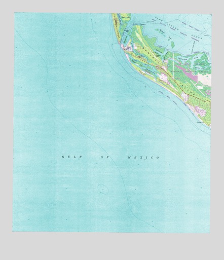
Wulfert, FL USGS Topographic Map
Click on map above to begin viewing in our Map Viewer.

This topographic map contains these locations and features:
Feature Name Type Latitude Longitude GNIS ID View Map
Albright KeyIslandN26.4848°W82.1798°277730View Map
Blind PassChannelN26.4759°W82.1782°278989View Map
Bowmans Beach HelistopAirportN26.4629°W82.1565°309879View Map
Captiva Census Designated PlaceCensusN26.4848°W82.2089°2402748View Map
Clam BayouLakeN26.4712°W82.1672°280480View Map
Coral Creek InletBayN26.4763°W82.1373°280799View Map
Dinken BayouLakeN26.4763°W82.1683°281567View Map
Golden Gate Shopping CenterLocaleN26.4059°W82.1318°296232View Map
Halloway BayouBayN26.4783°W82.1587°283631View Map
Hardworking BayouLakeN26.4738°W82.1425°283733View Map
Kesson BayouBayN26.4711°W82.1529°285067View Map
Long PointCapeN26.4781°W82.1293°286030View Map
Old Blind PassLakeN26.4672°W82.1629°288077View Map
Runyan KeyIslandN26.4892°W82.1773°290058View Map
Sanibel Fire and Rescue District Station 2BuildingN26.4654°W82.1522°2131607View Map
Sanibel RocksBarN26.4392°W82.1312°307682View Map
Santa Barbara Square Shopping CenterLocaleN26.4004°W82.1290°296233View Map
Silver KeyIslandN26.4720°W82.1701°291116View Map
WulfertPopulated PlaceN26.4804°W82.1779°293547View Map
Wulfert ChannelChannelN26.4945°W82.1759°293548View Map
Wulfert KeysIslandN26.4837°W82.1498°293549View Map

Note: Coordinates in the location and feature list above are referenced to NAD83 datum.


Copyright (C) 2008-2025 Ryan Niemi / Sunset Dynamics ... All Rights Reserved