TopoQuest Logo
Do you find TopoQuest useful?
Help keep TopoQuest running and adding new maps/features by donating!
Bitcoin:  19c7KJd3qBynnjoSw5npx9KScwjBe4ifkT
Litecoin:  LXs6TkuXGGXo1vDsWCkWVdjQX94eUKd6ui
Home View Maps Find Maps Find Places Resources & Links


Wyoming, New York Topographic Map

USGS Map Title: Wyoming, NY
USGS Map MRC: 42078G1
DRG (GeoTIFF) Download: o42078g1.tif


Neighboring USGS Topographic Map Quads:


  Batavia South, NY  
42078H2
 

  Stafford, NY  
42078H1
 

  Le Roy, NY  
42077H8
 

  Dale, NY  
42078G2
 

  Wyoming, NY  
42078G1
 

  Leicester, NY  
42077G8
 

  Warsaw, NY  
42078F2
 

  Castile, NY  
42078F1
 

  Mount Morris, NY  
42077F8


Map MRC Location:

N43°
W79°
N43°
W78°
H8 H7 H6 H5 H4 H3 H2 H1
G8 G7 G6 G5 G4 G3 G2 G1
F8 F7 F6 F5 F4 F3 F2 F1
E8 E7 E6 E5 E4 E3 E2 E1
D8 D7 D6 D5 D4 D3 D2 D1
C8 C7 C6 C5 C4 C3 C2 C1
B8 B7 B6 B5 B4 B3 B2 B1
A8 A7 A6 A5 A4 A3 A2 A1
N42°
W79°
N42°
W78°

Wyoming, NY USGS 1:24K Topographic Map Preview:
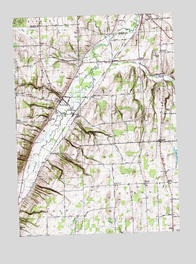
Wyoming, NY USGS Topographic Map
Click on map above to begin viewing in our Map Viewer.

This topographic map contains these locations and features:
Feature Name Type Latitude Longitude GNIS ID View Map
Bow Hill FarmsLocaleN42.8147°W78.0339°2707186View Map
Buffalo CornersPopulated PlaceN42.7781°W78.0078°945108View Map
Burk HillPopulated PlaceN42.7781°W78.0261°945212View Map
Canaway GulfValleyN42.7928°W78.1003°945760View Map
Cascade BrookStreamN42.8198°W78.0875°945944View Map
Cascade FallsFallsN42.8228°W78.0997°945947View Map
CovingtonPopulated PlaceN42.8534°W78.0103°947586View Map
Covington Pioneer CemeteryCemeteryN42.8525°W78.0072°2515227View Map
Dillon GulfValleyN42.8066°W78.0890°948455View Map
Ewells CornerPopulated PlaceN42.8314°W78.1239°972451View Map
First Baptist ChurchChurchN42.8266°W78.0868°2438970View Map
First Presbyterian ChurchChurchN42.8293°W78.0876°2438972View Map
Frog HollowValleyN42.7578°W78.0842°950750View Map
Handyside GulfValleyN42.8144°W78.0801°952156View Map
HillsidesLocaleN42.8357°W78.0985°2438971View Map
Hilltop Acres Mobile Home ParkPopulated PlaceN42.8186°W78.0022°2495979View Map
Holihan GulfValleyN42.7795°W78.1119°952985View Map
Holstead GulfValleyN42.7973°W78.0964°953025View Map
Hurst HillSummitN42.8656°W78.0736°953532View Map
Kelly BrookStreamN42.8542°W78.0625°954468View Map
LagrangePopulated PlaceN42.8017°W78.0136°954888View Map
Lagrange CemeteryCemeteryN42.8038°W78.0127°2515226View Map
Lake Le RoyReservoirN42.7940°W78.0004°955130View Map
Lambs CornerPopulated PlaceN42.8184°W78.0770°972704View Map
Middlebury Academy (historical)SchoolN42.8272°W78.0892°2575230View Map
Millers CornerPopulated PlaceN42.8153°W78.1245°972800View Map
Paines CornerPopulated PlaceN42.8395°W78.0095°972908View Map
Pavilion Fire DepartmentBuildingN42.8667°W78.0274°2701056View Map
Pavilion Junior - Senior High SchoolSchoolN42.8716°W78.0186°946303View Map
Pearl CreekPopulated PlaceN42.8487°W78.0470°960052View Map
Pearl CreekStreamN42.8528°W78.0608°960053View Map
Pierson FarmsLocaleN42.7703°W78.0239°2707198View Map
Pikes PeakSummitN42.8512°W78.0145°960392View Map
Pioneer Salt WellLocaleN42.8162°W78.0986°960619View Map
Red BrookStreamN42.8034°W78.1056°962271View Map
Ridge CornersLocaleN42.8287°W78.0647°962494View Map
Saint Marys CemeteryCemeteryN42.8707°W78.0245°963900View Map
SaltvalePopulated PlaceN42.7839°W78.1097°973038View Map
School Number 1 (historical)SchoolN42.8019°W78.0142°2380872View Map
School Number 10 (historical)SchoolN42.7781°W78.0500°974948View Map
Spragues CornerPopulated PlaceN42.8487°W78.0272°973106View Map
Titus HillSummitN42.8309°W78.1167°967562View Map
Town of CovingtonCivilN42.8327°W78.0148°978875View Map
Town of PerryCivilN42.7574°W78.0148°979354View Map
Village BrookStreamN42.8220°W78.0817°968548View Map
Village of WyomingCivilN42.8241°W78.0841°2391228View Map
Woodvale FarmsLocaleN42.7800°W78.0239°2707202View Map
Wrights CornerPopulated PlaceN42.8587°W78.1039°971757View Map
WYDM-TV (Batavia)TowerN42.8462°W78.0264°978625View Map
WyomingPopulated PlaceN42.8264°W78.0897°971788View Map
Wyoming CemeteryCemeteryN42.8284°W78.0924°2515225View Map
Wyoming Central SchoolSchoolN42.8209°W78.0931°946302View Map
Wyoming Free LibraryBuildingN42.8225°W78.0936°2617465View Map
Wyoming GulfValleyN42.8289°W78.0892°971789View Map
Wyoming Hook and Ladder Volunteer Fire Company Station 1BuildingN42.8269°W78.0827°2438967View Map
Wyoming Post OfficePost OfficeN42.8285°W78.0884°2618198View Map
Wyoming United Methodist ChurchChurchN42.8274°W78.0876°2438969View Map
Wyoming ValleyValleyN42.8448°W78.0586°971790View Map
Wyoming Village HallBuildingN42.8273°W78.0884°2438968View Map
Wyoming Village Historic DistrictParkN42.8281°W78.0881°2575232View Map

Note: Coordinates in the location and feature list above are referenced to NAD83 datum.


Copyright (C) 2008-2025 Ryan Niemi / Sunset Dynamics ... All Rights Reserved