TopoQuest Logo
Do you find TopoQuest useful?
Help keep TopoQuest running and adding new maps/features by donating!
Bitcoin:  19c7KJd3qBynnjoSw5npx9KScwjBe4ifkT
Litecoin:  LXs6TkuXGGXo1vDsWCkWVdjQX94eUKd6ui
Home View Maps Find Maps Find Places Resources & Links


Le Roy, New York Topographic Map

USGS Map Title: Le Roy, NY
USGS Map MRC: 42077H8
DRG (GeoTIFF) Download: o42077h8.tif


Neighboring USGS Topographic Map Quads:


  Byron, NY  
43078A1
 

  Churchville, NY  
43077A8
 

  Clifton, NY  
43077A7
 

  Stafford, NY  
42078H1
 

  Le Roy, NY  
42077H8
 

  Caledonia, NY  
42077H7
 

  Wyoming, NY  
42078G1
 

  Leicester, NY  
42077G8
 

  Geneseo, NY  
42077G7


Map MRC Location:

N43°
W78°
N43°
W77°
H8 H7 H6 H5 H4 H3 H2 H1
G8 G7 G6 G5 G4 G3 G2 G1
F8 F7 F6 F5 F4 F3 F2 F1
E8 E7 E6 E5 E4 E3 E2 E1
D8 D7 D6 D5 D4 D3 D2 D1
C8 C7 C6 C5 C4 C3 C2 C1
B8 B7 B6 B5 B4 B3 B2 B1
A8 A7 A6 A5 A4 A3 A2 A1
N42°
W78°
N42°
W77°

Le Roy, NY USGS 1:24K Topographic Map Preview:
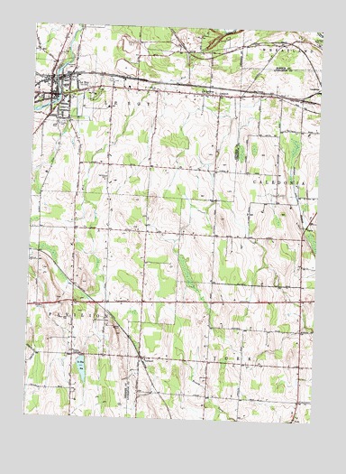
Le Roy, NY USGS Topographic Map
Click on map above to begin viewing in our Map Viewer.

This topographic map contains these locations and features:
Feature Name Type Latitude Longitude GNIS ID View Map
Ayers Tree FarmLocaleN42.8906°W77.9317°2548118View Map
Barefoot Mobile Home ParkPopulated PlaceN42.9178°W77.8868°2598826View Map
Buell CemeteryCemeteryN42.9799°W77.9485°948902View Map
Calvary Baptist Church of Le RoyChurchN42.9916°W77.9881°2615661View Map
First Baptist Church of LeRoyChurchN42.9782°W77.9872°2615963View Map
Harper ParkPopulated PlaceN42.9803°W77.9453°2495965View Map
Harris FarmsLocaleN42.9256°W77.9669°2559185View Map
Heritage Manor of LeRoyBuildingN42.9928°W77.9892°2614669View Map
Holy Family SchoolSchoolN42.9803°W77.9907°2669039View Map
Job CemeteryCemeteryN42.8889°W77.9205°954041View Map
Le RoyPopulated PlaceN42.9784°W77.9842°955133View Map
Le Roy AirportAirportN42.9798°W77.9358°978114View Map
Le Roy Junior - Senior High SchoolSchoolN42.9617°W77.9808°2669058View Map
Le Roy Police DepartmentBuildingN42.9775°W77.9926°2780350View Map
LeRoy Country ClubLocaleN42.9820°W77.9653°974696View Map
LeRoy Fire DepartmentBuildingN42.9772°W77.9927°2700886View Map
LeRoy ReservoirReservoirN42.8909°W77.9753°955134View Map
LeRoy United Methodist ChurchChurchN42.9772°W77.9857°2616640View Map
LeRoy Village Green Residential Health Care FacilityBuildingN42.9719°W77.9942°2614702View Map
LimerockPopulated PlaceN42.9787°W77.9189°955349View Map
LinwoodPopulated PlaceN42.8948°W77.9492°955426View Map
Linwood Census Designated PlaceCensusN42.8967°W77.9476°2584274View Map
Machpelah CemeteryCemeteryN42.9878°W77.9826°956231View Map
Maple Lawn CemeteryCemeteryN42.9070°W77.9817°956436View Map
Mud CreekStreamN42.9990°W77.9172°957995View Map
Mumford Rural CemeteryCemeteryN42.9959°W77.8764°958158View Map
Myrtle Street CemeteryCemeteryN42.9759°W77.9971°2516298View Map
New York State Police Troop A Zone 1 Le Roy StationBuildingN42.9782°W77.9909°2780372View Map
Saint Anthony ChurchChurchN42.9792°W77.9239°963327View Map
Saint Francis CemeteryCemeteryN42.9692°W77.9857°963486View Map
Saint Joseph's Catholic ChurchChurchN42.9811°W77.9918°2616947View Map
Saint Marks CemeteryCemeteryN42.9802°W77.9873°2516299View Map
Saint Marks Episcopal ChurchChurchN42.9779°W77.9879°2616963View Map
School Number 10 (historical)SchoolN42.9036°W77.8811°2108437View Map
School Number 2 (historical)SchoolN42.9372°W77.8792°2108436View Map
School Number 2 (historical)SchoolN42.9947°W77.9044°2108454View Map
School Number 7 (historical)SchoolN42.9792°W77.9228°2108375View Map
School Number 8 (historical)SchoolN42.9308°W77.9497°2108376View Map
School Number 9 (historical)SchoolN42.9353°W77.9806°2108378View Map
Second Baptist ChurchChurchN42.9750°W77.9967°2617073View Map
TaylorPopulated PlaceN42.9370°W77.8806°973141View Map
Town of Le RoyCivilN42.9937°W77.9720°979142View Map
Union CornersPopulated PlaceN42.8951°W77.9795°968188View Map
Van Allen CemeteryCemeteryN42.9519°W77.9674°968378View Map
Village of Le RoyCivilN42.9780°W77.9900°2390937View Map
Village of Le Roy Sewage Treatment PlantLocaleN42.9907°W77.9855°2617769View Map
Wolcott Street SchoolSchoolN42.9763°W77.9863°2669136View Map
Woodward Memorial LibraryBuildingN42.9764°W77.9869°2617464View Map

Note: Coordinates in the location and feature list above are referenced to NAD83 datum.


Copyright (C) 2008-2025 Ryan Niemi / Sunset Dynamics ... All Rights Reserved