TopoQuest Logo
Do you find TopoQuest useful?
Help keep TopoQuest running and adding new maps/features by donating!
Bitcoin:  19c7KJd3qBynnjoSw5npx9KScwjBe4ifkT
Litecoin:  LXs6TkuXGGXo1vDsWCkWVdjQX94eUKd6ui
Home View Maps Find Maps Find Places Resources & Links


Wolcott, Vermont Topographic Map

USGS Map Title: Wolcott, VT
USGS Map MRC: 44072E4
DRG (GeoTIFF) Download: o44072e4.tif


Neighboring USGS Topographic Map Quads:


  Eden, VT  
44072F5
 

  Albany, VT  
44072F4
 

  Craftsbury, VT  
44072F3
 

  Morrisville, VT  
44072E5
 

  Wolcott, VT  
44072E4
 

  Caspian Lake, VT  
44072E3
 

  Mount Worcester, VT  
44072D5
 

  Woodbury, VT  
44072D4
 

  Cabot, VT  
44072D3


Map MRC Location:

N45°
W73°
N45°
W72°
H8 H7 H6 H5 H4 H3 H2 H1
G8 G7 G6 G5 G4 G3 G2 G1
F8 F7 F6 F5 F4 F3 F2 F1
E8 E7 E6 E5 E4 E3 E2 E1
D8 D7 D6 D5 D4 D3 D2 D1
C8 C7 C6 C5 C4 C3 C2 C1
B8 B7 B6 B5 B4 B3 B2 B1
A8 A7 A6 A5 A4 A3 A2 A1
N44°
W73°
N44°
W72°

Wolcott, VT USGS 1:24K Topographic Map Preview:
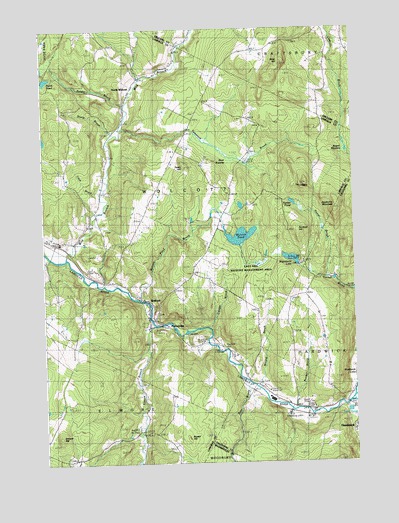
Wolcott, VT USGS Topographic Map
Click on map above to begin viewing in our Map Viewer.

This topographic map contains these locations and features:
Feature Name Type Latitude Longitude GNIS ID View Map
Baldin BrookStreamN44.6031°W72.4662°1461837View Map
Bear SwampSwampN44.5920°W72.4296°1461838View Map
Beaver MeadowLakeN44.5906°W72.3777°1461839View Map
Brown HillSummitN44.5095°W72.4471°1461840View Map
Bruce BrookStreamN44.5939°W72.4729°1461841View Map
Bunker BrookStreamN44.5156°W72.3987°1461842View Map
Camp WapanackiLocaleN44.5573°W72.3962°1918302View Map
Center for Northern StudiesSchoolN44.5871°W72.4370°2427490View Map
Church of the NazareneChurchN44.5481°W72.4629°1918311View Map
Clark BrookStreamN44.5773°W72.4771°1461844View Map
Currier BrookStreamN44.5389°W72.4357°1461845View Map
Davenport CemeteryCemeteryN44.6006°W72.4382°1918316View Map
East Hill Wildlife Management AreaParkN44.5556°W72.4148°1918319View Map
Elmore BranchStreamN44.5398°W72.4559°1461846View Map
Elmore HillSummitN44.5081°W72.4946°1461847View Map
Fairmont Lower CemeteryCemeteryN44.5423°W72.4556°1918332View Map
Fairmont Upper CemeteryCemeteryN44.5438°W72.4548°1918333View Map
Fisher Covered Railroad BridgeBridgeN44.5323°W72.4443°1918336View Map
Green Mountain Waldorf SchoolSchoolN44.5443°W72.4580°2427370View Map
Hampshire SchoolSchoolN44.5734°W72.4273°1461848View Map
Hardwick Lake DamDamN44.5167°W72.3768°1766623View Map
Hubbell CemeteryCemeteryN44.5644°W72.4954°1918356View Map
Jackson BridgeBridgeN44.5170°W72.3762°1461850View Map
Jackson SchoolSchoolN44.5192°W72.3771°1461851View Map
Jacob Paine CemeteryCemeteryN44.5234°W72.4129°1919561View Map
Jeudevine MountainSummitN44.5748°W72.3815°1461852View Map
Kate BrookStreamN44.5228°W72.4179°1461853View Map
Keeler BrookStreamN44.5534°W72.3857°1461854View Map
Keeler PondLakeN44.5749°W72.3997°1461855View Map
Lamoille River ReservoirReservoirN44.5367°W72.4446°1766610View Map
Millard BrookStreamN44.5214°W72.4140°1461857View Map
North WolcottPopulated PlaceN44.6112°W72.4604°1461859View Map
Perch PondLakeN44.6107°W72.4980°1461860View Map
Pierce CemeteryCemeteryN44.5992°W72.4186°1918430View Map
Pleasant Valley SchoolSchoolN44.5076°W72.4607°1461861View Map
PottersvillePopulated PlaceN44.5389°W72.4526°1461862View Map
Riverside SchoolSchoolN44.5637°W72.4898°1461863View Map
Scribner HillSummitN44.5676°W72.3976°1461864View Map
Tamarack BrookStreamN44.5970°W72.4687°1461865View Map
Taylor AirportAirportN44.6056°W72.4737°1461979View Map
Taylor CemeteryCemeteryN44.5673°W72.4751°1918470View Map
The LedgesBenchN44.5812°W72.3982°1461866View Map
Town HillSummitN44.5859°W72.4423°1461867View Map
Town Hill SchoolSchoolN44.5751°W72.4571°1461868View Map
Town of WolcottCivilN44.5729°W72.4548°1462269View Map
Wapanacki LakeLakeN44.5587°W72.4000°1461870View Map
West HillSummitN44.6151°W72.4029°1461871View Map
West Hill CemeteryCemeteryN44.6016°W72.4918°1918489View Map
Wild BranchStreamN44.5595°W72.4907°1461872View Map
WolcottPopulated PlaceN44.5464°W72.4584°1461873View Map
Wolcott DamDamN44.5367°W72.4446°1766609View Map
Wolcott Elementary SchoolSchoolN44.5383°W72.4529°1918492View Map
Wolcott Fire DepartmentBuildingN44.5423°W72.4583°2121415View Map
Wolcott Mennonite ChurchChurchN44.5487°W72.4662°1918493View Map
Wolcott PondReservoirN44.5653°W72.4205°1461874View Map
Wolcott Pond BrookStreamN44.5473°W72.4612°1461875View Map
Wolcott Pond DamDamN44.5664°W72.4267°1766615View Map
Wolcott Post OfficePost OfficeN44.5471°W72.4601°1918494View Map

Note: Coordinates in the location and feature list above are referenced to NAD83 datum.


Copyright (C) 2008-2024 Ryan Niemi / Sunset Dynamics ... All Rights Reserved