TopoQuest Logo
Do you find TopoQuest useful?
Help keep TopoQuest running and adding new maps/features by donating!
Bitcoin:  19c7KJd3qBynnjoSw5npx9KScwjBe4ifkT
Litecoin:  LXs6TkuXGGXo1vDsWCkWVdjQX94eUKd6ui
Home View Maps Find Maps Find Places Resources & Links


Craftsbury, Vermont Topographic Map

USGS Map Title: Craftsbury, VT
USGS Map MRC: 44072F3
DRG (GeoTIFF) Download: o44072f3.tif


Neighboring USGS Topographic Map Quads:


  Lowell, VT  
44072G4
 

  Irasburg, VT  
44072G3
 

  Orleans, VT  
44072G2
 

  Albany, VT  
44072F4
 

  Craftsbury, VT  
44072F3
 

  Crystal Lake, VT  
44072F2
 

  Wolcott, VT  
44072E4
 

  Caspian Lake, VT  
44072E3
 

  Stannard, VT  
44072E2


Map MRC Location:

N45°
W73°
N45°
W72°
H8 H7 H6 H5 H4 H3 H2 H1
G8 G7 G6 G5 G4 G3 G2 G1
F8 F7 F6 F5 F4 F3 F2 F1
E8 E7 E6 E5 E4 E3 E2 E1
D8 D7 D6 D5 D4 D3 D2 D1
C8 C7 C6 C5 C4 C3 C2 C1
B8 B7 B6 B5 B4 B3 B2 B1
A8 A7 A6 A5 A4 A3 A2 A1
N44°
W73°
N44°
W72°

Craftsbury, VT USGS 1:24K Topographic Map Preview:
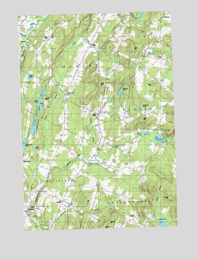
Craftsbury, VT USGS Topographic Map
Click on map above to begin viewing in our Map Viewer.

This topographic map contains these locations and features:
Feature Name Type Latitude Longitude GNIS ID View Map
Albany CenterPopulated PlaceN44.7367°W72.3496°1460391View Map
Albany Center CemeteryCemeteryN44.7397°W72.3512°1921660View Map
Ames HillSummitN44.7098°W72.3095°1456155View Map
Andersonville CemeteryCemeteryN44.6748°W72.3039°1921668View Map
Babcock HillSummitN44.6284°W72.3068°1456200View Map
Beach HillSummitN44.6881°W72.2768°1456302View Map
Cate HillSummitN44.6414°W72.3243°1456791View Map
Catholic CemeteryCemeteryN44.7061°W72.3365°1919956View Map
CraftsburyPopulated PlaceN44.6367°W72.3726°1457041View Map
Craftsbury Fire DepartmentBuildingN44.6369°W72.3712°2121494View Map
Craftsbury Nordic CenterLocaleN44.6789°W72.3676°1919969View Map
Craftsbury Post OfficePost OfficeN44.6346°W72.3719°1919970View Map
Craftsbury School (historical)SchoolN44.6803°W72.3632°1919972View Map
Daniels PondLakeN44.6763°W72.2629°1457103View Map
Duck PondLakeN44.6729°W72.3651°1457206View Map
East AlbanyPopulated PlaceN44.7312°W72.3162°1457244View Map
East CraftsburyPopulated PlaceN44.6426°W72.3432°1457272View Map
East Craftsbury CemeteryCemeteryN44.6371°W72.3382°1919989View Map
East Craftsbury Presbyterian ChurchChurchN44.6414°W72.3415°1919991View Map
Fisher HillSummitN44.7078°W72.2679°1457439View Map
Gebbie CornerPopulated PlaceN44.6320°W72.2848°1460419View Map
Great Hosmer PondLakeN44.6939°W72.3610°1457625View Map
Hartwell PondLakeN44.7043°W72.2932°1457751View Map
Hazen Road SchoolSchoolN44.6312°W72.3282°1457780View Map
Heart PondLakeN44.6998°W72.3650°1457786View Map
Holiday HillSummitN44.7000°W72.3546°1457865View Map
Holiday Hill CampLocaleN44.6973°W72.3548°1920024View Map
John Woodruff Simpson Memorial LibraryBuildingN44.6364°W72.3609°1920042View Map
Lamphean BrookStreamN44.7456°W72.3623°1458155View Map
Long PondLakeN44.6251°W72.2626°1458278View Map
McCleary BrookStreamN44.7370°W72.3679°1458391View Map
Merrill CornerPopulated PlaceN44.7034°W72.3387°1460434View Map
Miles HillSummitN44.7292°W72.2820°1458448View Map
Mitchell - McLaren CemeteryCemeteryN44.6439°W72.2943°1920062View Map
Old Covenanter Church (historical)ChurchN44.6414°W72.3415°1920087View Map
Paddock HillSummitN44.6414°W72.2568°1458876View Map
Page PondLakeN44.7145°W72.3664°1458881View Map
Rowell CemeteryCemeteryN44.6955°W72.3394°1920107View Map
Seaver BrookStreamN44.6670°W72.3309°1459440View Map
Skunk HollowValleyN44.6363°W72.2666°1459529View Map
South AlbanyPopulated PlaceN44.6914°W72.3120°1459564View Map
South Albany CemeteryCemeteryN44.6935°W72.3171°1920118View Map
Sweeney PondLakeN44.6953°W72.2767°1459804View Map
Town of AlbanyCivilN44.7339°W72.3379°1462024View Map
Whitney BrookStreamN44.6631°W72.3621°1460237View Map
Wright SchoolSchoolN44.7242°W72.2723°1460331View Map

Note: Coordinates in the location and feature list above are referenced to NAD83 datum.


Copyright (C) 2008-2024 Ryan Niemi / Sunset Dynamics ... All Rights Reserved