TopoQuest Logo
Do you find TopoQuest useful?
Help keep TopoQuest running and adding new maps/features by donating!
Bitcoin:  19c7KJd3qBynnjoSw5npx9KScwjBe4ifkT
Litecoin:  LXs6TkuXGGXo1vDsWCkWVdjQX94eUKd6ui
Home View Maps Find Maps Find Places Resources & Links


Yaak, Montana Topographic Map

USGS Map Title: Yaak, MT
USGS Map MRC: 48115G6
DRG (GeoTIFF) Download: o48115g6.tif


Neighboring USGS Topographic Map Quads:


  Garver Mountain, MT  
48115H7
 

  Bonnet Top, MT  
48115H6
 

  Mount Henry, MT  
48115H5
 

  Clark Mountain, MT  
48115G7
 

  Yaak, MT  
48115G6
 

  Lost Horse Mountain, MT  
48115G5
 

  Sylvanite, MT  
48115F7
 

  Flatiron Mountain, MT  
48115F6
 

  Pink Mountain, MT  
48115F5


Map MRC Location:

N49°
W116°
N49°
W115°
H8 H7 H6 H5 H4 H3 H2 H1
G8 G7 G6 G5 G4 G3 G2 G1
F8 F7 F6 F5 F4 F3 F2 F1
E8 E7 E6 E5 E4 E3 E2 E1
D8 D7 D6 D5 D4 D3 D2 D1
C8 C7 C6 C5 C4 C3 C2 C1
B8 B7 B6 B5 B4 B3 B2 B1
A8 A7 A6 A5 A4 A3 A2 A1
N48°
W116°
N48°
W115°

Yaak, MT USGS 1:24K Topographic Map Preview:
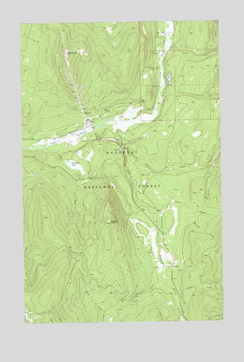
Yaak, MT USGS Topographic Map
Click on map above to begin viewing in our Map Viewer.

This topographic map contains these locations and features:
Feature Name Type Latitude Longitude GNIS ID View Map
Beaver CreekStreamN48.8225°W115.6863°779613View Map
Browning CreekStreamN48.8238°W115.6268°780450View Map
Clay CreekStreamN48.7733°W115.6627°781340View Map
Dutch CreekStreamN48.7513°W115.6952°782726View Map
Fix CreekStreamN48.7708°W115.6607°783482View Map
Fowler CreekStreamN48.7955°W115.6657°783663View Map
Hartman CreekStreamN48.7947°W115.6438°784601View Map
Hensley HillSummitN48.8619°W115.7224°784792View Map
Kelsey CreekStreamN48.7619°W115.6568°785669View Map
Lang CreekStreamN48.8247°W115.7296°785950View Map
Lap CreekStreamN48.8750°W115.6885°785955View Map
Obermayer LakeReservoirN48.8160°W115.7215°788379View Map
Obermayer Lake DamDamN48.8150°W115.7210°798745View Map
Roderick ButteSummitN48.7911°W115.6988°789739View Map
South Fork Yaak RiverStreamN48.8338°W115.6918°791094View Map
Taylor Post Office (historical)Post OfficeN48.8319°W115.6885°1782326View Map
Vinal CreekStreamN48.8561°W115.6627°792714View Map
Vinal LakeLakeN48.8509°W115.6577°792715View Map
YaakPopulated PlaceN48.8330°W115.7088°778715View Map
Yaak Air Force Station (historical)MilitaryN48.8619°W115.7222°2090231View Map
Yaak Census Designated PlaceCensusN48.7937°W115.6476°2583869View Map
Yaak Community CenterLocaleN48.8555°W115.6671°793577View Map
Yaak MineMineN48.8388°W115.7152°804091View Map
Yaak Post Office (historical)Post OfficeN48.8330°W115.7088°1782331View Map
Yaak SchoolSchoolN48.8383°W115.6969°778716View Map
Yaak Volunteer Fire DepartmentBuildingN48.8322°W115.7095°2546733View Map

Note: Coordinates in the location and feature list above are referenced to NAD83 datum.


Copyright (C) 2008-2025 Ryan Niemi / Sunset Dynamics ... All Rights Reserved