TopoQuest Logo
Do you find TopoQuest useful?
Help keep TopoQuest running and adding new maps/features by donating!
Bitcoin:  19c7KJd3qBynnjoSw5npx9KScwjBe4ifkT
Litecoin:  LXs6TkuXGGXo1vDsWCkWVdjQX94eUKd6ui
Home View Maps Find Maps Find Places Resources & Links


Yturria, Texas Topographic Map

USGS Map Title: Yturria, TX
USGS Map MRC: 26097E7
DRG (GeoTIFF) Download: o26097e7.tif


Neighboring USGS Topographic Map Quads:


  Andrea Ranch, TX  
26097F8
 

  Rudolph, TX  
26097F7
 

  Rosita Lake, TX  
26097F6
 

  La Sal Vieja, TX  
26097E8
 

  Yturria, TX  
26097E7
 

  San Perlita North, TX  
26097E6
 

  Lasara, TX  
26097D8
 

  Raymondville, TX  
26097D7
 

  San Perlita South, TX  
26097D6


Map MRC Location:

N27°
W98°
N27°
W97°
H8 H7 H6 H5 H4 H3 H2 H1
G8 G7 G6 G5 G4 G3 G2 G1
F8 F7 F6 F5 F4 F3 F2 F1
E8 E7 E6 E5 E4 E3 E2 E1
D8 D7 D6 D5 D4 D3 D2 D1
C8 C7 C6 C5 C4 C3 C2 C1
B8 B7 B6 B5 B4 B3 B2 B1
A8 A7 A6 A5 A4 A3 A2 A1
N26°
W98°
N26°
W97°

Yturria, TX USGS 1:24K Topographic Map Preview:
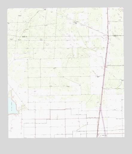
Yturria, TX USGS Topographic Map
Click on map above to begin viewing in our Map Viewer.

This topographic map contains these locations and features:
Feature Name Type Latitude Longitude GNIS ID View Map
Ano Nuevo WindmillLocaleN26.6090°W97.8342°1329565View Map
Artesiano WindmillLocaleN26.6115°W97.8750°1329785View Map
Benitez ColoniaPopulated PlaceN26.5053°W97.7703°2010677View Map
Coast Guard Station RaymondvilleMilitaryN26.5320°W97.8329°2512136View Map
El Chapote ColoniaPopulated PlaceN26.5273°W97.7892°2010679View Map
El Ebanito WindmillLocaleN26.5951°W97.8631°1335185View Map
Esperanza RanchLocaleN26.5595°W97.7789°1335511View Map
La Chata RanchLocaleN26.5556°W97.7533°1339294View Map
La Sal WindmillLocaleN26.5676°W97.8239°1339407View Map
Laguna Panda WindmillLocaleN26.5956°W97.8722°1339465View Map
Lisa ColoniaPopulated PlaceN26.5115°W97.7703°2010635View Map
Los Ansares WindmillLocaleN26.5945°W97.8375°1340568View Map
Los Cedros Artesian WellsWellN26.6051°W97.8522°1340579View Map
Saltine WindmillLocaleN26.5495°W97.8108°1346257View Map
Steer WindmillLocaleN26.5501°W97.8294°1347872View Map
Thomas RanchLocaleN26.6117°W97.8025°1348487View Map
Toro Melon WindmillLocaleN26.6184°W97.8625°1348654View Map
West Main DrainCanalN26.5145°W97.8458°1349762View Map
Willacy Acres ColoniaPopulated PlaceN26.5173°W97.7992°2010641View Map
YturriaPopulated PlaceN26.5684°W97.7708°1379300View Map

Note: Coordinates in the location and feature list above are referenced to NAD83 datum.


Copyright (C) 2008-2024 Ryan Niemi / Sunset Dynamics ... All Rights Reserved