TopoQuest Logo
Do you find TopoQuest useful?
Help keep TopoQuest running and adding new maps/features by donating!
Bitcoin:  19c7KJd3qBynnjoSw5npx9KScwjBe4ifkT
Litecoin:  LXs6TkuXGGXo1vDsWCkWVdjQX94eUKd6ui
Home View Maps Find Maps Find Places Resources & Links


San Perlita North, Texas Topographic Map

USGS Map Title: San Perlita North, TX
USGS Map MRC: 26097E6
DRG (GeoTIFF) Download: o26097e6.tif


Neighboring USGS Topographic Map Quads:


  Rudolph, TX  
26097F7
 

  Rosita Lake, TX  
26097F6
 

  Rosita Lake NE, TX  
26097F5
 

  Yturria, TX  
26097E7
 

  San Perlita North, TX  
26097E6
 

  El Jardin, TX  
26097E5
 

  Raymondville, TX  
26097D7
 

  San Perlita South, TX  
26097D6
 

  Willamar, TX  
26097D5


Map MRC Location:

N27°
W98°
N27°
W97°
H8 H7 H6 H5 H4 H3 H2 H1
G8 G7 G6 G5 G4 G3 G2 G1
F8 F7 F6 F5 F4 F3 F2 F1
E8 E7 E6 E5 E4 E3 E2 E1
D8 D7 D6 D5 D4 D3 D2 D1
C8 C7 C6 C5 C4 C3 C2 C1
B8 B7 B6 B5 B4 B3 B2 B1
A8 A7 A6 A5 A4 A3 A2 A1
N26°
W98°
N26°
W97°

San Perlita North, TX USGS 1:24K Topographic Map Preview:
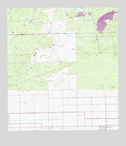
San Perlita North, TX USGS Topographic Map
Click on map above to begin viewing in our Map Viewer.

This topographic map contains these locations and features:
Feature Name Type Latitude Longitude GNIS ID View Map
Atwood WindmillLocaleN26.5762°W97.6478°1329833View Map
Cabeza Blanca WindmillLocaleN26.5873°W97.6975°1331809View Map
City of San PerlitaCivilN26.5010°W97.6396°2411803View Map
East Main DrainCanalN26.5120°W97.6280°1334961View Map
El Sauz WindmillLocaleN26.6073°W97.7294°1335272View Map
El Tajo WindmillLocaleN26.5965°W97.7372°1335276View Map
Fourth of July WindmillLocaleN26.6148°W97.6767°1336127View Map
Las Golondrinas WindmillLocaleN26.5709°W97.6889°1339664View Map
Los Cuates WindmillLocaleN26.5837°W97.7175°1340588View Map
New WindmillLocaleN26.5465°W97.7394°1342530View Map
Pescadito TankReservoirN26.5451°W97.6444°1343891View Map
Punta del Monte RanchLocaleN26.6126°W97.7217°1344633View Map
Raymondville Oil FieldOilfieldN26.5534°W97.7317°1344859View Map
Repardo WindmillLocaleN26.6203°W97.7483°1345044View Map
Retama WindmillLocaleN26.5767°W97.6567°1345112View Map
Retama WindmillLocaleN26.5826°W97.6758°1345113View Map
Salado WindmillLocaleN26.5642°W97.7239°1346148View Map
San PerlitaPopulated PlaceN26.5012°W97.6397°1346465View Map
San Perlita Post OfficePost OfficeN26.5009°W97.6395°2732113View Map
Santo Domingo TankReservoirN26.5496°W97.7099°1346682View Map
Santo Domingo WindmillLocaleN26.5509°W97.7030°1346683View Map
TajitosLakeN26.6011°W97.6488°1348204View Map
Tanque del BurroReservoirN26.5773°W97.7352°1348234View Map
Tanque los CuatesReservoirN26.5766°W97.7198°1348235View Map
Villarreal Artesian WellWellN26.6187°W97.6605°1349287View Map
White Wing Artesian WellWellN26.5442°W97.6336°1349999View Map

Note: Coordinates in the location and feature list above are referenced to NAD83 datum.


Copyright (C) 2008-2025 Ryan Niemi / Sunset Dynamics ... All Rights Reserved