TopoQuest Logo
Do you find TopoQuest useful?
Help keep TopoQuest running and adding new maps/features by donating!
Bitcoin:  19c7KJd3qBynnjoSw5npx9KScwjBe4ifkT
Litecoin:  LXs6TkuXGGXo1vDsWCkWVdjQX94eUKd6ui
Home View Maps Find Maps Find Places Resources & Links


Yucca Valley North, California Topographic Map

USGS Map Title: Yucca Valley North, CA
USGS Map MRC: 34116B4
DRG (GeoTIFF) Download: o34116b4.tif


Neighboring USGS Topographic Map Quads:


  Bighorn Canyon, CA  
34116C5
 

  Landers, CA  
34116C4
 

  Goat Mountain, CA  
34116C3
 

  Rimrock, CA  
34116B5
 

  Yucca Valley North, CA  
34116B4
 

  Joshua Tree North, CA  
34116B3
 

  Morongo Valley, CA  
34116A5
 

  Yucca Valley South, CA  
34116A4
 

  Joshua Tree South, CA  
34116A3


Map MRC Location:

N35°
W117°
N35°
W116°
H8 H7 H6 H5 H4 H3 H2 H1
G8 G7 G6 G5 G4 G3 G2 G1
F8 F7 F6 F5 F4 F3 F2 F1
E8 E7 E6 E5 E4 E3 E2 E1
D8 D7 D6 D5 D4 D3 D2 D1
C8 C7 C6 C5 C4 C3 C2 C1
B8 B7 B6 B5 B4 B3 B2 B1
A8 A7 A6 A5 A4 A3 A2 A1
N34°
W117°
N34°
W116°

Yucca Valley North, CA USGS 1:24K Topographic Map Preview:
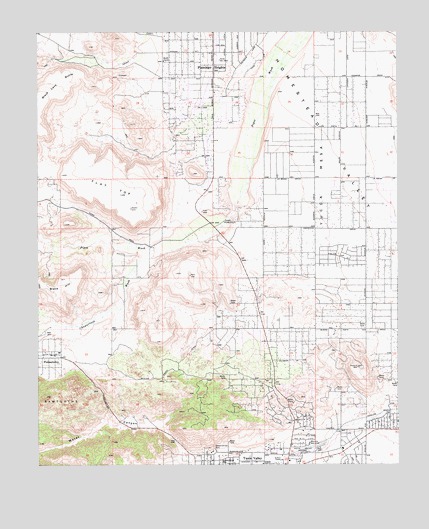
Yucca Valley North, CA USGS Topographic Map
Click on map above to begin viewing in our Map Viewer.

This topographic map contains these locations and features:
Feature Name Type Latitude Longitude GNIS ID View Map
Black HillSummitN34.1789°W116.4920°239404View Map
Calvary Baptist ChurchChurchN34.1295°W116.4170°1842193View Map
Chaparrosa WashStreamN34.1858°W116.4578°240479View Map
Church of the NazareneChurchN34.1278°W116.4370°1842195View Map
Desert Christ ParkParkN34.1286°W116.4397°241430View Map
First Christian ChurchChurchN34.1278°W116.4358°1842201View Map
Flamingo HeightsPopulated PlaceN34.2406°W116.4389°242291View Map
Flat TopSummitN34.2025°W116.4717°242295View Map
Golden Rule ParkParkN34.1292°W116.4383°1842203View Map
Hi-Desert Nature MuseumBuildingN34.1256°W116.4170°1842204View Map
Joshua Village Shopping CenterLocaleN34.1253°W116.4095°1842211View Map
Paradise ParkParkN34.1395°W116.3783°247232View Map
PioneertownPopulated PlaceN34.1567°W116.4961°247574View Map
Pioneertown Post OfficePost OfficeN34.1569°W116.4987°1842219View Map
San Bernardino County Fire Department Station 42 - Yucca ValleyBuildingN34.1933°W116.3846°2665372View Map
The WindmillLocaleN34.1953°W116.4350°250416View Map
Warrens WellWellN34.1303°W116.4067°251203View Map
Water CanyonValleyN34.1271°W116.4491°251248View Map
Yucca MesaSummitN34.2050°W116.4020°1661719View Map
Yucca Mesa Elementary SchoolSchoolN34.1914°W116.3878°1842062View Map
Yucca Valley AirportAirportN34.1288°W116.4075°1654135View Map
Yucca Valley Service Center HeliportAirportN34.1261°W116.4142°1654138View Map

Note: Coordinates in the location and feature list above are referenced to NAD83 datum.


Copyright (C) 2008-2025 Ryan Niemi / Sunset Dynamics ... All Rights Reserved