TopoQuest Logo
Do you find TopoQuest useful?
Help keep TopoQuest running and adding new maps/features by donating!
Bitcoin:  19c7KJd3qBynnjoSw5npx9KScwjBe4ifkT
Litecoin:  LXs6TkuXGGXo1vDsWCkWVdjQX94eUKd6ui
Home View Maps Find Maps Find Places Resources & Links


Zamora, California Topographic Map

USGS Map Title: Zamora, CA
USGS Map MRC: 38121G8
DRG (GeoTIFF) Download: o38121g8.tif


Neighboring USGS Topographic Map Quads:


  Wildwood School, CA  
38122H1
 

  Dunnigan, CA  
38121H8
 

  Kirkville, CA  
38121H7
 

  Bird Valley, CA  
38122G1
 

  Zamora, CA  
38121G8
 

  Eldorado Bend, CA  
38121G7
 

  Esparto, CA  
38122F1
 

  Madison, CA  
38121F8
 

  Woodland, CA  
38121F7


Map MRC Location:

N39°
W122°
N39°
W121°
H8 H7 H6 H5 H4 H3 H2 H1
G8 G7 G6 G5 G4 G3 G2 G1
F8 F7 F6 F5 F4 F3 F2 F1
E8 E7 E6 E5 E4 E3 E2 E1
D8 D7 D6 D5 D4 D3 D2 D1
C8 C7 C6 C5 C4 C3 C2 C1
B8 B7 B6 B5 B4 B3 B2 B1
A8 A7 A6 A5 A4 A3 A2 A1
N38°
W122°
N38°
W121°

Zamora, CA USGS 1:24K Topographic Map Preview:
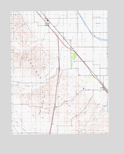
Zamora, CA USGS Topographic Map
Click on map above to begin viewing in our Map Viewer.

This topographic map contains these locations and features:
Feature Name Type Latitude Longitude GNIS ID View Map
Bird CreekStreamN38.8599°W121.9233°219310View Map
Bird ValleyValleyN38.8474°W121.9591°233504View Map
Bretona CreekStreamN38.8177°W121.9141°219806View Map
Britona (historical)Populated PlaceN38.8243°W121.9089°1670267View Map
Colusa Basin Drainage CanalCanalN38.8580°W121.9019°233704View Map
Dunnigan HillsRangeN38.7943°W121.9552°233807View Map
Dunnigan Hills Gas FieldOilfieldN38.7807°W121.9602°277326View Map
Knights Landing DivisionCivilN38.8143°W121.8771°1935155View Map
North Fork Bird CreekStreamN38.8371°W121.9950°229646View Map
Oat CreekStreamN38.8496°W121.8964°229902View Map
Oat ValleyValleyN38.8266°W121.9361°234402View Map
Smith CreekStreamN38.7760°W121.8761°233316View Map
Willow Spring CreekStreamN38.7893°W121.8955°237880View Map
Wycoff (historical)Populated PlaceN38.8591°W121.9455°1670269View Map
ZamoraPopulated PlaceN38.7966°W121.8819°1660224View Map
Zamora CreekStreamN38.8080°W121.9064°238304View Map
Zamora Fire Protection DistrictBuildingN38.7972°W121.8825°2624482View Map
Zamora Post OfficePost OfficeN38.7978°W121.8837°1703246View Map

Note: Coordinates in the location and feature list above are referenced to NAD83 datum.


Copyright (C) 2008-2024 Ryan Niemi / Sunset Dynamics ... All Rights Reserved