TopoQuest Logo
Do you find TopoQuest useful?
Help keep TopoQuest running and adding new maps/features by donating!
Bitcoin:  19c7KJd3qBynnjoSw5npx9KScwjBe4ifkT
Litecoin:  LXs6TkuXGGXo1vDsWCkWVdjQX94eUKd6ui
Home View Maps Find Maps Find Places Resources & Links


Kirkville, California Topographic Map

USGS Map Title: Kirkville, CA
USGS Map MRC: 38121H7
DRG (GeoTIFF) Download: o38121h7.tif


Neighboring USGS Topographic Map Quads:


  Grimes, CA  
39121A8
 

  Tisdale Weir, CA  
39121A7
 

  Gilsizer Slough, CA  
39121A6
 

  Dunnigan, CA  
38121H8
 

  Kirkville, CA  
38121H7
 

  Sutter Causeway, CA  
38121H6
 

  Zamora, CA  
38121G8
 

  Eldorado Bend, CA  
38121G7
 

  Knights Landing, CA  
38121G6


Map MRC Location:

N39°
W122°
N39°
W121°
H8 H7 H6 H5 H4 H3 H2 H1
G8 G7 G6 G5 G4 G3 G2 G1
F8 F7 F6 F5 F4 F3 F2 F1
E8 E7 E6 E5 E4 E3 E2 E1
D8 D7 D6 D5 D4 D3 D2 D1
C8 C7 C6 C5 C4 C3 C2 C1
B8 B7 B6 B5 B4 B3 B2 B1
A8 A7 A6 A5 A4 A3 A2 A1
N38°
W122°
N38°
W121°

Kirkville, CA USGS 1:24K Topographic Map Preview:
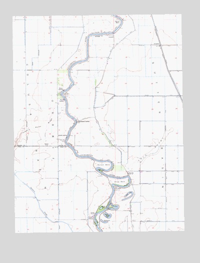
Kirkville, CA USGS Topographic Map
Click on map above to begin viewing in our Map Viewer.

This topographic map contains these locations and features:
Feature Name Type Latitude Longitude GNIS ID View Map
Beaver LakeLakeN38.8888°W121.8123°218946View Map
Boyers BendBendN38.9549°W121.8386°219747View Map
Boyers LandingPopulated PlaceN38.9516°W121.8391°1658121View Map
Bullock BendBendN38.9121°W121.8072°220134View Map
Chicken GroveWoodsN38.9246°W121.8519°220975View Map
China BendBendN38.9035°W121.7989°221013View Map
Cole PointRidgeN38.9213°W121.7750°221356View Map
Collins EddyLakeN38.8883°W121.8014°221391View Map
Collins Eddy CutoffChannelN38.8896°W121.8075°221392View Map
CranmorePopulated PlaceN38.9880°W121.8066°1658345View Map
Cranmore LandingLocaleN38.9896°W121.8011°1703367View Map
EvergladePopulated PlaceN38.9824°W121.7675°223294View Map
Hiatt LakeLakeN38.8948°W121.7905°225229View Map
Hog Lake (historical)LakeN38.9677°W121.7800°1703383View Map
Horseshoe LakeLakeN38.8830°W121.8073°225646View Map
Howells LandingLocaleN38.9307°W121.8366°1658791View Map
Howells Point RidgeRidgeN38.9371°W121.8541°234051View Map
KirkvillePopulated PlaceN38.9088°W121.7927°226631View Map
Little Poker BendBendN38.9002°W121.8022°227331View Map
Meridian-Robbins DivisionCivilN38.9713°W121.7590°1935202View Map
Millers LandingPopulated PlaceN38.9566°W121.8397°1659132View Map
Ministerial BendBendN38.9032°W121.7922°228802View Map
Mummas LandingLocaleN38.9874°W121.8205°1670438View Map
Mystic LakeLakeN38.8807°W121.8102°229403View Map
Poffenbergers LandingPopulated PlaceN38.9388°W121.8291°1659410View Map
Poker BendBendN38.9105°W121.8122°230894View Map
Racetrack BendBendN38.9127°W121.8033°231157View Map
Steiner BendBendN38.9957°W121.7975°235437View Map
Tyndall LandingPopulated PlaceN38.8830°W121.8180°1660067View Map
Tyndall MoundSummitN38.8849°W121.8200°1660068View Map
West Side CanalCanalN38.9866°W121.7950°237524View Map

Note: Coordinates in the location and feature list above are referenced to NAD83 datum.


Copyright (C) 2008-2024 Ryan Niemi / Sunset Dynamics ... All Rights Reserved