TopoQuest Logo
Do you find TopoQuest useful?
Help keep TopoQuest running and adding new maps/features by donating!
Bitcoin:  19c7KJd3qBynnjoSw5npx9KScwjBe4ifkT
Litecoin:  LXs6TkuXGGXo1vDsWCkWVdjQX94eUKd6ui
Home View Maps Find Maps Find Places Resources & Links


Alexander Lake, Wisconsin Topographic Map

USGS Map Title: Alexander Lake, WI
USGS Map MRC: 45089B7
DRG (GeoTIFF) Download: o45089b7.tif


Neighboring USGS Topographic Map Quads:


  Natzke Camp, WI  
45089C8
 

  Grandfather Falls, WI  
45089C7
 

  Irma, WI  
45089C6
 

  Fromm Lookout Tower, WI  
45089B8
 

  Alexander Lake, WI  
45089B7
 

  Merrill, WI  
45089B6
 

  Hamburg, WI  
45089A8
 

  Little Chicago, WI  
45089A7
 

  Brokaw, WI  
45089A6


Map MRC Location:

N46°
W90°
N46°
W89°
H8 H7 H6 H5 H4 H3 H2 H1
G8 G7 G6 G5 G4 G3 G2 G1
F8 F7 F6 F5 F4 F3 F2 F1
E8 E7 E6 E5 E4 E3 E2 E1
D8 D7 D6 D5 D4 D3 D2 D1
C8 C7 C6 C5 C4 C3 C2 C1
B8 B7 B6 B5 B4 B3 B2 B1
A8 A7 A6 A5 A4 A3 A2 A1
N45°
W90°
N45°
W89°

Alexander Lake, WI USGS 1:24K Topographic Map Preview:
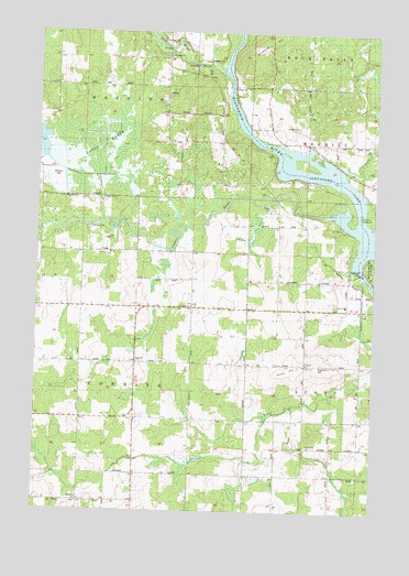
Alexander Lake, WI USGS Topographic Map
Click on map above to begin viewing in our Map Viewer.

This topographic map contains these locations and features:
Feature Name Type Latitude Longitude GNIS ID View Map
Alexander DamDamN45.1880°W89.7548°1560753View Map
Alexander LakeReservoirN45.2123°W89.7636°1792972View Map
Alexander WP200 DamDamN45.1883°W89.7551°1792971View Map
Bagga MarshSwampN45.2202°W89.8507°1561081View Map
Copper RiverStreamN45.2027°W89.7674°1563393View Map
Copper School (historical)SchoolN45.2105°W89.8071°1838316View Map
Corning School (historical)SchoolN45.1633°W89.8385°1838317View Map
Corning TownhallBuildingN45.1639°W89.8376°1838318View Map
Corning Volunteer Fire DepartmentBuildingN45.1659°W89.8386°2696935View Map
Elm Grove School (historical)SchoolN45.1419°W89.7748°1838320View Map
Farming Dale School (historical)SchoolN45.1858°W89.8182°1838324View Map
Garrison CreekStreamN45.2014°W89.8504°1565428View Map
Grace Church (historical)ChurchN45.2336°W89.8276°1838333View Map
Harding TownhallBuildingN45.2336°W89.8276°1838338View Map
Joe Snow CreekStreamN45.2147°W89.7618°1567194View Map
Methodist CemeteryCemeteryN45.1277°W89.8573°1569384View Map
New Wood RiverStreamN45.2397°W89.8060°1570236View Map
Ninemile HillSummitN45.2483°W89.7896°1570302View Map
Pine Grove School (historical)SchoolN45.2177°W89.7676°1838372View Map
Prairie View School (historical)SchoolN45.1850°W89.7593°1838375View Map
Rock IslandIslandN45.2027°W89.7549°1572449View Map
Saint Pauls ChurchChurchN45.1633°W89.7751°1573488View Map
Saint Pauls ChurchChurchN45.1786°W89.8171°1573489View Map
Scott Elementary SchoolSchoolN45.1794°W89.7604°1573846View Map
Snow HillSummitN45.1630°W89.7790°1574348View Map
Snow Hill CemeteryCemeteryN45.1638°W89.7696°1574349View Map
Snow Hill School (historical)SchoolN45.1636°W89.7749°1838403View Map

Note: Coordinates in the location and feature list above are referenced to NAD83 datum.


Copyright (C) 2008-2025 Ryan Niemi / Sunset Dynamics ... All Rights Reserved