TopoQuest Logo
Do you find TopoQuest useful?
Help keep TopoQuest running and adding new maps/features by donating!
Bitcoin:  19c7KJd3qBynnjoSw5npx9KScwjBe4ifkT
Litecoin:  LXs6TkuXGGXo1vDsWCkWVdjQX94eUKd6ui
Home View Maps Find Maps Find Places Resources & Links


Brokaw, Wisconsin Topographic Map

USGS Map Title: Brokaw, WI
USGS Map MRC: 45089A6
DRG (GeoTIFF) Download: o45089a6.tif


Neighboring USGS Topographic Map Quads:


  Alexander Lake, WI  
45089B7
 

  Merrill, WI  
45089B6
 

  Pine Dells, WI  
45089B5
 

  Little Chicago, WI  
45089A7
 

  Brokaw, WI  
45089A6
 

  Nutterville, WI  
45089A5
 

  Marathon, WI  
44089H7
 

  Wausau West, WI  
44089H6
 

  Wausau East, WI  
44089H5


Map MRC Location:

N46°
W90°
N46°
W89°
H8 H7 H6 H5 H4 H3 H2 H1
G8 G7 G6 G5 G4 G3 G2 G1
F8 F7 F6 F5 F4 F3 F2 F1
E8 E7 E6 E5 E4 E3 E2 E1
D8 D7 D6 D5 D4 D3 D2 D1
C8 C7 C6 C5 C4 C3 C2 C1
B8 B7 B6 B5 B4 B3 B2 B1
A8 A7 A6 A5 A4 A3 A2 A1
N45°
W90°
N45°
W89°

Brokaw, WI USGS 1:24K Topographic Map Preview:
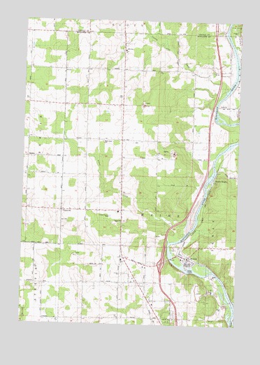
Brokaw, WI USGS Topographic Map
Click on map above to begin viewing in our Map Viewer.

This topographic map contains these locations and features:
Feature Name Type Latitude Longitude GNIS ID View Map
Adams School (historical)SchoolN45.0761°W89.7471°1876666View Map
Baumann FarmsLocaleN45.0167°W89.6764°2723426View Map
BrokawPopulated PlaceN45.0272°W89.6532°1562231View Map
Brokaw Methodist Church (historical)ChurchN45.0266°W89.6523°1844060View Map
Brokaw Post OfficePost OfficeN45.0269°W89.6535°1844061View Map
Bryan Valley School (historical)SchoolN45.1047°W89.6532°1876673View Map
Churchill School (historical)SchoolN45.0172°W89.6932°1876679View Map
County Line CreekStreamN45.0972°W89.6348°1563455View Map
Down To Earth Greenhouse and NurseryBuildingN45.0275°W89.7042°2629069View Map
Endres FarmLocaleN45.0236°W89.7053°2723405View Map
Faith ChurchChurchN45.1127°W89.6923°1844109View Map
Falcon Valley FarmsLocaleN45.0158°W89.7008°2723425View Map
Grace Lutheran ChurchChurchN45.0472°W89.7223°1844133View Map
Granite HeightsPopulated PlaceN45.0600°W89.6396°1565732View Map
Jackson School (historical)SchoolN45.1052°W89.7471°1876702View Map
Jehn CemeteryCemeteryN45.1136°W89.6940°1567139View Map
Lentz CreekStreamN45.0097°W89.6265°1567972View Map
MainePopulated PlaceN45.0272°W89.6904°2783852View Map
Maine Elementary SchoolSchoolN45.0263°W89.6919°1568908View Map
Maine Township Fire DepartmentBuildingN45.0276°W89.6919°2696927View Map
Maple Grove CemeteryCemeteryN45.0758°W89.7037°1568977View Map
Red Granite School (historical)SchoolN45.0758°W89.6732°1876727View Map
Rib Mountain QuarryMineN45.0900°W89.6808°2633282View Map
Ruby Red QuarryMineN45.0703°W89.6633°2633281View Map
Saint John Evangelical Lutheran ChurchChurchN45.0208°W89.6926°1573018View Map
Sturm FarmsLocaleN45.0458°W89.7256°2723407View Map
TaegesvillePopulated PlaceN45.0466°W89.7265°1577848View Map
Taegesville School (historical)SchoolN45.0466°W89.7135°1876744View Map
Town CemeteryCemeteryN45.0422°W89.7273°1575530View Map
Town of MaineCivilN45.0505°W89.6827°1583630View Map
Valley View School (historical)SchoolN45.1050°W89.7043°1876753View Map
Village of BrokawCivilN45.0272°W89.6577°1582866View Map
WMZK-FM (Merrill)TowerN45.1039°W89.7182°1582415View Map
Zion CemeteryCemeteryN45.0941°W89.6935°1845326View Map
Zion ChurchChurchN45.0941°W89.6937°1577172View Map

Note: Coordinates in the location and feature list above are referenced to NAD83 datum.


Copyright (C) 2008-2025 Ryan Niemi / Sunset Dynamics ... All Rights Reserved