TopoQuest Logo
Do you find TopoQuest useful?
Help keep TopoQuest running and adding new maps/features by donating!
Bitcoin:  19c7KJd3qBynnjoSw5npx9KScwjBe4ifkT
Litecoin:  LXs6TkuXGGXo1vDsWCkWVdjQX94eUKd6ui
Home View Maps Find Maps Find Places Resources & Links


Aberdeen, California Topographic Map

USGS Map Title: Aberdeen, CA
USGS Map MRC: 36118H3
DRG (GeoTIFF) Download: o36118h3.tif


Neighboring USGS Topographic Map Quads:


  Split Mountain, CA  
37118A4
 

  Fish Springs, CA  
37118A3
 

  Tinemaha Reservoir, CA  
37118A2
 

  Mount Pinchot, CA  
36118H4
 

  Aberdeen, CA  
36118H3
 

  Blackrock, CA  
36118H2
 

  Mount Clarence King, CA  
36118G4
 

  Kearsarge Peak, CA  
36118G3
 

  Independence, CA  
36118G2


Map MRC Location:

N37°
W119°
N37°
W118°
H8 H7 H6 H5 H4 H3 H2 H1
G8 G7 G6 G5 G4 G3 G2 G1
F8 F7 F6 F5 F4 F3 F2 F1
E8 E7 E6 E5 E4 E3 E2 E1
D8 D7 D6 D5 D4 D3 D2 D1
C8 C7 C6 C5 C4 C3 C2 C1
B8 B7 B6 B5 B4 B3 B2 B1
A8 A7 A6 A5 A4 A3 A2 A1
N36°
W119°
N36°
W118°

Aberdeen, CA USGS 1:24K Topographic Map Preview:
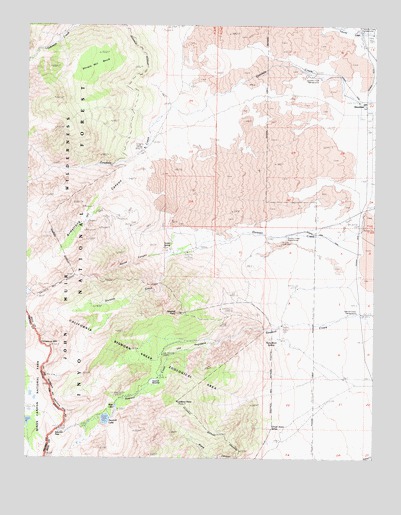
Aberdeen, CA USGS Topographic Map
Click on map above to begin viewing in our Map Viewer.

This topographic map contains these locations and features:
Feature Name Type Latitude Longitude GNIS ID View Map
AberdeenPopulated PlaceN36.9780°W118.2534°256098View Map
Armstrong CanyonValleyN36.9640°W118.3263°256322View Map
Colosseum MountainSummitN36.9072°W118.3670°258607View Map
Division CreekStreamN36.9402°W118.2982°259400View Map
Division Creek PowerhouseLocaleN36.9385°W118.2829°1654234View Map
Eightmile RanchLocaleN36.9110°W118.2507°259804View Map
Firecracker MineMineN36.9422°W118.3504°260123View Map
Glacier MinesMineN36.9433°W118.3551°260586View Map
Goodale Creek CampgroundLocaleN36.9858°W118.2743°275579View Map
Grover Anton SpringSpringN36.8834°W118.2876°260970View Map
Harry Birch SpringsSpringN36.9098°W118.2880°261116View Map
Lookout PointSummitN36.8913°W118.3213°262908View Map
Mule LakeReservoirN36.8899°W118.3445°263953View Map
Pinnacle MineMineN36.9413°W118.3515°264792View Map
Rudy MineMineN36.9416°W118.3562°265660View Map
Sawmill Creek CampgroundLocaleN36.9172°W118.2570°1667249View Map
Sawmill LakeLakeN36.8861°W118.3471°265874View Map
Sawmill MeadowsFlatN36.8970°W118.3294°265877View Map
Sawmill PassGapN36.8830°W118.3644°265879View Map
Sawmill Pass TrailheadLocaleN36.9388°W118.2902°2547699View Map
Sawmill PointSummitN36.9170°W118.3206°265882View Map
Scotty SpringSpringN36.9391°W118.3245°265947View Map
Shingle Mill BenchBenchN36.9922°W118.3526°266122View Map
Sierra View MineMineN36.9447°W118.3454°266164View Map
Spook CanyonValleyN36.9338°W118.3221°267575View Map
Taboose Creek CampgroundLocaleN36.9174°W118.2576°275580View Map
The HogsbackRidgeN36.9062°W118.3245°268192View Map
Valley View MineMineN36.9419°W118.3398°268658View Map

Note: Coordinates in the location and feature list above are referenced to NAD83 datum.


Copyright (C) 2008-2024 Ryan Niemi / Sunset Dynamics ... All Rights Reserved