TopoQuest Logo
Do you find TopoQuest useful?
Help keep TopoQuest running and adding new maps/features by donating!
Bitcoin:  19c7KJd3qBynnjoSw5npx9KScwjBe4ifkT
Litecoin:  LXs6TkuXGGXo1vDsWCkWVdjQX94eUKd6ui
Home View Maps Find Maps Find Places Resources & Links


Bradley, Wisconsin Topographic Map

USGS Map Title: Bradley, WI
USGS Map MRC: 45089E7
DRG (GeoTIFF) Download: o45089e7.tif


Neighboring USGS Topographic Map Quads:


  Pier Lake, WI  
45089F8
 

  Burrows Lake, WI  
45089F7
 

  Harshaw, WI  
45089F6
 

  Tripoli, WI  
45089E8
 

  Bradley, WI  
45089E7
 

  Heafford Junction, WI  
45089E6
 

  Spirit Falls, WI  
45089D8
 

  Coffee Creek, WI  
45089D7
 

  Tomahawk, WI  
45089D6


Map MRC Location:

N46°
W90°
N46°
W89°
H8 H7 H6 H5 H4 H3 H2 H1
G8 G7 G6 G5 G4 G3 G2 G1
F8 F7 F6 F5 F4 F3 F2 F1
E8 E7 E6 E5 E4 E3 E2 E1
D8 D7 D6 D5 D4 D3 D2 D1
C8 C7 C6 C5 C4 C3 C2 C1
B8 B7 B6 B5 B4 B3 B2 B1
A8 A7 A6 A5 A4 A3 A2 A1
N45°
W90°
N45°
W89°

Bradley, WI USGS 1:24K Topographic Map Preview:
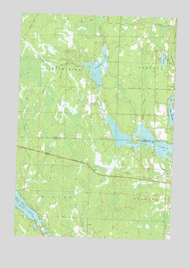
Bradley, WI USGS Topographic Map
Click on map above to begin viewing in our Map Viewer.

This topographic map contains these locations and features:
Feature Name Type Latitude Longitude GNIS ID View Map
BradleyPopulated PlaceN45.5394°W89.7551°1562127View Map
Brown CreekStreamN45.6097°W89.8068°1562260View Map
Clukey CreekStreamN45.6219°W89.8096°1563212View Map
Hay Creek School (historical)SchoolN45.5075°W89.8160°1838340View Map
Kelly School (historical)SchoolN45.5841°W89.8174°1843863View Map
Killarney LakeReservoirN45.5956°W89.8121°1567477View Map
Killarney Lake 32ReservoirN45.5850°W89.8101°1791977View Map
Little Rice RiverStreamN45.5722°W89.8085°1568382View Map
Little Rice River 2WP1331 DamDamN45.5850°W89.8101°1791976View Map
Little Rice TownhallBuildingN45.5841°W89.8174°1843870View Map
Lund CreekStreamN45.5647°W89.7738°1568806View Map
Lund School (historical)SchoolN45.5764°W89.7757°1843872View Map
Prairie LakeLakeN45.6017°W89.7600°1571880View Map
Prairie Lake School (historical)SchoolN45.5997°W89.7660°1843890View Map
Prairie Rapids CemeteryCemeteryN45.5852°W89.7515°1571887View Map
Prairie Rapids Church (historical)ChurchN45.5847°W89.7515°1843891View Map
Rice River FlowageChannelN45.5539°W89.7688°1572275View Map
Somo LakeLakeN45.5193°W89.8712°1574375View Map
Town of WilsonCivilN45.5114°W89.8579°1584445View Map
Wilson TownhallBuildingN45.5075°W89.8160°1838421View Map

Note: Coordinates in the location and feature list above are referenced to NAD83 datum.


Copyright (C) 2008-2025 Ryan Niemi / Sunset Dynamics ... All Rights Reserved