TopoQuest Logo
Do you find TopoQuest useful?
Help keep TopoQuest running and adding new maps/features by donating!
Bitcoin:  19c7KJd3qBynnjoSw5npx9KScwjBe4ifkT
Litecoin:  LXs6TkuXGGXo1vDsWCkWVdjQX94eUKd6ui
Home View Maps Find Maps Find Places Resources & Links


Bridge Canyon, Nevada Topographic Map

USGS Map Title: Bridge Canyon, NV
USGS Map MRC: 35114B6
DRG (GeoTIFF) Download: o35114b6.tif


Neighboring USGS Topographic Map Quads:


  Searchlight SE, NV  
35114C7
 

  Spirit Mountain, NV  
35114C6
 

  Spirit Mountain SE, AZ  
35114C5
 

  Juniper Mine, NV  
35114B7
 

  Bridge Canyon, NV  
35114B6
 

  Davis Dam, AZ  
35114B5
 

  East of Homer Mountain, CA  
35114A7
 

  Mount Manchester, CA  
35114A6
 

  Davis Dam SE, AZ  
35114A5


Map MRC Location:

N36°
W115°
N36°
W114°
H8 H7 H6 H5 H4 H3 H2 H1
G8 G7 G6 G5 G4 G3 G2 G1
F8 F7 F6 F5 F4 F3 F2 F1
E8 E7 E6 E5 E4 E3 E2 E1
D8 D7 D6 D5 D4 D3 D2 D1
C8 C7 C6 C5 C4 C3 C2 C1
B8 B7 B6 B5 B4 B3 B2 B1
A8 A7 A6 A5 A4 A3 A2 A1
N35°
W115°
N35°
W114°

Bridge Canyon, NV USGS 1:24K Topographic Map Preview:
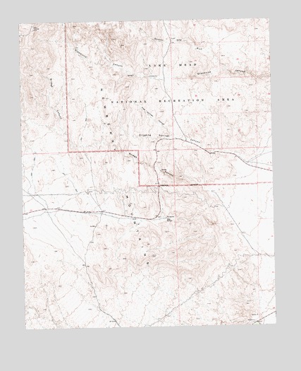
Bridge Canyon, NV USGS Topographic Map
Click on map above to begin viewing in our Map Viewer.

This topographic map contains these locations and features:
Feature Name Type Latitude Longitude GNIS ID View Map
Bridge CanyonValleyN35.1739°W114.6483°839058View Map
Bridge Canyon WildernessReserveN35.2260°W114.7018°2542650View Map
Conical PeakSummitN35.1550°W114.6772°851571View Map
Dripping SpringSpringN35.2019°W114.6727°851514View Map
Dripping Springs CanyonValleyN35.1908°W114.6380°840128View Map
Firpos WellWellN35.1667°W114.7147°846651View Map
Hiko SpringsSpringN35.1691°W114.6797°845863View Map
KROL-AM (Laughlin)TowerN35.1694°W114.6369°865051View Map
Laughlin Census Designated PlaceCensusN35.1317°W114.6888°2408587View Map
Little PeakSummitN35.2469°W114.7433°851578View Map
Middle PeakSummitN35.2325°W114.7391°851528View Map
Moss SpringSpringN35.2278°W114.6941°851579View Map
Nevada Highway Patrol Southern Command Laughlin SubstationBuildingN35.1314°W114.6270°2740063View Map
Newberry MountainsRangeN35.1881°W114.7027°845320View Map
Pipe Springs CanyonValleyN35.2022°W114.6747°842871View Map
Quail SpringSpringN35.1661°W114.7111°851553View Map
Rats Nest SpringSpringN35.2428°W114.7433°851554View Map
Rattlesnake SpringSpringN35.2436°W114.7280°851551View Map
Sacatone CanyonValleyN35.2303°W114.6480°846652View Map
Sacatone SpringSpringN35.2417°W114.6727°851552View Map
Sacatone WashStreamN35.2303°W114.6486°845323View Map

Note: Coordinates in the location and feature list above are referenced to NAD83 datum.


Copyright (C) 2008-2025 Ryan Niemi / Sunset Dynamics ... All Rights Reserved