TopoQuest Logo
Do you find TopoQuest useful?
Help keep TopoQuest running and adding new maps/features by donating!
Bitcoin:  19c7KJd3qBynnjoSw5npx9KScwjBe4ifkT
Litecoin:  LXs6TkuXGGXo1vDsWCkWVdjQX94eUKd6ui
Home View Maps Find Maps Find Places Resources & Links


Bridgeport, Michigan Topographic Map

USGS Map Title: Bridgeport, MI
USGS Map MRC: 43083C8
DRG (GeoTIFF) Download: o43083c8.tif


Neighboring USGS Topographic Map Quads:


  Shields, MI  
43084D1
 

  Saginaw, MI  
43083D8
 

  Saginaw NE, MI  
43083D7
 

  Alicia, MI  
43084C1
 

  Bridgeport, MI  
43083C8
 

  Birch Run North, MI  
43083C7
 

  Chesaning East, MI  
43084B1
 

  Montrose, MI  
43083B8
 

  Birch Run South, MI  
43083B7


Map MRC Location:

N44°
W84°
N44°
W83°
H8 H7 H6 H5 H4 H3 H2 H1
G8 G7 G6 G5 G4 G3 G2 G1
F8 F7 F6 F5 F4 F3 F2 F1
E8 E7 E6 E5 E4 E3 E2 E1
D8 D7 D6 D5 D4 D3 D2 D1
C8 C7 C6 C5 C4 C3 C2 C1
B8 B7 B6 B5 B4 B3 B2 B1
A8 A7 A6 A5 A4 A3 A2 A1
N43°
W84°
N43°
W83°

Bridgeport, MI USGS 1:24K Topographic Map Preview:
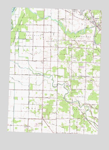
Bridgeport, MI USGS Topographic Map
Click on map above to begin viewing in our Map Viewer.

This topographic map contains these locations and features:
Feature Name Type Latitude Longitude GNIS ID View Map
Albee SchoolSchoolN43.2556°W83.9730°619901View Map
Albee Township Fire DepartmentBuildingN43.2672°W83.9520°2636187View Map
Assumption CemeteryCemeteryN43.3259°W83.9141°620287View Map
Assumption ChurchChurchN43.3084°W83.8939°620288View Map
Birch RunStreamN43.3547°W83.9978°621417View Map
Bortle DrainStreamN43.2589°W83.9400°621748View Map
BridgeportPopulated PlaceN43.3595°W83.8816°621968View Map
Bridgeport Census Designated PlaceCensusN43.3706°W83.8828°2393346View Map
Bridgeport Community ChurchChurchN43.3606°W83.8794°2558944View Map
Bridgeport Fire DepartmentBuildingN43.3572°W83.8794°2558942View Map
Bridgeport Mobile Home ParkPopulated PlaceN43.3661°W83.8875°2558615View Map
Bridgeport Post OfficePost OfficeN43.3586°W83.8811°2558939View Map
Bridgeport Public LibraryBuildingN43.3731°W83.9064°2558611View Map
Bridgeport StationLocaleN43.3622°W83.8836°2558950View Map
Bridgeport Township Police DepartmentBuildingN43.3553°W83.8752°2558943View Map
Brucker SchoolSchoolN43.3356°W83.8841°622127View Map
Calvary Community ChurchChurchN43.3364°W83.9014°2558599View Map
Charter Township of BridgeportCivilN43.3501°W83.8754°1625977View Map
Cole DrainStreamN43.3364°W83.9880°623586View Map
Davis ParkParkN43.3542°W83.8814°2558948View Map
Faith Lutheran ChurchChurchN43.3619°W83.8869°2558941View Map
Ferguson BayouGutN43.3572°W83.9989°625902View Map
FostersLocaleN43.2950°W83.9144°2558441View Map
FostersPopulated PlaceN43.2981°W83.9164°626320View Map
Fosters Post Office (historical)Post OfficeN43.2981°W83.9164°2558494View Map
Hess SchoolSchoolN43.3517°W83.9450°628161View Map
Hess School Historical MarkerParkN43.3511°W83.9450°2559020View Map
Lyle ParkParkN43.3528°W83.8831°2558949View Map
Mahar SchoolSchoolN43.3214°W83.9636°631332View Map
Martin G. Atkins Elementary SchoolSchoolN43.3708°W83.9067°2558648View Map
Oak Grove CemeteryCemeteryN43.3614°W83.8825°2558988View Map
Orville SchoolSchoolN43.3364°W83.9194°634120View Map
Parkwood Village Mobile Home ParkPopulated PlaceN43.2597°W83.9542°2558934View Map
Price Nature CenterParkN43.3306°W83.9306°2558951View Map
Saint Christopher's ChurchChurchN43.3656°W83.8931°2558936View Map
Saint Mark's Episcopal ChurchChurchN43.3678°W83.9092°2558940View Map
Sheridan Road Baptist ChurchChurchN43.3236°W83.9319°2558598View Map
Silver CreekStreamN43.2775°W83.8889°637917View Map
Spaulding CemeteryCemeteryN43.3422°W83.9450°638475View Map
Spaulding Township Fire DepartmentBuildingN43.3505°W83.9537°2636188View Map
Spaulding Township Police DepartmentBuildingN43.3506°W83.9537°2737584View Map
Spring Brook DrainStreamN43.2709°W83.8941°638548View Map
Taymouth CemeteryCemeteryN43.2806°W83.8883°1614637View Map
Township of AlbeeCivilN43.2638°W83.9920°1625811View Map
Township of SpauldingCivilN43.3422°W83.9881°1627103View Map
Verne Post Office (historical)Post OfficeN43.2653°W83.9319°2558450View Map
Village ParkParkN43.3586°W83.8847°2558947View Map
White SchoolSchoolN43.3697°W83.9036°1616344View Map
WKNX-AM (Frankenmuth)TowerN43.3417°W83.8977°1625203View Map
WTLZ-FM (Saginaw)TowerN43.3539°W83.9183°1625487View Map

Note: Coordinates in the location and feature list above are referenced to NAD83 datum.


Copyright (C) 2008-2024 Ryan Niemi / Sunset Dynamics ... All Rights Reserved