TopoQuest Logo
Do you find TopoQuest useful?
Help keep TopoQuest running and adding new maps/features by donating!
Bitcoin:  19c7KJd3qBynnjoSw5npx9KScwjBe4ifkT
Litecoin:  LXs6TkuXGGXo1vDsWCkWVdjQX94eUKd6ui
Home View Maps Find Maps Find Places Resources & Links


Bridgeport NW, Nebraska Topographic Map

USGS Map Title: Bridgeport NW, NE
USGS Map MRC: 41103F2
DRG (GeoTIFF) Download: o41103f2.tif


Neighboring USGS Topographic Map Quads:


  Bayard, NE  
41103G3
 

  Angora, NE  
41103G2
 

  Angora SE, NE  
41103G1
 

  South Bayard, NE  
41103F3
 

  Bridgeport NW, NE  
41103F2
 

  Bridgeport, NE  
41103F1
 

  Redington, NE  
41103E3
 

  Roundhouse Rock, NE  
41103E2
 

  Courthouse Rock, NE  
41103E1


Map MRC Location:

N42°
W104°
N42°
W103°
H8 H7 H6 H5 H4 H3 H2 H1
G8 G7 G6 G5 G4 G3 G2 G1
F8 F7 F6 F5 F4 F3 F2 F1
E8 E7 E6 E5 E4 E3 E2 E1
D8 D7 D6 D5 D4 D3 D2 D1
C8 C7 C6 C5 C4 C3 C2 C1
B8 B7 B6 B5 B4 B3 B2 B1
A8 A7 A6 A5 A4 A3 A2 A1
N41°
W104°
N41°
W103°

Bridgeport NW, NE USGS 1:24K Topographic Map Preview:
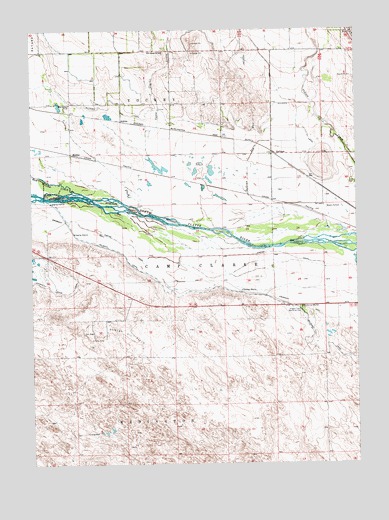
Bridgeport NW, NE USGS Topographic Map
Click on map above to begin viewing in our Map Viewer.

This topographic map contains these locations and features:
Feature Name Type Latitude Longitude GNIS ID View Map
Alliance CanalCanalN41.7277°W103.2247°826964View Map
AtkinsPopulated PlaceN41.7239°W103.2152°835238View Map
Belmont CanalCanalN41.6558°W103.1283°827312View Map
Belmont DamDamN41.7027°W103.2458°827313View Map
Belmont Diversion DamDamN41.7016°W103.2455°1769580View Map
Belmont Diversion ReservoirReservoirN41.7016°W103.2455°1769581View Map
Camp Clarke Bridge and Sidney - Black Hills Trail Historical MarkerParkN41.6700°W103.1466°1830006View Map
Camp Clarke DrainStreamN41.7139°W103.2044°827886View Map
DeGrawPopulated PlaceN41.7150°W103.1558°835283View Map
DeGraw DrainStreamN41.6908°W103.1258°828610View Map
Dunlap Oil FieldOilfieldN41.6614°W103.2152°828893View Map
Empire CanalCanalN41.6850°W103.1858°829122View Map
Hill School Number 44SchoolN41.7439°W103.1985°836050View Map
Lapaseotes FeedyardLocaleN41.6642°W103.1308°2581905View Map
MohlerPopulated PlaceN41.7147°W103.2349°835384View Map
Oregon Trail Memorial Park CemeteryCemeteryN41.6691°W103.1460°831896View Map
Red Willow CreekStreamN41.7041°W103.2335°832496View Map
West Camp Clarke Election PrecinctCivilN41.6656°W103.1684°1929375View Map
West School Number 44SchoolN41.7289°W103.2355°837253View Map

Note: Coordinates in the location and feature list above are referenced to NAD83 datum.


Copyright (C) 2008-2024 Ryan Niemi / Sunset Dynamics ... All Rights Reserved