TopoQuest Logo
Do you find TopoQuest useful?
Help keep TopoQuest running and adding new maps/features by donating!
Bitcoin:  19c7KJd3qBynnjoSw5npx9KScwjBe4ifkT
Litecoin:  LXs6TkuXGGXo1vDsWCkWVdjQX94eUKd6ui
Home View Maps Find Maps Find Places Resources & Links


Bridger, Montana Topographic Map

USGS Map Title: Bridger, MT
USGS Map MRC: 45108C8
DRG (GeoTIFF) Download: o45108c8.tif


Neighboring USGS Topographic Map Quads:


  Boyd, MT  
45109D1
 

  Fromberg, MT  
45108D8
 

  Edgar, MT  
45108D7
 

  The Big Slide, MT  
45109C1
 

  Bridger, MT  
45108C8
 

  Bluewater, MT  
45108C7
 

  Belfry, MT  
45109B1
 

  Hatcher Pass, MT  
45108B8
 

  Wade, MT  
45108B7


Map MRC Location:

N46°
W109°
N46°
W108°
H8 H7 H6 H5 H4 H3 H2 H1
G8 G7 G6 G5 G4 G3 G2 G1
F8 F7 F6 F5 F4 F3 F2 F1
E8 E7 E6 E5 E4 E3 E2 E1
D8 D7 D6 D5 D4 D3 D2 D1
C8 C7 C6 C5 C4 C3 C2 C1
B8 B7 B6 B5 B4 B3 B2 B1
A8 A7 A6 A5 A4 A3 A2 A1
N45°
W109°
N45°
W108°

Bridger, MT USGS 1:24K Topographic Map Preview:
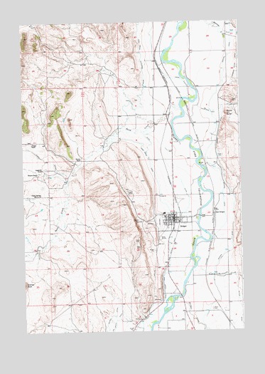
Bridger, MT USGS Topographic Map
Click on map above to begin viewing in our Map Viewer.

This topographic map contains these locations and features:
Feature Name Type Latitude Longitude GNIS ID View Map
05S23E28ADAD01 WellWellN45.3699°W108.8835°809139View Map
05S23E31ACAD01 WellWellN45.3580°W108.9288°809076View Map
05S23E32DABC01 WellWellN45.3544°W108.9071°809063View Map
05S23E32DABC02 WellWellN45.3544°W108.9071°809064View Map
05S23E33BBBB01 WellWellN45.3624°W108.9018°809098View Map
06S22E01CDBD01 WellWellN45.3349°W108.9774°808981View Map
06S22E13BDAB01 WellWellN45.3152°W108.9774°808888View Map
06S23E03BACA01 WellWellN45.3461°W108.8974°809032View Map
06S23E04CADC01 WellWellN45.3380°W108.9165°808996View Map
06S23E08DBBD01 WellWellN45.3247°W108.9321°808940View Map
06S23E08DBBD02 WellWellN45.3252°W108.9324°808944View Map
06S23E08DBCA01 WellWellN45.3244°W108.9321°808939View Map
06S23E08DBDB01 WellWellN45.3244°W108.9321°808938View Map
06S23E09ABAB01 WellWellN45.3336°W108.9110°808973View Map
06S23E09CDAD01 WellWellN45.3213°W108.9143°808923View Map
06S23E09CDCC01 WellWellN45.3194°W108.9190°808907View Map
06S23E09CDCD01 WellWellN45.3194°W108.9179°808906View Map
06S23E09CDDA01 WellWellN45.3202°W108.9143°808914View Map
06S23E09CDDC01 WellWellN45.3194°W108.9163°808905View Map
06S23E16DDDC01 WellWellN45.3052°W108.9063°808829View Map
06S23E20CADA01 WellWellN45.2955°W108.9349°808782View Map
06S23E20DBDC01 WellWellN45.2944°W108.9313°808775View Map
06S23E21DBCD01 WellWellN45.2941°W108.9118°808774View Map
06S23E22AAAB01 WellWellN45.3041°W108.8851°808823View Map
06S23E27DBBA01 WellWellN45.2822°W108.8921°808711View Map
06S23E33ADCA01 WellWellN45.2697°W108.9063°808662View Map
06S23E33DBBB01 WellWellN45.2677°W108.9135°808655View Map
06S23E34DAAC01 WellWellN45.2674°W108.8863°808652View Map
06S23E34DABD01 WellWellN45.2674°W108.8854°808651View Map
06S23E35BBCC01 WellWellN45.2727°W108.8832°808673View Map
07S23E03BDCA01 WellWellN45.2552°W108.8974°808604View Map
07S23E05ACCC01 WellWellN45.2547°W108.9343°808599View Map
07S23E05CBBA01 WellWellN45.2538°W108.9426°808593View Map
07S23E05DDAA01 WellWellN45.2502°W108.9246°808583View Map
Bluewater Creek BridgeBridgeN45.3694°W108.8821°1726632View Map
Bostic School (historical)SchoolN45.2583°W108.9076°1726812View Map
BridgerPopulated PlaceN45.2958°W108.9138°802058View Map
Bridger (historical)LocaleN45.2958°W108.9107°1726669View Map
Bridger Baptist ChurchChurchN45.2958°W108.9113°1726618View Map
Bridger CemeteryCemeteryN45.2824°W108.9251°769223View Map
Bridger City ParkParkN45.2955°W108.9110°1726565View Map
Bridger CreekStreamN45.2624°W108.9129°769224View Map
Bridger DitchCanalN45.2605°W108.8924°769225View Map
Bridger Elementary SchoolSchoolN45.2963°W108.9198°1726815View Map
Bridger Municipal AirportAirportN45.2897°W108.9219°806373View Map
Bridger Police DepartmentBuildingN45.2954°W108.9099°2548943View Map
Bridger Post OfficePost OfficeN45.2963°W108.9138°1726670View Map
Bridger Public LibraryBuildingN45.2961°W108.9160°1726538View Map
Bridger Rest AreaLocaleN45.3436°W108.9151°1726558View Map
Bridger United Methodist ChurchChurchN45.2955°W108.9168°1726620View Map
Bridger Volunteer Fire Department - Clarks Fork Fire District 2BuildingN45.2939°W108.9115°1726686View Map
Carbon County Waterfowl Production AreaParkN45.3167°W108.9031°2765228View Map
Cedar CreekStreamN45.3111°W108.9740°769708View Map
Charles Miller DitchCanalN45.3544°W108.8757°769763View Map
Cherry Springs (historical)Populated PlaceN45.3052°W108.9899°1726662View Map
Cherry Springs School (historical)SchoolN45.3052°W108.9899°769797View Map
Church of the Good ShepherdChurchN45.2947°W108.9168°1726621View Map
City Park CampgroundLocaleN45.2955°W108.9110°1726566View Map
Clarks Fork Medical CenterHospitalN45.2944°W108.9154°1726545View Map
Clarks Fork Valley AmbulanceBuildingN45.2941°W108.9115°2637825View Map
East BridgerLocaleN45.2974°W108.8910°770990View Map
Gupton (historical)LocaleN45.2716°W108.8965°1726798View Map
Jim Bridger Mountain Man Historical MarkerParkN45.2647°W108.9113°1726554View Map
Jim Bridger ParkParkN45.2958°W108.9138°1726593View Map
Kienitz RanchLocaleN45.3197°W108.9665°773027View Map
Langstaff Number 1 DamDamN45.2883°W108.9974°797284View Map
Langstaff RanchLocaleN45.3158°W108.9885°773219View Map
Memorial ParkParkN45.2958°W108.9138°1726592View Map
Mountain View CemeteryCemeteryN45.2589°W108.8926°769117View Map
Orchard CanalCanalN45.3469°W108.8879°774975View Map
Phillips RanchLocaleN45.3258°W108.9946°775199View Map
Pryor Mountains Historical MarkerParkN45.3436°W108.9151°1726557View Map
Round ButteSummitN45.3374°W108.8824°775977View Map
Round Butte School (historical)SchoolN45.3433°W108.8868°1726846View Map
Rushwater CreekStreamN45.2761°W108.9010°776019View Map
Sacred Heart Catholic ChurchChurchN45.2944°W108.9182°1726623View Map
Saint Pauls Lutheran ChurchChurchN45.2924°W108.9174°1726622View Map
Sand CreekStreamN45.3402°W108.9090°776174View Map
Sand Creek CanalCanalN45.2758°W108.9168°776192View Map
Sand Creek Extension DitchCanalN45.3533°W108.9299°776193View Map
Sand Creek School (historical)SchoolN45.3133°W108.9743°1726849View Map
Seventh Day Adventist ChurchChurchN45.2927°W108.9157°1726619View Map
Simpson RanchLocaleN45.3136°W108.9918°776570View Map
Skunk CreekStreamN45.3433°W108.8996°776624View Map
Town of BridgerCivilN45.2946°W108.9167°2411726View Map
Walrath Grain Elevator (historical)LocaleN45.2961°W108.9101°1726581View Map

Note: Coordinates in the location and feature list above are referenced to NAD83 datum.


Copyright (C) 2008-2025 Ryan Niemi / Sunset Dynamics ... All Rights Reserved