TopoQuest Logo
Do you find TopoQuest useful?
Help keep TopoQuest running and adding new maps/features by donating!
Bitcoin:  19c7KJd3qBynnjoSw5npx9KScwjBe4ifkT
Litecoin:  LXs6TkuXGGXo1vDsWCkWVdjQX94eUKd6ui
Home View Maps Find Maps Find Places Resources & Links


Edgar, Montana Topographic Map

USGS Map Title: Edgar, MT
USGS Map MRC: 45108D7
DRG (GeoTIFF) Download: o45108d7.tif


Neighboring USGS Topographic Map Quads:


  Montaqua, MT  
45108E8
 

  Silesia, MT  
45108E7
 

  Mossmain SW, MT  
45108E6
 

  Fromberg, MT  
45108D8
 

  Edgar, MT  
45108D7
 

  Pryor NW, MT  
45108D6
 

  Bridger, MT  
45108C8
 

  Bluewater, MT  
45108C7
 

  Section House Draw, MT  
45108C6


Map MRC Location:

N46°
W109°
N46°
W108°
H8 H7 H6 H5 H4 H3 H2 H1
G8 G7 G6 G5 G4 G3 G2 G1
F8 F7 F6 F5 F4 F3 F2 F1
E8 E7 E6 E5 E4 E3 E2 E1
D8 D7 D6 D5 D4 D3 D2 D1
C8 C7 C6 C5 C4 C3 C2 C1
B8 B7 B6 B5 B4 B3 B2 B1
A8 A7 A6 A5 A4 A3 A2 A1
N45°
W109°
N45°
W108°

Edgar, MT USGS 1:24K Topographic Map Preview:
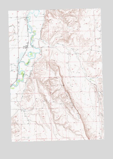
Edgar, MT USGS Topographic Map
Click on map above to begin viewing in our Map Viewer.

This topographic map contains these locations and features:
Feature Name Type Latitude Longitude GNIS ID View Map
04S16E20CCCB01 WellWellN45.4652°W108.7882°809627View Map
04S23E11CBBC01 WellWellN45.4994°W108.8615°809809View Map
04S23E13CCAA01 WellWellN45.4822°W108.8371°809706View Map
04S23E13CDAD01 WellWellN45.4813°W108.8318°809702View Map
04S23E13DBCA01 WellWellN45.4844°W108.8299°809720View Map
04S23E22DCBB01 WellWellN45.4674°W108.8718°809643View Map
04S23E23CBBB01 WellWellN45.4716°W108.8618°809662View Map
04S23E23CDDD01 WellWellN45.4649°W108.8532°809625View Map
04S23E25BCDC01 WellWellN45.4577°W108.8382°809581View Map
04S23E27DADA01 WellWellN45.4552°W108.8638°809563View Map
04S23E35CACD01 WellWellN45.4394°W108.8549°809496View Map
05S23E03AABA01 WellWellN45.4352°W108.8657°809474View Map
05S23E10AABB01 WellWellN45.4199°W108.8663°809399View Map
EdgarPopulated PlaceN45.4647°W108.8524°771137View Map
EdgarLocaleN45.4647°W108.8524°1726761View Map
Edgar CanalCanalN45.4686°W108.8263°771138View Map
Edgar Census Designated PlaceCensusN45.4638°W108.8553°2583805View Map
Edgar Elementary SchoolSchoolN45.4638°W108.8563°1726824View Map
Edgar ElevatorLocaleN45.4688°W108.8493°1726579View Map
Edgar Post OfficePost OfficeN45.4647°W108.8539°1726760View Map
Edgar Rural Fire District 4BuildingN45.4663°W108.8508°2546449View Map
Elbow CreekStreamN45.4477°W108.8626°783023View Map
Five Mile CreekStreamN45.4757°W108.8416°793925View Map
Fivemile CreekStreamN45.4758°W108.8417°768059View Map
Heiser (historical)LocaleN45.4380°W108.8640°1726797View Map
Middle Fork Fivemile CreekStreamN45.4205°W108.7547°774162View Map
North Fork Fivemile CreekStreamN45.4320°W108.7667°774754View Map
Rockvale CemeteryCemeteryN45.4887°W108.8618°775869View Map
Two Bear CreekStreamN45.4427°W108.8460°1726559View Map
Two Bear RidgeRidgeN45.4147°W108.7951°777865View Map

Note: Coordinates in the location and feature list above are referenced to NAD83 datum.


Copyright (C) 2008-2024 Ryan Niemi / Sunset Dynamics ... All Rights Reserved