TopoQuest Logo
Do you find TopoQuest useful?
Help keep TopoQuest running and adding new maps/features by donating!
Bitcoin:  19c7KJd3qBynnjoSw5npx9KScwjBe4ifkT
Litecoin:  LXs6TkuXGGXo1vDsWCkWVdjQX94eUKd6ui
Home View Maps Find Maps Find Places Resources & Links


Bridgewater, Iowa Topographic Map

USGS Map Title: Bridgewater, IA
USGS Map MRC: 41094B6
DRG (GeoTIFF) Download: o41094b6.tif


Neighboring USGS Topographic Map Quads:


  Massena, IA  
41094C7
 

  Fontanelle SW, IA  
41094C6
 

  Fontanelle, IA  
41094C5
 

  Dewey, IA  
41094B7
 

  Bridgewater, IA  
41094B6
 

  Nevinville, IA  
41094B5
 

  Carbon, IA  
41094A7
 

  Corning North, IA  
41094A6
 

  Prescott, IA  
41094A5


Map MRC Location:

N42°
W95°
N42°
W94°
H8 H7 H6 H5 H4 H3 H2 H1
G8 G7 G6 G5 G4 G3 G2 G1
F8 F7 F6 F5 F4 F3 F2 F1
E8 E7 E6 E5 E4 E3 E2 E1
D8 D7 D6 D5 D4 D3 D2 D1
C8 C7 C6 C5 C4 C3 C2 C1
B8 B7 B6 B5 B4 B3 B2 B1
A8 A7 A6 A5 A4 A3 A2 A1
N41°
W95°
N41°
W94°

Bridgewater, IA USGS 1:24K Topographic Map Preview:
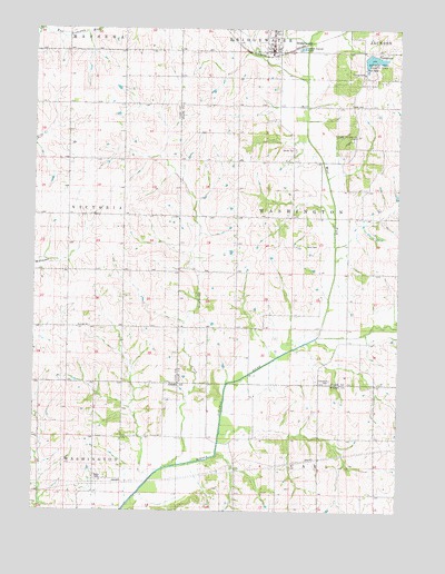
Bridgewater, IA USGS Topographic Map
Click on map above to begin viewing in our Map Viewer.

This topographic map contains these locations and features:
Feature Name Type Latitude Longitude GNIS ID View Map
BridgewaterPopulated PlaceN41.2450°W94.6689°454823View Map
Bridgewater (historical)LocaleN41.2433°W94.6669°1969012View Map
Bridgewater Fire Department and Emergency Medical ServicesBuildingN41.2446°W94.6692°2577475View Map
Bridgewater Post OfficePost OfficeN41.2444°W94.6697°1969009View Map
Camp Eo-wa-taLocaleN41.2222°W94.6411°1823003View Map
Campbell CemeteryCemeteryN41.1589°W94.6486°455140View Map
City of BridgewaterCivilN41.2471°W94.6689°2393418View Map
Garner CemeteryCemeteryN41.2187°W94.6609°456846View Map
Morman Trail County ParkParkN41.2403°W94.6339°463933View Map
Morman Trail Lake DamDamN41.2433°W94.6364°463512View Map
Mormon Trail LakeReservoirN41.2433°W94.6364°1968973View Map
Normon Trail LakeLakeN41.2425°W94.6350°459549View Map
Thompson CreekStreamN41.1367°W94.7036°462221View Map
Township of WashingtonCivilN41.2010°W94.6429°468899View Map
Trinity Christian ChurchChurchN41.2450°W94.6700°1969011View Map
United Methodist ChurchChurchN41.2458°W94.6697°1969010View Map
West Fork Middle Nodaway RiverStreamN41.1705°W94.6522°462856View Map
Winn CemeteryCemeteryN41.1938°W94.6570°463132View Map
Witt CemeteryCemeteryN41.2304°W94.6421°463148View Map

Note: Coordinates in the location and feature list above are referenced to NAD83 datum.


Copyright (C) 2008-2024 Ryan Niemi / Sunset Dynamics ... All Rights Reserved