TopoQuest Logo
Do you find TopoQuest useful?
Help keep TopoQuest running and adding new maps/features by donating!
Bitcoin:  19c7KJd3qBynnjoSw5npx9KScwjBe4ifkT
Litecoin:  LXs6TkuXGGXo1vDsWCkWVdjQX94eUKd6ui
Home View Maps Find Maps Find Places Resources & Links


Corning North, Iowa Topographic Map

USGS Map Title: Corning North, IA
USGS Map MRC: 41094A6
DRG (GeoTIFF) Download: o41094a6.tif


Neighboring USGS Topographic Map Quads:


  Dewey, IA  
41094B7
 

  Bridgewater, IA  
41094B6
 

  Nevinville, IA  
41094B5
 

  Carbon, IA  
41094A7
 

  Corning North, IA  
41094A6
 

  Prescott, IA  
41094A5
 

  Brooks, IA  
40094H7
 

  Corning South, IA  
40094H6
 

  Lenox, IA  
40094H5


Map MRC Location:

N42°
W95°
N42°
W94°
H8 H7 H6 H5 H4 H3 H2 H1
G8 G7 G6 G5 G4 G3 G2 G1
F8 F7 F6 F5 F4 F3 F2 F1
E8 E7 E6 E5 E4 E3 E2 E1
D8 D7 D6 D5 D4 D3 D2 D1
C8 C7 C6 C5 C4 C3 C2 C1
B8 B7 B6 B5 B4 B3 B2 B1
A8 A7 A6 A5 A4 A3 A2 A1
N41°
W95°
N41°
W94°

Corning North, IA USGS 1:24K Topographic Map Preview:
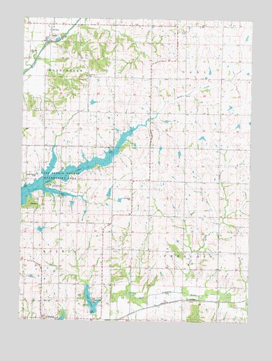
Corning North, IA USGS Topographic Map
Click on map above to begin viewing in our Map Viewer.

This topographic map contains these locations and features:
Feature Name Type Latitude Longitude GNIS ID View Map
Adams CountyCivilN41.0290°W94.6992°465191View Map
Brown BranchStreamN41.0125°W94.6611°454853View Map
CarlPopulated PlaceN41.1200°W94.6630°455164View Map
Carl CemeteryCemeteryN41.1215°W94.6634°1968965View Map
Carl Methodist ChurchChurchN41.1203°W94.6630°1968945View Map
Carl Post Office (historical)Post OfficeN41.1200°W94.6630°1968905View Map
Forest Hill CemeteryCemeteryN41.1011°W94.7156°456670View Map
Grace Baptist ChurchChurchN41.0011°W94.7375°1968936View Map
Homan CemeteryCemeteryN41.1083°W94.7086°1968961View Map
Lake BinderReservoirN41.0084°W94.7111°465856View Map
Lake IcariaReservoirN41.0616°W94.7247°457743View Map
Lake Icaria County Recreation AreaParkN41.0561°W94.7336°1823002View Map
Lakeview CampgroundLocaleN41.0555°W94.7336°1968913View Map
Mount EtnaPopulated PlaceN41.1205°W94.7353°459290View Map
Mount Etna CemeteryCemeteryN41.1111°W94.7462°459291View Map
Mount Etna Church of the BrethrenChurchN41.1205°W94.7353°1968941View Map
Mount Etna Post Office (historical)Post OfficeN41.1205°W94.7353°1968904View Map
Mount Etna QuarryMineN41.1172°W94.7339°2628372View Map
Mount Pleasant CemeteryCemeteryN41.0508°W94.6902°459329View Map
Mount Washington Post Office (historical)Post OfficeN41.0972°W94.7169°1968899View Map
Old Mount Etna CemeteryCemeteryN41.1222°W94.7280°1968962View Map
Old Queen City CemeteryCemeteryN41.0080°W94.7091°459834View Map
Queen City (historical)Populated PlaceN41.0053°W94.7100°465481View Map
Queen City CemeteryCemeteryN41.0125°W94.7086°1968964View Map
Timber Ridge CampgroundLocaleN41.0486°W94.7447°1968914View Map
Township of CarlCivilN41.1148°W94.6426°467530View Map
Township of PrescottCivilN41.0289°W94.6426°468576View Map

Note: Coordinates in the location and feature list above are referenced to NAD83 datum.


Copyright (C) 2008-2025 Ryan Niemi / Sunset Dynamics ... All Rights Reserved