TopoQuest Logo
Do you find TopoQuest useful?
Help keep TopoQuest running and adding new maps/features by donating!
Bitcoin:  19c7KJd3qBynnjoSw5npx9KScwjBe4ifkT
Litecoin:  LXs6TkuXGGXo1vDsWCkWVdjQX94eUKd6ui
Home View Maps Find Maps Find Places Resources & Links


Bridgewater, Michigan Topographic Map

USGS Map Title: Bridgewater, MI
USGS Map MRC: 42083B8
DRG (GeoTIFF) Download: o42083b8.tif


Neighboring USGS Topographic Map Quads:


  Chelsea, MI  
42084C1
 

  Dexter, MI  
42083C8
 

  Ann Arbor West, MI  
42083C7
 

  Manchester, MI  
42084B1
 

  Bridgewater, MI  
42083B8
 

  Saline, MI  
42083B7
 

  Tipton, MI  
42084A1
 

  Tecumseh North, MI  
42083A8
 

  Macon, MI  
42083A7


Map MRC Location:

N43°
W84°
N43°
W83°
H8 H7 H6 H5 H4 H3 H2 H1
G8 G7 G6 G5 G4 G3 G2 G1
F8 F7 F6 F5 F4 F3 F2 F1
E8 E7 E6 E5 E4 E3 E2 E1
D8 D7 D6 D5 D4 D3 D2 D1
C8 C7 C6 C5 C4 C3 C2 C1
B8 B7 B6 B5 B4 B3 B2 B1
A8 A7 A6 A5 A4 A3 A2 A1
N42°
W84°
N42°
W83°

Bridgewater, MI USGS 1:24K Topographic Map Preview:
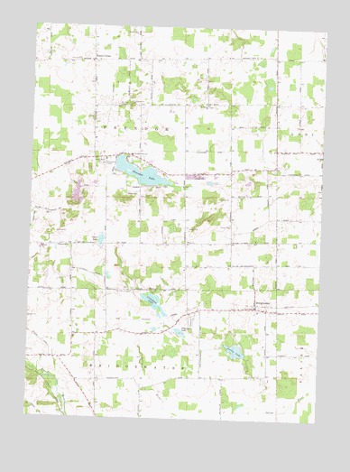
Bridgewater, MI USGS Topographic Map
Click on map above to begin viewing in our Map Viewer.

This topographic map contains these locations and features:
Feature Name Type Latitude Longitude GNIS ID View Map
Bethel ChurchChurchN42.1809°W83.9319°621212View Map
Bethel Church CemeteryCemeteryN42.1805°W83.9319°2646800View Map
Bethel Church Historical MarkerParkN42.1813°W83.9135°2635712View Map
BridgewaterPopulated PlaceN42.1609°W83.9022°621974View Map
Bridgewater Post OfficePost OfficeN42.1609°W83.9019°2646677View Map
Bridgewater Station (historical)LocaleN42.1618°W83.9019°2646676View Map
Columbia LakeLakeN42.1620°W83.9458°623639View Map
Fletcher Road CemeteryCemeteryN42.2211°W83.9739°2646799View Map
Fredonia Post Office (historical)Post OfficeN42.2250°W83.9542°2646735View Map
Freedom CemeteryCemeteryN42.2394°W83.9472°2646798View Map
Freedom Emanuel Evangelical Memorial CemeteryCemeteryN42.2250°W83.9542°2646801View Map
Hickory Sticks Golf CourseLocaleN42.2042°W83.9014°2647595View Map
Joslin LakeLakeN42.1470°W83.9105°629401View Map
Mount Hope CemeteryCemeteryN42.2250°W83.9634°632799View Map
Pleasant LakeLakeN42.2030°W83.9529°635099View Map
Pleasant Lake SchoolSchoolN42.2092°W83.9572°635112View Map
Rogers CornerPopulated PlaceN42.2389°W83.9741°636116View Map
Rogers Corners Addition CemeteryCemeteryN42.2393°W83.9748°2646802View Map
Saint Francis' Catholic CemeteryCemeteryN42.1805°W83.9419°2646804View Map
Saint John United ChurchChurchN42.2393°W83.9718°2649001View Map
Saint John's Lutheran CemeteryCemeteryN42.1599°W83.8981°2646776View Map
Saint Thomas ChurchChurchN42.2253°W83.9252°637073View Map
Saint Thomas' Lutheran CemeteryCemeteryN42.2250°W83.9247°2646805View Map
Schasser LakeLakeN42.1525°W83.9344°637325View Map
Schneider Road CemeteryCemeteryN42.1992°W83.9342°2646803View Map
Shellenberger Road CemeteryCemeteryN42.1472°W83.9258°2646775View Map
Silver LakeLakeN42.1816°W83.9693°637937View Map
Thomas Church Historical MarkerParkN42.2254°W83.9251°2635753View Map
Township of FreedomCivilN42.2091°W83.9537°1626313View Map
Weinsburg Post Office (historical)Post OfficeN42.2408°W83.8756°2646689View Map
Zion Lutheran CemeteryCemeteryN42.2393°W83.9806°1616941View Map
Zion Lutheran ChurchChurchN42.2387°W83.9746°2649000View Map
Zion Lutheran Church Historical MarkerParkN42.2392°W83.9742°2635765View Map

Note: Coordinates in the location and feature list above are referenced to NAD83 datum.


Copyright (C) 2008-2025 Ryan Niemi / Sunset Dynamics ... All Rights Reserved