TopoQuest Logo
Do you find TopoQuest useful?
Help keep TopoQuest running and adding new maps/features by donating!
Bitcoin:  19c7KJd3qBynnjoSw5npx9KScwjBe4ifkT
Litecoin:  LXs6TkuXGGXo1vDsWCkWVdjQX94eUKd6ui
Home View Maps Find Maps Find Places Resources & Links


Tipton, Michigan Topographic Map

USGS Map Title: Tipton, MI
USGS Map MRC: 42084A1
DRG (GeoTIFF) Download: o42084a1.tif


Neighboring USGS Topographic Map Quads:


  Norvell, MI  
42084B2
 

  Manchester, MI  
42084B1
 

  Bridgewater, MI  
42083B8
 

  Onsted, MI  
42084A2
 

  Tipton, MI  
42084A1
 

  Tecumseh North, MI  
42083A8
 

  Rome Center, MI  
41084H2
 

  Adrian, MI  
41084H1
 

  Tecumseh South, MI  
41083H8


Map MRC Location:

N43°
W85°
N43°
W84°
H8 H7 H6 H5 H4 H3 H2 H1
G8 G7 G6 G5 G4 G3 G2 G1
F8 F7 F6 F5 F4 F3 F2 F1
E8 E7 E6 E5 E4 E3 E2 E1
D8 D7 D6 D5 D4 D3 D2 D1
C8 C7 C6 C5 C4 C3 C2 C1
B8 B7 B6 B5 B4 B3 B2 B1
A8 A7 A6 A5 A4 A3 A2 A1
N42°
W85°
N42°
W84°

Tipton, MI USGS 1:24K Topographic Map Preview:
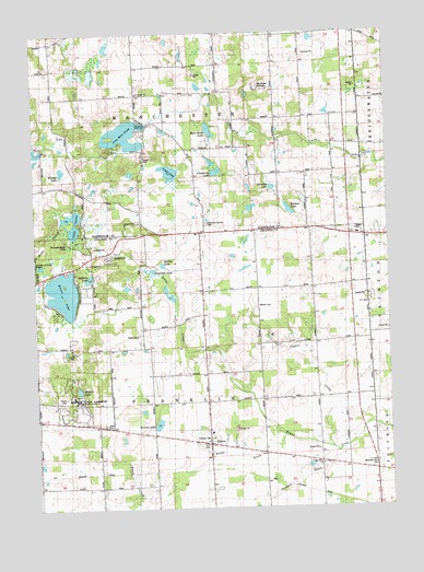
Tipton, MI USGS Topographic Map
Click on map above to begin viewing in our Map Viewer.

This topographic map contains these locations and features:
Feature Name Type Latitude Longitude GNIS ID View Map
Bradley SchoolSchoolN42.0603°W84.0661°621854View Map
Bruno DrainStreamN42.0189°W84.0377°622138View Map
Church of GodChurchN42.0494°W84.0069°2465592View Map
Cranberry LakeLakeN42.0884°W84.0602°623992View Map
Davenport House Historical MarkerParkN42.0622°W84.1181°2465770View Map
English SchoolSchoolN42.1023°W84.0383°625603View Map
Evans LakeLakeN42.0571°W84.1151°625678View Map
Evans Lake Post Office (historical)Post OfficeN42.0633°W84.1139°2435688View Map
Evans SchoolSchoolN42.0639°W84.1105°625680View Map
Excelsior SchoolSchoolN42.0420°W84.0877°625724View Map
Franklin CemeteryCemeteryN42.0183°W84.0631°2112762View Map
Franklin Center SchoolSchoolN42.0270°W84.0638°626411View Map
Grace Bible ChurchChurchN42.0114°W84.0244°2112761View Map
Grubb SchoolSchoolN42.0225°W84.1049°627484View Map
Half Moon LakeLakeN42.0994°W84.0625°627621View Map
Hidden LakeLakeN42.0311°W84.1100°2112764View Map
Hidden Lake GardensParkN42.0294°W84.1122°2112763View Map
Hidden Lake ParkParkN42.0312°W84.1108°628214View Map
Hudson LakeLakeN42.0803°W84.0297°628771View Map
Iron Creek ChurchChurchN42.1095°W84.0891°629074View Map
Iron Mill PondLakeN42.0983°W84.0925°629078View Map
Jado Park CampgroundLocaleN42.0658°W84.0986°2436121View Map
Jefferey LakeLakeN42.0607°W84.1058°629227View Map
Jehovah's WitnessesChurchN42.0139°W84.0400°2436101View Map
Keeney LakeLakeN42.0221°W84.0822°629503View Map
Lamkin DrainStreamN42.0142°W84.0197°630106View Map
Lamkin SchoolSchoolN42.0292°W84.0066°630107View Map
Lower LakeLakeN42.0884°W84.0768°631176View Map
Madison SchoolSchoolN42.1142°W84.1186°631321View Map
Manchester SpeedwayLocaleN42.1108°W84.0458°2112905View Map
McMahon SchoolSchoolN42.1239°W84.0894°631989View Map
Memorial Park CemeteryCemeteryN42.0114°W84.0044°2112760View Map
Mills CemeteryCemeteryN42.0217°W84.1013°632421View Map
Pentecost SchoolSchoolN42.0064°W84.1133°634606View Map
Pink SchoolSchoolN42.0109°W84.0247°635016View Map
Reynolds Corners CemeteryCemeteryN42.0748°W84.0643°635823View Map
Reynolds LakeLakeN42.0626°W84.0835°635825View Map
Sand Lake Volunteer Fire Department Station 1BuildingN42.0624°W84.1187°2620095View Map
Sand Lake Volunteer Fire Department Station 2BuildingN42.0217°W84.0638°2436119View Map
Smalley LakeLakeN42.0842°W84.0407°638122View Map
Spring LakeLakeN42.0639°W84.0797°638598View Map
Stone SchoolSchoolN42.0503°W84.0258°638879View Map
Taylor CreekStreamN42.0159°W84.0211°1614619View Map
Tecumseh Woods CampLocaleN42.0706°W84.1139°2112766View Map
TiptonPopulated PlaceN42.0167°W84.0641°1614882View Map
Tipton Community ChurchChurchN42.0175°W84.0644°2436118View Map
Tipton Post OfficePost OfficeN42.0167°W84.0644°2436120View Map
Tipton Station (historical)LocaleN42.0103°W84.0639°2436117View Map
Township of FranklinCivilN42.0285°W84.0687°1626308View Map
Township of ManchesterCivilN42.1169°W84.0714°1626665View Map
Twin LakesLakeN42.0727°W84.1122°1615273View Map
West Clinton SchoolSchoolN42.0739°W84.0288°1616093View Map
Whelan LakeLakeN42.0889°W84.1151°1616271View Map
Wisner CemeteryCemeteryN42.0531°W84.0458°2112765View Map
Zimmerman SchoolSchoolN42.1162°W84.0602°1616934View Map

Note: Coordinates in the location and feature list above are referenced to NAD83 datum.


Copyright (C) 2008-2024 Ryan Niemi / Sunset Dynamics ... All Rights Reserved