TopoQuest Logo
Do you find TopoQuest useful?
Help keep TopoQuest running and adding new maps/features by donating!
Bitcoin:  19c7KJd3qBynnjoSw5npx9KScwjBe4ifkT
Litecoin:  LXs6TkuXGGXo1vDsWCkWVdjQX94eUKd6ui
Home View Maps Find Maps Find Places Resources & Links


Brothertown, Wisconsin Topographic Map

USGS Map Title: Brothertown, WI
USGS Map MRC: 43088H3
DRG (GeoTIFF) Download: o43088h3.tif


Neighboring USGS Topographic Map Quads:


  Indian Point, WI  
44088A4
 

  Stockbridge, WI  
44088A3
 

  Chilton, WI  
44088A2
 

  Fahrney Point, WI  
43088H4
 

  Brothertown, WI  
43088H3
 

  Marytown, WI  
43088H2
 

  Fond du Lac, WI  
43088G4
 

  Saint Peter, WI  
43088G3
 

  Saint Cloud, WI  
43088G2


Map MRC Location:

N44°
W89°
N44°
W88°
H8 H7 H6 H5 H4 H3 H2 H1
G8 G7 G6 G5 G4 G3 G2 G1
F8 F7 F6 F5 F4 F3 F2 F1
E8 E7 E6 E5 E4 E3 E2 E1
D8 D7 D6 D5 D4 D3 D2 D1
C8 C7 C6 C5 C4 C3 C2 C1
B8 B7 B6 B5 B4 B3 B2 B1
A8 A7 A6 A5 A4 A3 A2 A1
N43°
W89°
N43°
W88°

Brothertown, WI USGS 1:24K Topographic Map Preview:
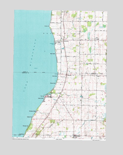
Brothertown, WI USGS Topographic Map
Click on map above to begin viewing in our Map Viewer.

This topographic map contains these locations and features:
Feature Name Type Latitude Longitude GNIS ID View Map
Artesia BeachPopulated PlaceN43.9347°W88.3151°1560963View Map
Bock CemeteryCemeteryN43.9341°W88.3112°1561995View Map
BrothertownPopulated PlaceN43.9680°W88.3090°1562251View Map
Brothertown HarborBayN43.9661°W88.3207°1562252View Map
Calumet HarborPopulated PlaceN43.9130°W88.3323°1562522View Map
Calumet SchoolSchoolN43.9217°W88.2626°1562523View Map
Calumet Volunteer Fire DepartmentBuildingN43.9139°W88.3144°2698034View Map
CalumetvillePopulated PlaceN43.9361°W88.3034°1562524View Map
Camp ShaginappiLocaleN43.9186°W88.3259°1562655View Map
Columbia ParkParkN43.9153°W88.3282°1563281View Map
Dick Family CemeteryCemeteryN43.9966°W88.3123°1837420View Map
GarnetPopulated PlaceN43.9355°W88.2629°1565424View Map
Heritage OrchardLocaleN43.9956°W88.3144°2631415View Map
Highland ParkPopulated PlaceN43.8942°W88.3476°1566397View Map
Holy Trinity Catholic CemeteryCemeteryN43.9714°W88.2643°1837438View Map
Holy Trinity Catholic ChurchChurchN43.9703°W88.2657°1837439View Map
JerichoPopulated PlaceN43.9700°W88.2665°1567156View Map
JohnsburgPopulated PlaceN43.8772°W88.2898°1567207View Map
Laudolff BeachPopulated PlaceN43.8778°W88.3573°1567876View Map
Maple HeightsPopulated PlaceN43.9564°W88.3176°1568983View Map
Morrill Family CemeteryCemeteryN43.9700°W88.2857°1837451View Map
PipePopulated PlaceN43.9142°W88.3126°1571550View Map
Pipe CreekStreamN43.9155°W88.3323°1571551View Map
Pukwana BeachPopulated PlaceN43.9278°W88.3170°1571961View Map
Rothmann CemeteryCemeteryN43.9378°W88.2593°1572628View Map
Saint John the Baptist Catholic ChurchChurchN43.8769°W88.2907°1845909View Map
Saint Pauls CemeteryCemeteryN43.9133°W88.2773°1845940View Map
Saint Pauls ChurchChurchN43.9158°W88.2818°1573481View Map
Town of BrothertownCivilN43.9691°W88.2774°1582873View Map
Town of CalumetCivilN43.9108°W88.2910°1582907View Map
Union CemeteryCemeteryN43.9744°W88.3112°1575884View Map
Winnebago HeightsPopulated PlaceN43.9003°W88.3426°1576872View Map
Winnebago ParkPopulated PlaceN43.8853°W88.3526°1576874View Map
Winnebago PointCapeN43.9828°W88.3273°1576875View Map

Note: Coordinates in the location and feature list above are referenced to NAD83 datum.


Copyright (C) 2008-2024 Ryan Niemi / Sunset Dynamics ... All Rights Reserved