TopoQuest Logo
Do you find TopoQuest useful?
Help keep TopoQuest running and adding new maps/features by donating!
Bitcoin:  19c7KJd3qBynnjoSw5npx9KScwjBe4ifkT
Litecoin:  LXs6TkuXGGXo1vDsWCkWVdjQX94eUKd6ui
Home View Maps Find Maps Find Places Resources & Links


Bruceton Mills, West Virginia Topographic Map

USGS Map Title: Bruceton Mills, WV
USGS Map MRC: 39079F6
DRG (GeoTIFF) Download: o39079f6.tif


Neighboring USGS Topographic Map Quads:


  Smithfield, PA  
39079G7
 

  Brownfield, PA  
39079G6
 

  Fort Necessity, PA  
39079G5
 

  Lake Lynn, PA  
39079F7
 

  Bruceton Mills, WV  
39079F6
 

  Brandonville, WV  
39079F5
 

  Masontown, WV  
39079E7
 

  Valley Point, WV  
39079E6
 

  Cuzzart, WV  
39079E5


Map MRC Location:

N40°
W80°
N40°
W79°
H8 H7 H6 H5 H4 H3 H2 H1
G8 G7 G6 G5 G4 G3 G2 G1
F8 F7 F6 F5 F4 F3 F2 F1
E8 E7 E6 E5 E4 E3 E2 E1
D8 D7 D6 D5 D4 D3 D2 D1
C8 C7 C6 C5 C4 C3 C2 C1
B8 B7 B6 B5 B4 B3 B2 B1
A8 A7 A6 A5 A4 A3 A2 A1
N39°
W80°
N39°
W79°

Bruceton Mills, WV USGS 1:24K Topographic Map Preview:
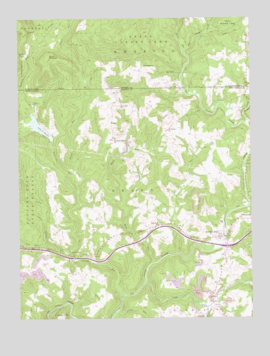
Bruceton Mills, WV USGS Topographic Map
Click on map above to begin viewing in our Map Viewer.

This topographic map contains these locations and features:
Feature Name Type Latitude Longitude GNIS ID View Map
Barmaster BridgeBridgeN39.6729°W79.6254°2647541View Map
Bruceton Community Ambulance Service 3BuildingN39.6605°W79.6391°2581042View Map
Bruceton Junior High School (historical)SchoolN39.6579°W79.6420°1558461View Map
Bruceton MillsPopulated PlaceN39.6587°W79.6412°1553998View Map
Bruceton Mills - Brandonville Volunteer Fire DepartmentBuildingN39.6612°W79.6391°2577634View Map
Bruceton Mills DamDamN39.6600°W79.6380°1559242View Map
Bruceton Mills Elementary School (historical)SchoolN39.6579°W79.6423°1558462View Map
Bruceton Mills LakeReservoirN39.6613°W79.6377°1559243View Map
Bruceton Mills Post OfficePost OfficeN39.6591°W79.6401°1559875View Map
Bruceton SchoolSchoolN39.6578°W79.6416°2088143View Map
Bruceton United Methodist ChurchChurchN39.6629°W79.6400°1558464View Map
Devies MountainSummitN39.7342°W79.7334°1173194View Map
East View CemeteryCemeteryN39.7190°W79.6992°1538522View Map
East View ChurchChurchN39.7142°W79.6942°1538524View Map
Fair View CemeteryCemeteryN39.6476°W79.7375°1538786View Map
Florence (historical)Populated PlaceN39.7001°W79.6989°1558522View Map
Glade RunStreamN39.6523°W79.6642°1539440View Map
Glade RunStreamN39.6767°W79.6270°1539442View Map
Greenville School (historical)SchoolN39.6729°W79.7117°1558532View Map
Guthrie School (historical)SchoolN39.7337°W79.6250°1206124View Map
Hazel RunStreamN39.6479°W79.6789°1540098View Map
HopewellPopulated PlaceN39.6637°W79.6748°1558557View Map
Hopewell ChurchChurchN39.6637°W79.6753°1540449View Map
Interchange 23CrossingN39.6548°W79.6381°1558567View Map
Lake O' WoodsReservoirN39.7048°W79.7383°1544267View Map
Lake O'Woods Recreation Club DamDamN39.7034°W79.7414°1559229View Map
Laurel Church (historical)ChurchN39.6506°W79.7214°1558585View Map
Laurel RunStreamN39.6348°W79.6945°1178996View Map
Laurel RunPopulated PlaceN39.6512°W79.7226°1541491View Map
Laurel RunStreamN39.6342°W79.6948°1541532View Map
Lick RunStreamN39.6565°W79.7353°1541947View Map
Little Laurel CreekStreamN39.6767°W79.7462°1542147View Map
Little Laurel RunStreamN39.6531°W79.7228°1542161View Map
Little SandyPopulated PlaceN39.6304°W79.6445°1558589View Map
Little Sandy CreekStreamN39.7059°W79.6275°1542210View Map
Little Sandy CreekStreamN39.6404°W79.6820°1542211View Map
Little Sandy CreekStreamN39.7059°W79.6275°1192819View Map
Little Sandy Creek BridgeBridgeN39.6315°W79.6456°1558590View Map
Little Sandy Nazarene ChurchChurchN39.6292°W79.6470°1558591View Map
Mountain Grove Church of the Brethren (historical)ChurchN39.7004°W79.6989°1558616View Map
Mountain Grove School (historical)SchoolN39.6995°W79.6987°1543860View Map
Parker RunStreamN39.6273°W79.6984°1544585View Map
Patterson RunStreamN39.6798°W79.7181°1183374View Map
Patterson RunStreamN39.6798°W79.7184°1544630View Map
Petitte Number One Refuse Impoundment DamDamN39.6917°W79.6548°1559152View Map
Quebec RunStreamN39.7367°W79.6598°1214657View Map
Robinson Run LakeReservoirN39.6917°W79.6548°1559153View Map
Saint Peters ChurchChurchN39.7031°W79.6695°1546271View Map
Tebolt RunStreamN39.7279°W79.6612°1201704View Map
Town of BrandonvilleCivilN39.6671°W79.6277°2390749View Map
Town of Bruceton MillsCivilN39.6594°W79.6406°2390758View Map
Valley School (historical)SchoolN39.7006°W79.7320°1558703View Map
Ward Thompson SpringSpringN39.6592°W79.6512°1558706View Map
Webster RunStreamN39.6295°W79.6487°1548875View Map
West Clifton Mills Truss BridgeBridgeN39.7200°W79.6603°2647540View Map
White School (historical)SchoolN39.7020°W79.6628°1558716View Map
WirsingLocaleN39.7276°W79.6867°1212722View Map
Wirsing School (historical)SchoolN39.7267°W79.6814°1206126View Map
Wymps GapGapN39.7348°W79.7495°1191829View Map
Wymps Gap School (historical)SchoolN39.7351°W79.7448°1206125View Map

Note: Coordinates in the location and feature list above are referenced to NAD83 datum.


Copyright (C) 2008-2025 Ryan Niemi / Sunset Dynamics ... All Rights Reserved