TopoQuest Logo
Do you find TopoQuest useful?
Help keep TopoQuest running and adding new maps/features by donating!
Bitcoin:  19c7KJd3qBynnjoSw5npx9KScwjBe4ifkT
Litecoin:  LXs6TkuXGGXo1vDsWCkWVdjQX94eUKd6ui
Home View Maps Find Maps Find Places Resources & Links


Smithfield, Pennsylvania Topographic Map

USGS Map Title: Smithfield, PA
USGS Map MRC: 39079G7
DRG (GeoTIFF) Download: o39079g7.tif


Neighboring USGS Topographic Map Quads:


  Carmichaels, PA  
39079H8
 

  New Salem, PA  
39079H7
 

  Uniontown, PA  
39079H6
 

  Masontown, PA  
39079G8
 

  Smithfield, PA  
39079G7
 

  Brownfield, PA  
39079G6
 

  Morgantown North, WV  
39079F8
 

  Lake Lynn, PA  
39079F7
 

  Bruceton Mills, WV  
39079F6


Map MRC Location:

N40°
W80°
N40°
W79°
H8 H7 H6 H5 H4 H3 H2 H1
G8 G7 G6 G5 G4 G3 G2 G1
F8 F7 F6 F5 F4 F3 F2 F1
E8 E7 E6 E5 E4 E3 E2 E1
D8 D7 D6 D5 D4 D3 D2 D1
C8 C7 C6 C5 C4 C3 C2 C1
B8 B7 B6 B5 B4 B3 B2 B1
A8 A7 A6 A5 A4 A3 A2 A1
N39°
W80°
N39°
W79°

Smithfield, PA USGS 1:24K Topographic Map Preview:
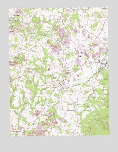
Smithfield, PA USGS Topographic Map
Click on map above to begin viewing in our Map Viewer.

This topographic map contains these locations and features:
Feature Name Type Latitude Longitude GNIS ID View Map
AmendPopulated PlaceN39.8729°W79.7892°1168258View Map
Bartons HollowValleyN39.7847°W79.7586°1168786View Map
Borough of FairchanceCivilN39.8251°W79.7540°1215228View Map
Borough of SmithfieldCivilN39.8023°W79.8088°1215237View Map
BowoodPopulated PlaceN39.8162°W79.8495°1170077View Map
Brownfield HollowValleyN39.7743°W79.7721°1170383View Map
ChadvillePopulated PlaceN39.8665°W79.7517°1171523View Map
CollierPopulated PlaceN39.8504°W79.7787°1172212View Map
Collier Volunteer Fire Department Station 9BuildingN39.8539°W79.7786°2645094View Map
Cores School (historical)SchoolN39.8659°W79.8220°1205659View Map
CornishPopulated PlaceN39.7576°W79.8256°1203340View Map
Crozier Run Branch Junction Station (historical)BuildingN39.8398°W79.8142°1212645View Map
Croziers RunStreamN39.8065°W79.8281°1201558View Map
DeffenbaughPopulated PlaceN39.8526°W79.8737°1203398View Map
Dugan HillPopulated PlaceN39.8676°W79.8576°1173584View Map
EmeryPopulated PlaceN39.8576°W79.8617°1212648View Map
FairchancePopulated PlaceN39.8248°W79.7545°1174420View Map
Fairchance Police DepartmentBuildingN39.8204°W79.7576°2770035View Map
Fairchance Post OfficePost OfficeN39.8204°W79.7545°2768342View Map
Fairchance Volunteer Fire Department Station 16BuildingN39.8262°W79.7503°2644936View Map
Fairchance-Georges SchoolSchoolN39.8306°W79.7839°1174421View Map
Gans Hill SchoolSchoolN39.7590°W79.8723°1175418View Map
GilmorePopulated PlaceN39.8301°W79.8028°1203670View Map
Goodwin KnobSummitN39.8129°W79.7931°1175822View Map
Gossip RunStreamN39.8104°W79.8195°2043476View Map
Grace ChapelChurchN39.8615°W79.8134°1175875View Map
Griffin SchoolSchoolN39.7995°W79.8651°1205661View Map
HaydentownPopulated PlaceN39.7890°W79.7706°1176686View Map
Haydentown Volunteer Fire Department Station 50BuildingN39.7929°W79.7684°2645896View Map
HighhousePopulated PlaceN39.8662°W79.8098°1177020View Map
LeckronePopulated PlaceN39.8615°W79.8701°1179107View Map
Leckrone Post OfficePost OfficeN39.8635°W79.8698°2779852View Map
Lewis CrossingPopulated PlaceN39.8676°W79.8692°1204019View Map
Locust HillPopulated PlaceN39.7545°W79.8692°1179783View Map
Lutheran ChurchChurchN39.8509°W79.8514°1205663View Map
Lynndale School (historical)SchoolN39.7645°W79.7728°1205662View Map
Maple Grove CemeteryCemeteryN39.8204°W79.7650°2777551View Map
Miller Airport (historical)AirportN39.8001°W79.8164°1193744View Map
Morris CrossroadsPopulated PlaceN39.7534°W79.8573°1181570View Map
Mount Moriah ChurchChurchN39.8034°W79.8123°1181750View Map
Mountain CreekStreamN39.7837°W79.8117°1192975View Map
Muddy RunStreamN39.8134°W79.7639°1182053View Map
North Branch Browns RunStreamN39.8629°W79.8720°1182527View Map
Oak Grove ChurchChurchN39.7540°W79.8678°1182741View Map
Old FramePopulated PlaceN39.8076°W79.8623°1182916View Map
OutcropPopulated PlaceN39.7659°W79.8251°1183128View Map
Pauls SchoolSchoolN39.7776°W79.7912°1183389View Map
Pleasant Hill ChurchChurchN39.8101°W79.8034°1200110View Map
Pleasant Hill SchoolSchoolN39.8101°W79.8034°1209043View Map
PlummerPopulated PlaceN39.8706°W79.8653°1184126View Map
Rich Hill SchoolSchoolN39.7712°W79.8331°1184999View Map
Ruble MillPopulated PlaceN39.7817°W79.7951°1185595View Map
Saint Joseph's CemeteryCemeteryN39.8183°W79.7630°1186206View Map
Saint Marys ChurchChurchN39.8642°W79.8737°1186406View Map
Seghis LakesLakeN39.7797°W79.7895°1187227View Map
ShoafPopulated PlaceN39.8409°W79.8084°1187569View Map
Skala AirportAirportN39.8575°W79.8249°1193761View Map
SmileyPopulated PlaceN39.8387°W79.8028°1187851View Map
SmithfieldPopulated PlaceN39.8031°W79.8078°1187897View Map
Smithfield Elementary SchoolSchoolN39.8004°W79.8098°1211548View Map
Smithfield Post OfficePost OfficeN39.8017°W79.8102°2779669View Map
Smithfield Volunteer Fire Department Station 38BuildingN39.8012°W79.8103°2645257View Map
South Branch Browns RunStreamN39.8626°W79.8720°1188017View Map
Strum Station (historical)BuildingN39.8362°W79.8039°1212647View Map
Sulphur Springs Union ChapelChurchN39.7998°W79.7609°1189016View Map
Tent ChurchChurchN39.8534°W79.7581°1189369View Map
Tobin SchoolSchoolN39.7545°W79.8028°1189611View Map
Township of GeorgesCivilN39.7798°W79.7581°1216434View Map
Township of NicholsonCivilN39.8109°W79.8694°1216440View Map
Valley School (historical)SchoolN39.8004°W79.8306°1205660View Map
Walnut Hill ChurchChurchN39.8712°W79.7784°1190546View Map
White HousePopulated PlaceN39.7529°W79.7945°1190957View Map
WoodbridgetownPopulated PlaceN39.7745°W79.8017°1191720View Map
WoodsidePopulated PlaceN39.8334°W79.8484°1191769View Map
York RunPopulated PlaceN39.8326°W79.7795°1191904View Map
York RunStreamN39.7817°W79.8489°1191905View Map
York Run JunctionPopulated PlaceN39.8170°W79.8028°1205006View Map
York Run Junction Station (historical)BuildingN39.8337°W79.8025°1212646View Map

Note: Coordinates in the location and feature list above are referenced to NAD83 datum.


Copyright (C) 2008-2024 Ryan Niemi / Sunset Dynamics ... All Rights Reserved