TopoQuest Logo
Do you find TopoQuest useful?
Help keep TopoQuest running and adding new maps/features by donating!
Bitcoin:  19c7KJd3qBynnjoSw5npx9KScwjBe4ifkT
Litecoin:  LXs6TkuXGGXo1vDsWCkWVdjQX94eUKd6ui
Home View Maps Find Maps Find Places Resources & Links


Bryant Pond, Maine Topographic Map

USGS Map Title: Bryant Pond, ME
USGS Map MRC: 44070D6
DRG (GeoTIFF) Download: o44070d6.tif


Neighboring USGS Topographic Map Quads:


  Puzzle Mountain, ME  
44070E7
 

  East Andover, ME  
44070E6
 

  Rumford, ME  
44070E5
 

  Bethel, ME  
44070D7
 

  Bryant Pond, ME  
44070D6
 

  Mount Zircon, ME  
44070D5
 

  East Stoneham, ME  
44070C7
 

  Greenwood, ME  
44070C6
 

  West Paris, ME  
44070C5


Map MRC Location:

N45°
W71°
N45°
W70°
H8 H7 H6 H5 H4 H3 H2 H1
G8 G7 G6 G5 G4 G3 G2 G1
F8 F7 F6 F5 F4 F3 F2 F1
E8 E7 E6 E5 E4 E3 E2 E1
D8 D7 D6 D5 D4 D3 D2 D1
C8 C7 C6 C5 C4 C3 C2 C1
B8 B7 B6 B5 B4 B3 B2 B1
A8 A7 A6 A5 A4 A3 A2 A1
N44°
W71°
N44°
W70°

Bryant Pond, ME USGS 1:24K Topographic Map Preview:
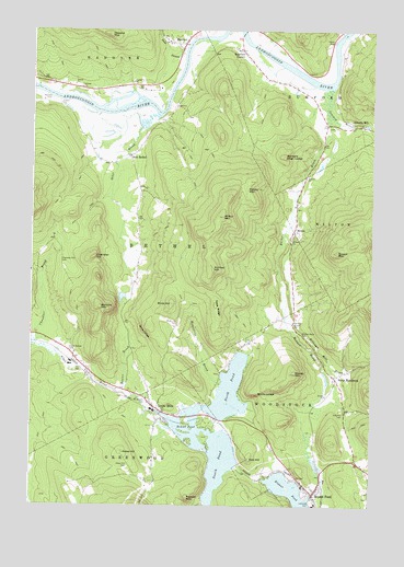
Bryant Pond, ME USGS Topographic Map
Click on map above to begin viewing in our Map Viewer.

This topographic map contains these locations and features:
Feature Name Type Latitude Longitude GNIS ID View Map
Abbotts MillPopulated PlaceN44.4759°W70.6320°579096View Map
Abbotts Mills CemeteryCemeteryN44.4749°W70.6392°2724605View Map
Alder River South Branch ReservoirReservoirN44.3973°W70.7024°1774544View Map
Barkers BrookStreamN44.4784°W70.6417°561610View Map
Barkers High LedgeSummitN44.4669°W70.6574°561611View Map
Bartlett CemeteryCemeteryN44.4817°W70.7428°561663View Map
Beaver BrookStreamN44.4053°W70.7187°561893View Map
Billings Hill BrookStreamN44.4242°W70.6565°562271View Map
Birds HillSummitN44.4281°W70.6981°562367View Map
Birds Hill CemeteryCemeteryN44.4234°W70.6962°562368View Map
Bryant MountainSummitN44.4417°W70.6378°563096View Map
Bryant PondPopulated PlaceN44.3784°W70.6459°563099View Map
Bryant PondReservoirN44.3759°W70.6516°563100View Map
Bryant Pond Post OfficePost OfficeN44.3781°W70.6462°1907944View Map
Bucks LedgeCliffN44.4051°W70.6628°563127View Map
Chandler HillSummitN44.4403°W70.7267°563823View Map
Chandler Hill CemeteryCemeteryN44.4392°W70.7390°563827View Map
Cole Hill CemeteryCemeteryN44.3992°W70.6345°564212View Map
Concord RiverStreamN44.4848°W70.6412°564280View Map
Days RidgeRidgeN44.4278°W70.6820°564845View Map
East BethelPopulated PlaceN44.4670°W70.7134°565522View Map
Goss LedgeCliffN44.4201°W70.7081°566980View Map
Greenwood Fire Department Locke Mills StationBuildingN44.3983°W70.7017°2552903View Map
Greenwood Post OfficePost OfficeN44.4012°W70.7051°2768967View Map
HanoverPopulated PlaceN44.4967°W70.6942°567571View Map
Hanover CemeteryCemeteryN44.4851°W70.7328°567572View Map
Hanover Post OfficePost OfficeN44.4994°W70.6919°1908033View Map
Howard MountainSummitN44.4988°W70.7222°568386View Map
Howe HillSummitN44.3889°W70.7158°568400View Map
Howe Hill CemeteryCemeteryN44.3856°W70.7137°568401View Map
Kimball HillSummitN44.4373°W70.6831°569177View Map
Lakeside CemeteryCemeteryN44.3762°W70.6462°569322View Map
Littlefield Beaches CampgroundLocaleN44.3967°W70.6842°1908066View Map
Locke MillsPopulated PlaceN44.4001°W70.7020°570147View Map
Locke Mills Union ChurchChurchN44.4020°W70.7065°1908069View Map
McCrillian BrookStreamN44.4076°W70.6798°570964View Map
Meadow BrookStreamN44.4242°W70.6565°571047View Map
MiltonPopulated PlaceN44.4478°W70.6531°571409View Map
Moody MountainSummitN44.4099°W70.6530°571546View Map
Mount Abram CemeteryCemeteryN44.4026°W70.7073°571751View Map
North PondLakeN44.4053°W70.6764°572386View Map
North WoodstockPopulated PlaceN44.4090°W70.6378°572430View Map
Oak HillSummitN44.3876°W70.6692°572582View Map
Otter BrookStreamN44.4778°W70.7042°572800View Map
Outlet DamDamN44.4001°W70.7036°1774099View Map
Peaked MountainSummitN44.3770°W70.6920°573092View Map
Pebley MountainSummitN44.4582°W70.6707°573126View Map
Pond StreamStreamN44.4953°W70.6934°573617View Map
Round PondReservoirN44.4001°W70.7036°574501View Map
Rumford CornerPopulated PlaceN44.4948°W70.6731°574583View Map
Rumford Corner CemeteryCemeteryN44.4957°W70.6762°2736394View Map
South Bethel CemeteryCemeteryN44.4162°W70.7359°575758View Map
South Branch DamDamN44.3973°W70.7024°1774543View Map
South PondLakeN44.3893°W70.6840°575891View Map
Town of HanoverCivilN44.4967°W70.7260°582510View Map
Walkers MountainSummitN44.4270°W70.7245°577798View Map
Whales Back CemeteryCemeteryN44.4202°W70.6509°578301View Map
Whitman Memorial LibraryBuildingN44.3793°W70.6435°2738520View Map
Wilbur MountainSummitN44.4511°W70.6797°578461View Map
Woodstock Elementary SchoolSchoolN44.3981°W70.6454°1908254View Map
Woodstock Fire DepartmentBuildingN44.3816°W70.6415°2552994View Map

Note: Coordinates in the location and feature list above are referenced to NAD83 datum.


Copyright (C) 2008-2024 Ryan Niemi / Sunset Dynamics ... All Rights Reserved