TopoQuest Logo
Do you find TopoQuest useful?
Help keep TopoQuest running and adding new maps/features by donating!
Bitcoin:  19c7KJd3qBynnjoSw5npx9KScwjBe4ifkT
Litecoin:  LXs6TkuXGGXo1vDsWCkWVdjQX94eUKd6ui
Home View Maps Find Maps Find Places Resources & Links


Greenwood, Maine Topographic Map

USGS Map Title: Greenwood, ME
USGS Map MRC: 44070C6
DRG (GeoTIFF) Download: o44070c6.tif


Neighboring USGS Topographic Map Quads:


  Bethel, ME  
44070D7
 

  Bryant Pond, ME  
44070D6
 

  Mount Zircon, ME  
44070D5
 

  East Stoneham, ME  
44070C7
 

  Greenwood, ME  
44070C6
 

  West Paris, ME  
44070C5
 

  North Waterford, ME  
44070B7
 

  Waterford Flat, ME  
44070B6
 

  Norway, ME  
44070B5


Map MRC Location:

N45°
W71°
N45°
W70°
H8 H7 H6 H5 H4 H3 H2 H1
G8 G7 G6 G5 G4 G3 G2 G1
F8 F7 F6 F5 F4 F3 F2 F1
E8 E7 E6 E5 E4 E3 E2 E1
D8 D7 D6 D5 D4 D3 D2 D1
C8 C7 C6 C5 C4 C3 C2 C1
B8 B7 B6 B5 B4 B3 B2 B1
A8 A7 A6 A5 A4 A3 A2 A1
N44°
W71°
N44°
W70°

Greenwood, ME USGS 1:24K Topographic Map Preview:
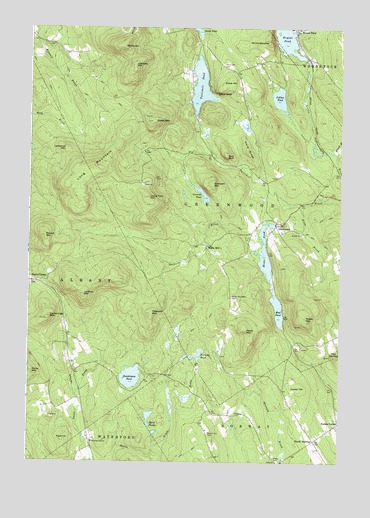
Greenwood, ME USGS Topographic Map
Click on map above to begin viewing in our Map Viewer.

This topographic map contains these locations and features:
Feature Name Type Latitude Longitude GNIS ID View Map
Ames CemeteryCemeteryN44.3416°W70.7052°2736842View Map
Bald BluffSummitN44.3383°W70.6711°561492View Map
Black BrookStreamN44.3384°W70.6267°562399View Map
Bryant Pond DamDamN44.3663°W70.6398°1773545View Map
Carter HillSummitN44.2709°W70.6409°563642View Map
Chapel CemeteryCemeteryN44.2514°W70.6509°563846View Map
Cummings MountainSummitN44.2918°W70.7410°564652View Map
Elwell MountainSummitN44.3481°W70.7003°565886View Map
Fisk HillSummitN44.2573°W70.7351°566243View Map
Furlong PondLakeN44.2806°W70.6828°566655View Map
GreenwoodPopulated PlaceN44.3184°W70.6509°579368View Map
Greenwood Center CemeteryCemeteryN44.3321°W70.6510°2736363View Map
Greenwood Fire Department Station 2BuildingN44.3190°W70.6492°2553125View Map
Halls RidgeRidgeN44.3401°W70.6623°567520View Map
Hicks PondReservoirN44.3105°W70.6550°567996View Map
Hicks Pond DamDamN44.3186°W70.6509°1774091View Map
Hunts CornerPopulated PlaceN44.3020°W70.7492°581065View Map
Hutchinson PondLakeN44.2745°W70.7084°568536View Map
Indian PondLakeN44.3546°W70.6500°568599View Map
Lawrence MountainSummitN44.3402°W70.7348°569408View Map
Long MountainSummitN44.3351°W70.7237°570252View Map
Lovejoy MountainSummitN44.2981°W70.7278°570440View Map
Merrill Hill CemeteryCemeteryN44.2584°W70.6773°571165View Map
Mount AbramSummitN44.3695°W70.7126°561069View Map
Mount ChristopherSummitN44.3715°W70.6547°563977View Map
Mud PondLakeN44.2937°W70.6496°571892View Map
Niles BrookStreamN44.3245°W70.6406°572173View Map
North NorwayPopulated PlaceN44.2565°W70.6348°579571View Map
Noyes MountainSummitN44.2917°W70.6387°572534View Map
Oversett MountainSummitN44.3295°W70.6766°572877View Map
Oversett PondLakeN44.3271°W70.6803°572878View Map
Patch MountainSummitN44.2879°W70.6624°573050View Map
Patch Mountain CemeteryCemeteryN44.2978°W70.6681°573051View Map
Payne LedgeCliffN44.3562°W70.6748°573080View Map
Peabody MountainSummitN44.2927°W70.7012°573084View Map
Round MountainSummitN44.3148°W70.7434°574481View Map
Rowe HillSummitN44.3587°W70.6695°574545View Map
Rowe Hill CemeteryCemeteryN44.3638°W70.6726°574548View Map
Sanborn RiverStreamN44.3092°W70.6551°574818View Map
Speck PondsLakeN44.2631°W70.7012°575996View Map
The NubbleSummitN44.2803°W70.6266°576881View Map
Tibbetts MountainSummitN44.3643°W70.7082°577094View Map
Town of GreenwoodCivilN44.3366°W70.6738°582503View Map
Town of GreenwoodCivilN44.3367°W70.6739°1987275View Map
Twitchell PondReservoirN44.3583°W70.6815°577496View Map
Twitchell Pond DamDamN44.3496°W70.6834°1774063View Map
Uncle Tom MountainSummitN44.3262°W70.7021°577533View Map
Willis MillPopulated PlaceN44.3123°W70.6790°579840View Map

Note: Coordinates in the location and feature list above are referenced to NAD83 datum.


Copyright (C) 2008-2024 Ryan Niemi / Sunset Dynamics ... All Rights Reserved