TopoQuest Logo
Do you find TopoQuest useful?
Help keep TopoQuest running and adding new maps/features by donating!
Bitcoin:  19c7KJd3qBynnjoSw5npx9KScwjBe4ifkT
Litecoin:  LXs6TkuXGGXo1vDsWCkWVdjQX94eUKd6ui
Home View Maps Find Maps Find Places Resources & Links


Buck Butte, Oregon Topographic Map

USGS Map Title: Buck Butte, OR
USGS Map MRC: 44121E1
DRG (GeoTIFF) Download: o44121e1.tif


Neighboring USGS Topographic Map Quads:


  Madras West, OR  
44121F2
 

  Madras East, OR  
44121F1
 

  Teller Butte, OR  
44120F8
 

  Culver, OR  
44121E2
 

  Buck Butte, OR  
44121E1
 

  Brewer Reservoir, OR  
44120E8
 

  Opal City, OR  
44121D2
 

  Gray Butte, OR  
44121D1
 

  Grizzly Mountain, OR  
44120D8


Map MRC Location:

N45°
W122°
N45°
W121°
H8 H7 H6 H5 H4 H3 H2 H1
G8 G7 G6 G5 G4 G3 G2 G1
F8 F7 F6 F5 F4 F3 F2 F1
E8 E7 E6 E5 E4 E3 E2 E1
D8 D7 D6 D5 D4 D3 D2 D1
C8 C7 C6 C5 C4 C3 C2 C1
B8 B7 B6 B5 B4 B3 B2 B1
A8 A7 A6 A5 A4 A3 A2 A1
N44°
W122°
N44°
W121°

Buck Butte, OR USGS 1:24K Topographic Map Preview:
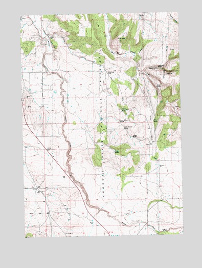
Buck Butte, OR USGS Topographic Map
Click on map above to begin viewing in our Map Viewer.

This topographic map contains these locations and features:
Feature Name Type Latitude Longitude GNIS ID View Map
Bennett WellWellN44.5515°W121.0250°1137929View Map
Bishop SpringSpringN44.5633°W121.0195°1138162View Map
Blanchard WellWellN44.5380°W121.0188°1138250View Map
Boyce CorralLocaleN44.5276°W121.1156°1138543View Map
Boyce Pond WellWellN44.5509°W121.1237°1156417View Map
Buck ButteSummitN44.6095°W121.0484°1138742View Map
C W A WellWellN44.5270°W121.1155°1139097View Map
Canyon SpringSpringN44.5833°W121.0195°1139339View Map
Cap Healy WellWellN44.5010°W121.1148°1139342View Map
Cottonwood SpringSpringN44.5943°W121.0182°1140198View Map
Crooked River National GrasslandForestN44.5202°W121.0948°1161808View Map
Dayton-Grant WellWellN44.5156°W121.0948°1140679View Map
Degner WellWellN44.5265°W121.1153°1140873View Map
Devine WellWellN44.5074°W121.0721°1140982View Map
Gray Butte CreekStreamN44.5151°W121.1025°1153137View Map
Hardwick WellWellN44.5756°W121.0390°1637954View Map
Juniper SpringSpringN44.5470°W121.0541°1144465View Map
Larson SpringSpringN44.5553°W121.0395°1144840View Map
Lower Bennett SpringSpringN44.5643°W121.0490°1145602View Map
McMeen CreekStreamN44.5010°W121.0200°1146021View Map
McMeen SpringSpringN44.5018°W121.0138°1146022View Map
North Combs SpringSpringN44.5702°W121.0443°1146890View Map
Parkey SpringsSpringN44.6229°W121.0319°1147460View Map
Reichen WellWellN44.5817°W121.0588°1148368View Map
Reuter WellWellN44.5586°W121.0575°1148390View Map
South Waste Water Treatment FacilityLocaleN44.6236°W121.1103°2697172View Map
Suicide WellWellN44.5754°W121.0392°1150567View Map
Upper Bennett SpringSpringN44.5605°W121.0460°1151663View Map
Wagonblast CanyonValleyN44.5918°W121.0289°1158535View Map
Willow Creek CorralLocaleN44.5915°W121.0581°1152420View Map

Note: Coordinates in the location and feature list above are referenced to NAD83 datum.


Copyright (C) 2008-2025 Ryan Niemi / Sunset Dynamics ... All Rights Reserved