TopoQuest Logo
Do you find TopoQuest useful?
Help keep TopoQuest running and adding new maps/features by donating!
Bitcoin:  19c7KJd3qBynnjoSw5npx9KScwjBe4ifkT
Litecoin:  LXs6TkuXGGXo1vDsWCkWVdjQX94eUKd6ui
Home View Maps Find Maps Find Places Resources & Links


Culver, Oregon Topographic Map

USGS Map Title: Culver, OR
USGS Map MRC: 44121E2
DRG (GeoTIFF) Download: o44121e2.tif


Neighboring USGS Topographic Map Quads:


  Seekseequa Junction, OR  
44121F3
 

  Madras West, OR  
44121F2
 

  Madras East, OR  
44121F1
 

  Round Butte Dam, OR  
44121E3
 

  Culver, OR  
44121E2
 

  Buck Butte, OR  
44121E1
 

  Steelhead Falls, OR  
44121D3
 

  Opal City, OR  
44121D2
 

  Gray Butte, OR  
44121D1


Map MRC Location:

N45°
W122°
N45°
W121°
H8 H7 H6 H5 H4 H3 H2 H1
G8 G7 G6 G5 G4 G3 G2 G1
F8 F7 F6 F5 F4 F3 F2 F1
E8 E7 E6 E5 E4 E3 E2 E1
D8 D7 D6 D5 D4 D3 D2 D1
C8 C7 C6 C5 C4 C3 C2 C1
B8 B7 B6 B5 B4 B3 B2 B1
A8 A7 A6 A5 A4 A3 A2 A1
N44°
W122°
N44°
W121°

Culver, OR USGS 1:24K Topographic Map Preview:
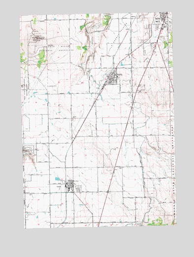
Culver, OR USGS Topographic Map
Click on map above to begin viewing in our Map Viewer.

This topographic map contains these locations and features:
Feature Name Type Latitude Longitude GNIS ID View Map
AgencyLocaleN44.6212°W121.1609°1137028View Map
Brewer Airstrip (historical)AirportN44.5235°W121.1653°1167304View Map
City of CulverCivilN44.5234°W121.2110°2410275View Map
City of MetoliusCivilN44.5875°W121.1760°2411091View Map
Crooked River GorgeValleyN44.5735°W121.1887°1140474View Map
CulverPopulated PlaceN44.5257°W121.2131°1140541View Map
Culver City HallBuildingN44.5269°W121.2097°2699274View Map
Culver City ParkParkN44.5244°W121.2067°2070843View Map
Culver City Public WorksBuildingN44.5269°W121.2090°2699275View Map
Culver DivisionCivilN44.5274°W121.2246°1937994View Map
Culver Elementary SchoolSchoolN44.5231°W121.2125°2440310View Map
Culver High SchoolSchoolN44.5229°W121.2136°2440309View Map
Culver IOOF CemeteryCemeteryN44.5343°W121.1703°1143200View Map
Culver Middle SchoolSchoolN44.5219°W121.2136°2440311View Map
Culver Police DepartmentBuildingN44.5270°W121.2096°2737762View Map
Culver Post OfficePost OfficeN44.5253°W121.2114°1165121View Map
Culver Sewage Treatment FacilityLocaleN44.5278°W121.2206°2697146View Map
German CemeteryCemeteryN44.5638°W121.2098°1142620View Map
Haystack GrangeBuildingN44.5210°W121.2095°1639285View Map
Jefferson County FairgroundsLocaleN44.6194°W121.1386°1638458View Map
Jefferson County Fire District 1BuildingN44.6246°W121.1291°2576842View Map
Jefferson County Fire District 2BuildingN44.5270°W121.2096°2576532View Map
Madras Southwest BaseLocaleN44.5782°W121.2214°1167300View Map
Madras Water TankReservoirN44.6194°W121.1280°1167301View Map
MetoliusPopulated PlaceN44.5865°W121.1784°1146116View Map
Metolius City HallBuildingN44.5865°W121.1776°2699595View Map
Metolius Elementary SchoolSchoolN44.5875°W121.1720°2440313View Map
Metolius Municipal CourtBuildingN44.5865°W121.1775°2699596View Map
Metolius Police DepartmentBuildingN44.5866°W121.1775°2737705View Map
Metolius Post Office (historical)Post OfficeN44.5865°W121.1784°1165627View Map
Metolius Sewage Treatment PlantLocaleN44.5975°W121.1716°2697150View Map
Metolius Water TankReservoirN44.5789°W121.1534°1167305View Map
Meuret Airstrip (historical)AirportN44.5632°W121.2498°1154016View Map
Oregon State Police Department MadrasBuildingN44.6124°W121.1359°2737875View Map
Round ButteSummitN44.6104°W121.2389°1148760View Map
South ParkParkN44.6244°W121.1292°2070850View Map

Note: Coordinates in the location and feature list above are referenced to NAD83 datum.


Copyright (C) 2008-2024 Ryan Niemi / Sunset Dynamics ... All Rights Reserved