TopoQuest Logo
Do you find TopoQuest useful?
Help keep TopoQuest running and adding new maps/features by donating!
Bitcoin:  19c7KJd3qBynnjoSw5npx9KScwjBe4ifkT
Litecoin:  LXs6TkuXGGXo1vDsWCkWVdjQX94eUKd6ui
Home View Maps Find Maps Find Places Resources & Links


Buck Mountain, Texas Topographic Map

USGS Map Title: Buck Mountain, TX
USGS Map MRC: 32098F8
DRG (GeoTIFF) Download: o32098f8.tif


Neighboring USGS Topographic Map Quads:


  Edwards Branch, TX  
32099G1
 

  Breckenridge, TX  
32098G8
 

  Grand Lake, TX  
32098G7
 

  Eolian, TX  
32099F1
 

  Buck Mountain, TX  
32098F8
 

  Necessity, TX  
32098F7
 

  Indian Knoll, TX  
32099E1
 

  Harpersville, TX  
32098E8
 

  Wayland, TX  
32098E7


Map MRC Location:

N33°
W99°
N33°
W98°
H8 H7 H6 H5 H4 H3 H2 H1
G8 G7 G6 G5 G4 G3 G2 G1
F8 F7 F6 F5 F4 F3 F2 F1
E8 E7 E6 E5 E4 E3 E2 E1
D8 D7 D6 D5 D4 D3 D2 D1
C8 C7 C6 C5 C4 C3 C2 C1
B8 B7 B6 B5 B4 B3 B2 B1
A8 A7 A6 A5 A4 A3 A2 A1
N32°
W99°
N32°
W98°

Buck Mountain, TX USGS 1:24K Topographic Map Preview:
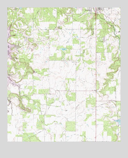
Buck Mountain, TX USGS Topographic Map
Click on map above to begin viewing in our Map Viewer.

This topographic map contains these locations and features:
Feature Name Type Latitude Longitude GNIS ID View Map
Breckenridge Oil FieldOilfieldN32.7162°W98.9173°1331216View Map
Brown BranchStreamN32.7426°W98.9009°1331333View Map
Buck MountainSummitN32.6587°W98.9842°1331497View Map
Conner LakeReservoirN32.7113°W98.9382°1333230View Map
Conner Lake DamDamN32.7118°W98.9370°1861409View Map
Curry Oil FieldOilfieldN32.7346°W98.9876°1333827View Map
Hart CemeteryCemeteryN32.6723°W98.9028°1337416View Map
Hitson BranchStreamN32.7360°W98.8876°1337842View Map
Hog MountainSummitN32.6907°W98.9720°1337905View Map
Iron Ore CreekStreamN32.6623°W98.9695°1374234View Map
Jones BranchStreamN32.7246°W98.9078°1338830View Map
Museum of Aircraft PerservationBuildingN32.7229°W98.8942°2014457View Map
O'Neal Oil FieldOilfieldN32.7473°W98.9948°1342941View Map
Petroleum Corporation of Texas DamDamN32.7435°W98.8987°1861411View Map
Petroleum Corporation of Texas ReservoirReservoirN32.7435°W98.8987°1861412View Map
Post Oak CemeteryCemeteryN32.7001°W98.9267°1344403View Map
Robbins Lake DamDamN32.7485°W98.9870°1862763View Map
South HanlonPopulated PlaceN32.7276°W98.8778°1379093View Map
Spy MountainSummitN32.7315°W98.9434°1347770View Map
Stephens County AirportAirportN32.7201°W98.8928°1386283View Map
T C Fambro DamDamN32.7101°W98.8753°1861413View Map
T C Fambro ReservoirReservoirN32.7101°W98.8753°1861414View Map
Van Winkle CemeteryCemeteryN32.6651°W98.9979°1331498View Map

Note: Coordinates in the location and feature list above are referenced to NAD83 datum.


Copyright (C) 2008-2025 Ryan Niemi / Sunset Dynamics ... All Rights Reserved