TopoQuest Logo
Do you find TopoQuest useful?
Help keep TopoQuest running and adding new maps/features by donating!
Bitcoin:  19c7KJd3qBynnjoSw5npx9KScwjBe4ifkT
Litecoin:  LXs6TkuXGGXo1vDsWCkWVdjQX94eUKd6ui
Home View Maps Find Maps Find Places Resources & Links


Buck Spring, Oregon Topographic Map

USGS Map Title: Buck Spring, OR
USGS Map MRC: 43119G6
DRG (GeoTIFF) Download: o43119g6.tif


Neighboring USGS Topographic Map Quads:


  Twelvemile Reservoir, OR  
43119H7
 

  Delintment Lake, OR  
43119H6
 

  Big Mowich Mountain, OR  
43119H5
 

  Mackey Butte, OR  
43119G7
 

  Buck Spring, OR  
43119G6
 

  Donnelly Butte, OR  
43119G5
 

  Bulger Ridge, OR  
43119F7
 

  Camp Currey Spring, OR  
43119F6
 

  Dry Mountain, OR  
43119F5


Map MRC Location:

N44°
W120°
N44°
W119°
H8 H7 H6 H5 H4 H3 H2 H1
G8 G7 G6 G5 G4 G3 G2 G1
F8 F7 F6 F5 F4 F3 F2 F1
E8 E7 E6 E5 E4 E3 E2 E1
D8 D7 D6 D5 D4 D3 D2 D1
C8 C7 C6 C5 C4 C3 C2 C1
B8 B7 B6 B5 B4 B3 B2 B1
A8 A7 A6 A5 A4 A3 A2 A1
N43°
W120°
N43°
W119°

Buck Spring, OR USGS 1:24K Topographic Map Preview:
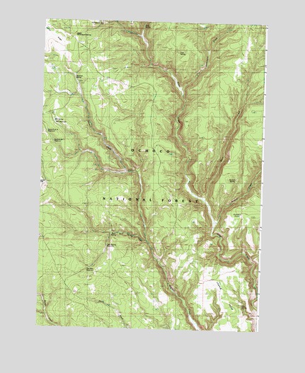
Buck Spring, OR USGS Topographic Map
Click on map above to begin viewing in our Map Viewer.

This topographic map contains these locations and features:
Feature Name Type Latitude Longitude GNIS ID View Map
Association Corral (historical)LocaleN43.8707°W119.7366°1137337View Map
Buck SpringSpringN43.7889°W119.7080°1138823View Map
Buck Spring CampgroundLocaleN43.7885°W119.7094°1156288View Map
Buck Spring CreekStreamN43.7863°W119.6900°1138830View Map
Buck Spring Guard Station (historical)LocaleN43.7885°W119.7097°1138831View Map
Camas ReservoirReservoirN43.8506°W119.7194°1156283View Map
Chapin TableRidgeN43.7757°W119.6705°1133918View Map
Corral RidgeRidgeN43.8676°W119.7447°1133917View Map
Cow CampLocaleN43.8568°W119.7066°1156284View Map
Delintment CreekStreamN43.8479°W119.6741°1140874View Map
Dodson CreekStreamN43.7940°W119.6527°1141105View Map
Dry Dam ReservoirReservoirN43.7743°W119.7208°1141324View Map
Foss SpringSpringN43.8625°W119.6738°1142330View Map
Gilchrist SpringSpringN43.8517°W119.7319°1142733View Map
Gravelly FlatFlatN43.8090°W119.7144°1133919View Map
Hollenbeck SpringSpringN43.8737°W119.7174°1143670View Map
Howard PointCliffN43.7988°W119.6405°1159229View Map
Mill ReservoirReservoirN43.8335°W119.7427°1146295View Map
Mill SpringSpringN43.8339°W119.7433°1154183View Map
Perkins SpringSpringN43.8114°W119.6405°1147597View Map
Pick SpringSpringN43.7601°W119.6351°1147645View Map
Pigeon SpringSpringN43.7540°W119.7400°1154184View Map
Sawmill Creek CampLocaleN43.7535°W119.6611°1149092View Map
Sawmill Number One ReservoirReservoirN43.8256°W119.7434°1149095View Map
Sawmill Number Two ReservoirReservoirN43.8295°W119.7470°1149096View Map
Short CreekStreamN43.8001°W119.6558°1149433View Map
Soda SpringSpringN43.8731°W119.6942°1149854View Map
Twin Spring ReservoirReservoirN43.7836°W119.7117°1151588View Map
Upper Hollenbeck SpringSpringN43.8691°W119.7325°1151678View Map

Note: Coordinates in the location and feature list above are referenced to NAD83 datum.


Copyright (C) 2008-2025 Ryan Niemi / Sunset Dynamics ... All Rights Reserved