TopoQuest Logo
Do you find TopoQuest useful?
Help keep TopoQuest running and adding new maps/features by donating!
Bitcoin:  19c7KJd3qBynnjoSw5npx9KScwjBe4ifkT
Litecoin:  LXs6TkuXGGXo1vDsWCkWVdjQX94eUKd6ui
Home View Maps Find Maps Find Places Resources & Links


Delintment Lake, Oregon Topographic Map

USGS Map Title: Delintment Lake, OR
USGS Map MRC: 43119H6
DRG (GeoTIFF) Download: o43119h6.tif


Neighboring USGS Topographic Map Quads:


  Angell Butte, OR  
44119A7
 

  Suplee, OR  
44119A6
 

  Funny Butte, OR  
44119A5
 

  Twelvemile Reservoir, OR  
43119H7
 

  Delintment Lake, OR  
43119H6
 

  Big Mowich Mountain, OR  
43119H5
 

  Mackey Butte, OR  
43119G7
 

  Buck Spring, OR  
43119G6
 

  Donnelly Butte, OR  
43119G5


Map MRC Location:

N44°
W120°
N44°
W119°
H8 H7 H6 H5 H4 H3 H2 H1
G8 G7 G6 G5 G4 G3 G2 G1
F8 F7 F6 F5 F4 F3 F2 F1
E8 E7 E6 E5 E4 E3 E2 E1
D8 D7 D6 D5 D4 D3 D2 D1
C8 C7 C6 C5 C4 C3 C2 C1
B8 B7 B6 B5 B4 B3 B2 B1
A8 A7 A6 A5 A4 A3 A2 A1
N43°
W120°
N43°
W119°

Delintment Lake, OR USGS 1:24K Topographic Map Preview:
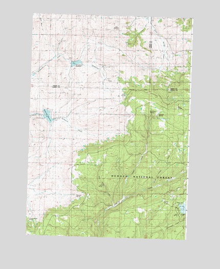
Delintment Lake, OR USGS Topographic Map
Click on map above to begin viewing in our Map Viewer.

This topographic map contains these locations and features:
Feature Name Type Latitude Longitude GNIS ID View Map
Colia Post Office (historical)Post OfficeN43.9404°W119.7311°1164280View Map
Copper CreekStreamN43.8974°W119.6766°1140100View Map
Delintment LakeLakeN43.8924°W119.6274°1140875View Map
Delintment Lake Boat RampLocaleN43.8902°W119.6258°2700025View Map
Delintment Lake DamDamN43.8901°W119.6250°1155551View Map
Delintment Lake Recreation SiteLocaleN43.8924°W119.6319°1926236View Map
Grindstone DamDamN43.9732°W119.7190°1155572View Map
Grindstone ReservoirReservoirN43.9726°W119.7152°1154176View Map
Iron MountainSummitN43.9920°W119.6845°1144118View Map
Jimmy McCuen SpringSpringN43.8842°W119.7480°1144282View Map
Lake SpringSpringN43.8890°W119.6324°1144785View Map
Mills Upper RanchLocaleN43.9715°W119.6941°1156289View Map
Pond SpringSpringN43.9555°W119.6755°1133914View Map
Rimrock SpringSpringN43.9448°W119.6494°1148470View Map
Robertson SpringSpringN43.9472°W119.6560°1148542View Map
Sherman RanchLocaleN43.9415°W119.7289°1156285View Map
Sherman SpringSpringN43.8980°W119.7117°1149386View Map
Still SpringSpringN43.9041°W119.6913°1150432View Map
Still Spring CreekStreamN43.8929°W119.6833°1150433View Map
Stone Corral CreekStreamN43.9043°W119.6536°1150444View Map
Tip Top SpringSpringN43.8959°W119.6434°1151276View Map
Twelvemile DamDamN43.9416°W119.7389°1155667View Map
Upper Sherman Ranch (historical)LocaleN43.9415°W119.7289°1162340View Map
Warm SpringsSpringN43.9496°W119.6351°1151897View Map
Williams ReservoirReservoirN43.9424°W119.7358°1152393View Map

Note: Coordinates in the location and feature list above are referenced to NAD83 datum.


Copyright (C) 2008-2025 Ryan Niemi / Sunset Dynamics ... All Rights Reserved