TopoQuest Logo
Do you find TopoQuest useful?
Help keep TopoQuest running and adding new maps/features by donating!
Bitcoin:  19c7KJd3qBynnjoSw5npx9KScwjBe4ifkT
Litecoin:  LXs6TkuXGGXo1vDsWCkWVdjQX94eUKd6ui
Home View Maps Find Maps Find Places Resources & Links


Buckskin Mountain, Nevada Topographic Map

USGS Map Title: Buckskin Mountain, NV
USGS Map MRC: 41117G5
DRG (GeoTIFF) Download: o41117g5.tif


Neighboring USGS Topographic Map Quads:


  McDermitt, NV  
41117H6
 

  McConnell Peak, NV  
41117H5
 

  Odell Mountain, NV  
41117H4
 

  South of McDermitt, NV  
41117G6
 

  Buckskin Mountain, NV  
41117G5
 

  Holloway Meadows, NV  
41117G4
 

  White Rock Canyon, NV  
41117F6
 

  Hinkey Summit, NV  
41117F5
 

  Black Ridge, NV  
41117F4


Map MRC Location:

N42°
W118°
N42°
W117°
H8 H7 H6 H5 H4 H3 H2 H1
G8 G7 G6 G5 G4 G3 G2 G1
F8 F7 F6 F5 F4 F3 F2 F1
E8 E7 E6 E5 E4 E3 E2 E1
D8 D7 D6 D5 D4 D3 D2 D1
C8 C7 C6 C5 C4 C3 C2 C1
B8 B7 B6 B5 B4 B3 B2 B1
A8 A7 A6 A5 A4 A3 A2 A1
N41°
W118°
N41°
W117°

Buckskin Mountain, NV USGS 1:24K Topographic Map Preview:
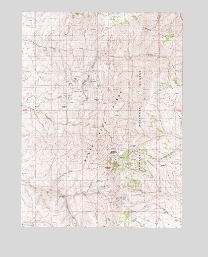
Buckskin Mountain, NV USGS Topographic Map
Click on map above to begin viewing in our Map Viewer.

This topographic map contains these locations and features:
Feature Name Type Latitude Longitude GNIS ID View Map
Auto HillSummitN41.8343°W117.5835°858769View Map
Birthday MineMineN41.8257°W117.5890°858929View Map
Blum ShaftMineN41.8354°W117.5860°855703View Map
Buckskin (historical)LocaleN41.7902°W117.5443°848246View Map
Buckskin CreekStreamN41.7696°W117.5765°859054View Map
Buckskin MountainSummitN41.7893°W117.5532°859056View Map
Buckskin National MineMineN41.7924°W117.5407°859057View Map
Buckskin SlideCliffN41.7838°W117.5543°859058View Map
Caustin MineMineN41.8199°W117.5754°855574View Map
Charleston GulchValleyN41.8516°W117.5660°859200View Map
Charleston HillSummitN41.8229°W117.5665°859201View Map
Chefoo TunnelMineN41.8299°W117.5899°855578View Map
Crawford MineMineN41.8404°W117.5776°855572View Map
Edmunds MineMineN41.8402°W117.5768°855571View Map
Eightmile MountainSummitN41.8646°W117.5296°859657View Map
First National MineMineN41.8221°W117.5737°855575View Map
Halcyon MineMineN41.7971°W117.5401°859924View Map
Hatch MineMineN41.8338°W117.5732°855569View Map
Indian Valley MineMineN41.8460°W117.5751°855570View Map
Mammoth MineMineN41.8324°W117.5771°855577View Map
McCormick MineMineN41.7932°W117.5426°855579View Map
National (historical)Populated PlaceN41.8282°W117.5862°862642View Map
National GulchValleyN41.8404°W117.5743°860716View Map
National MineMineN41.8354°W117.5735°860715View Map
National Mining DistrictCivilN41.8210°W117.5676°855573View Map
National Post Office (historical)Post OfficeN41.8282°W117.5862°864642View Map
North Fork Canyon CreekStreamN41.7704°W117.6051°860759View Map
Paradise MineMineN41.7913°W117.5493°860875View Map
Radiator HillSummitN41.8204°W117.5921°861049View Map
Round HillSummitN41.8335°W117.5904°861183View Map
South Fork Canyon CreekStreamN41.7677°W117.5915°861463View Map
South Fork Eightmile CreekStreamN41.8482°W117.5415°861475View Map
Staunton RidgeRidgeN41.7846°W117.5085°861570View Map
Transfer CampLocaleN41.7677°W117.5915°861772View Map
Union MineMineN41.8293°W117.5771°862954View Map
Utah National MineMineN41.8210°W117.5765°855576View Map
White HillSummitN41.8246°W117.5762°861969View Map
Windy GapGapN41.7668°W117.5474°862079View Map

Note: Coordinates in the location and feature list above are referenced to NAD83 datum.


Copyright (C) 2008-2025 Ryan Niemi / Sunset Dynamics ... All Rights Reserved